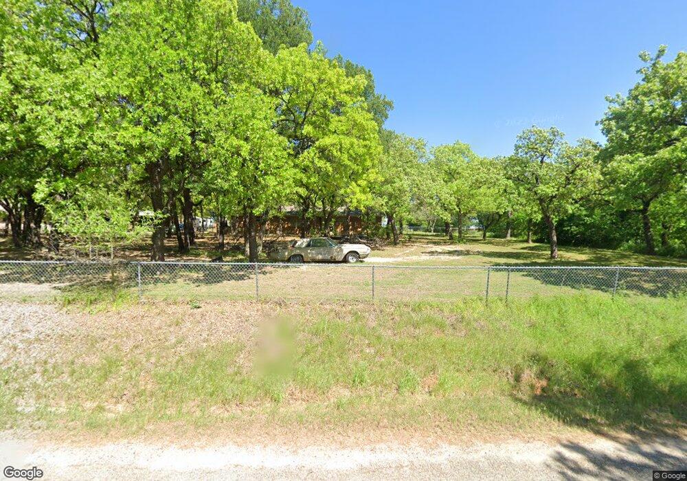
1915 County Road 1111 Decatur, TX 76234
Estimated Value: $362,376 - $679,000
--
Bed
--
Bath
1,645
Sq Ft
$310/Sq Ft
Est. Value
About This Home
This home is located at 1915 County Road 1111, Decatur, TX 76234 and is currently estimated at $510,344, approximately $310 per square foot. 1915 County Road 1111 is a home located in Wise County with nearby schools including Decatur High School.
Ownership History
Date
Name
Owned For
Owner Type
Purchase Details
Closed on
Jun 7, 2013
Sold by
Willis David W and Willis Kathleen L
Bought by
Franke Lorna L
Current Estimated Value
Home Financials for this Owner
Home Financials are based on the most recent Mortgage that was taken out on this home.
Original Mortgage
$133,860
Outstanding Balance
$94,880
Interest Rate
3.41%
Mortgage Type
New Conventional
Estimated Equity
$415,464
Purchase Details
Closed on
Jun 4, 2001
Sold by
Rawle Randle
Bought by
Franke Lorna
Purchase Details
Closed on
Jan 1, 1901
Bought by
Franke Lorna
Create a Home Valuation Report for This Property
The Home Valuation Report is an in-depth analysis detailing your home's value as well as a comparison with similar homes in the area
Home Values in the Area
Average Home Value in this Area
Purchase History
| Date | Buyer | Sale Price | Title Company |
|---|---|---|---|
| Franke Lorna L | -- | Guardian Title Co | |
| Franke Lorna | -- | -- | |
| Franke Lorna | -- | -- |
Source: Public Records
Mortgage History
| Date | Status | Borrower | Loan Amount |
|---|---|---|---|
| Open | Franke Lorna L | $133,860 |
Source: Public Records
Tax History Compared to Growth
Tax History
| Year | Tax Paid | Tax Assessment Tax Assessment Total Assessment is a certain percentage of the fair market value that is determined by local assessors to be the total taxable value of land and additions on the property. | Land | Improvement |
|---|---|---|---|---|
| 2025 | $2,667 | $337,811 | -- | -- |
| 2024 | $2,667 | $307,101 | $0 | $0 |
| 2023 | $3,373 | $279,183 | $0 | $0 |
| 2022 | $3,895 | $253,803 | $0 | $0 |
| 2021 | $3,699 | $230,730 | $69,880 | $160,850 |
| 2020 | $3,492 | $216,450 | $65,680 | $150,770 |
| 2019 | $3,497 | $203,490 | $65,680 | $137,810 |
| 2018 | $3,362 | $189,420 | $53,080 | $136,340 |
| 2017 | $3,057 | $172,220 | $44,500 | $127,720 |
| 2016 | -- | $160,180 | $40,300 | $119,880 |
| 2015 | -- | $161,600 | $40,300 | $121,300 |
| 2014 | -- | $137,460 | $21,840 | $115,620 |
Source: Public Records
Map
Nearby Homes
- 910 County Road 1111
- 258 W Ridge St
- 286 W Ridge St
- 263 Eastridge Rd
- 159 Rio Rancho Dr
- 189 Rio Rancho Dr
- 209 Rio Rancho Dr
- 1674 Cuba Rd
- 206 Rio Rancho Dr
- 2012 Cuba Rd
- 131 San Miguel Dr
- 112 La Paloma Way
- 5376 Us Highway 380
- 0 Hlavek Rd
- 141 Mission Oak Trail
- 181 County Road 1326
- 293 County Road 1111
- 516 Wild Wood Dr
- 127 Pleasant View Dr
- 996 Hlavek Rd
- 1915 County Road 1111
- 1832 County Road 1111
- 1929 County Road 1111
- 1769 County Road 1111
- 1945 County Road 1111
- 1955 County Road 1111
- 1701 County Road 1111
- 1701 County Road 1111
- 1961 County Road 1111
- 1631 County Road 1111
- 1973 County Road 1111
- 1965 County Road 1111
- 1621 County Road 1111
- 678 County Road 1110
- 678 County Road 1110
- 2011 County Road 1111
- 2011 County Road 1111
- 1638 County Road 1111
- 1615 County Road 1111
- 1611 County Road 1111