Estimated Value: $288,705 - $334,000
3
Beds
2
Baths
1,502
Sq Ft
$204/Sq Ft
Est. Value
About This Home
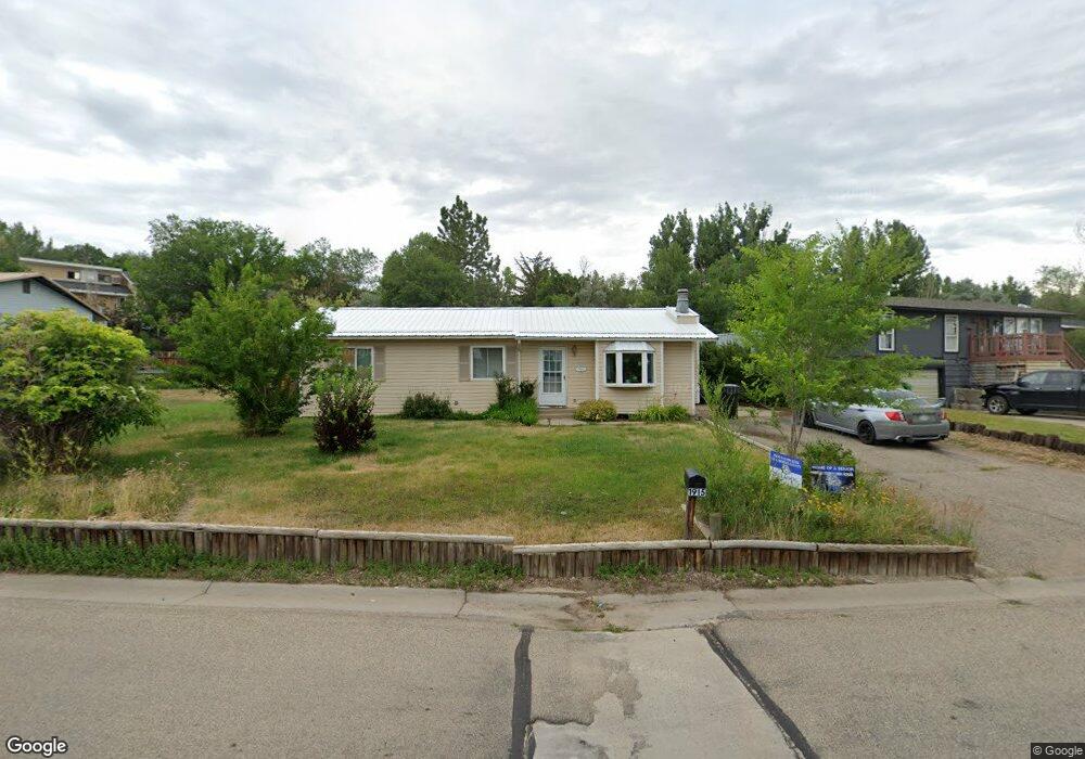
This home is located at 1915 Crockett Dr, Craig, CO 81625 and is currently estimated at $305,926, approximately $203 per square foot. 1915 Crockett Dr is a home located in Moffat County with nearby schools including Sandrock Elementary School, Moffat County High School, and Calvary Baptist School.
Ownership History
Date
Name
Owned For
Owner Type
Purchase Details
Closed on
Sep 26, 2023
Sold by
Schram Spencer Allen
Bought by
Schram Timothy and Schram Gregory
Current Estimated Value
Purchase Details
Closed on
Nov 29, 2012
Sold by
Gonzales Peggy
Bought by
Peggy A Cisar Living Trust
Purchase Details
Closed on
Apr 29, 2011
Sold by
Fannie Mae
Bought by
Gonzales Peggy
Purchase Details
Closed on
Mar 21, 2011
Sold by
Letsinger William
Bought by
Federal National Mortgage Association
Purchase Details
Closed on
Mar 31, 2006
Sold by
Sheridan Danette K
Bought by
Letsinger William
Home Financials for this Owner
Home Financials are based on the most recent Mortgage that was taken out on this home.
Original Mortgage
$120,000
Interest Rate
7.75%
Mortgage Type
Adjustable Rate Mortgage/ARM
Create a Home Valuation Report for This Property
The Home Valuation Report is an in-depth analysis detailing your home's value as well as a comparison with similar homes in the area
Home Values in the Area
Average Home Value in this Area
Purchase History
| Date | Buyer | Sale Price | Title Company |
|---|---|---|---|
| Schram Timothy | -- | None Listed On Document | |
| Peggy A Cisar Living Trust | -- | None Available | |
| Gonzales Peggy | $95,000 | None Available | |
| Federal National Mortgage Association | -- | None Available | |
| Letsinger William | $150,000 | None Available |
Source: Public Records
Mortgage History
| Date | Status | Borrower | Loan Amount |
|---|---|---|---|
| Previous Owner | Letsinger William | $158,300 | |
| Previous Owner | Letsinger William | $120,000 | |
| Previous Owner | Sheridan Danette K | $10,809 | |
| Previous Owner | Sheridan Danette K | $5,000 |
Source: Public Records
Tax History Compared to Growth
Tax History
| Year | Tax Paid | Tax Assessment Tax Assessment Total Assessment is a certain percentage of the fair market value that is determined by local assessors to be the total taxable value of land and additions on the property. | Land | Improvement |
|---|---|---|---|---|
| 2024 | $919 | $10,600 | $0 | $0 |
| 2023 | $919 | $10,600 | $1,180 | $9,420 |
| 2022 | $966 | $11,460 | $1,650 | $9,810 |
| 2021 | $976 | $11,790 | $1,700 | $10,090 |
| 2020 | $910 | $11,130 | $1,700 | $9,430 |
| 2019 | $901 | $11,130 | $1,700 | $9,430 |
| 2018 | $845 | $10,390 | $1,710 | $8,680 |
| 2017 | $872 | $10,390 | $1,710 | $8,680 |
| 2016 | $858 | $10,570 | $1,890 | $8,680 |
| 2015 | $847 | $10,570 | $1,890 | $8,680 |
| 2013 | $847 | $10,290 | $1,890 | $8,400 |
Source: Public Records
Map
Nearby Homes
- 834 Ashley Rd
- 702 Ashley Rd
- TBD Vacant Land
- 1262 Lecuyer Dr
- TBD E Victory Way
- 997 E 10th St
- TBD E 7th St
- 1018 E 11th St
- 821 Van Dorn Dr
- 769 Legion St
- 717 Country Club Dr
- TBD Pine St Unit 34-36
- TBD Pine St Unit 28-30
- TBD Pine St Unit 31-33
- TBD Pine St Unit 37-39
- TBD Pine St
- 595 Colorado St
- 1070 Lincoln St
- 000 Washington St
- 737 Rose St
- 1925 Crockett Dr
- 1905 Crockett Dr
- 797 Ashley Rd
- 805 Ashley Rd
- 1935 Crockett Dr
- 809 Ashley Rd
- 1920 Crockett Dr
- 1910 Crockett Dr
- 759 Ashley Rd
- 1930 Crockett Dr
- 815 Ashley Rd
- 1940 Crockett Dr
- 2015 Crockett Dr
- 778 Ashley Rd
- 1905 Baker Dr
- 1915 Baker Dr
- 1925 Baker Dr
- 2010 Crockett Dr
- 764 Ashley Rd
- 1935 Baker Dr