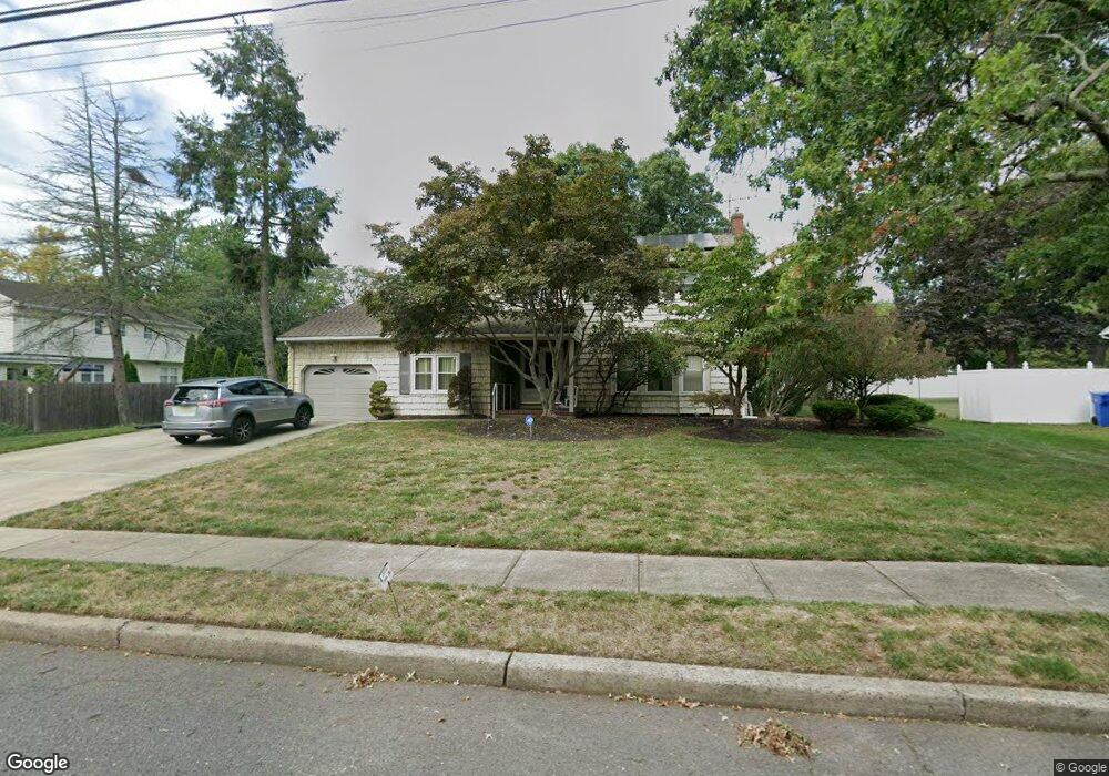
1915 Crocus Ave North Brunswick, NJ 08902
Estimated Value: $616,000 - $732,000
--
Bed
--
Bath
2,396
Sq Ft
$281/Sq Ft
Est. Value
About This Home
This home is located at 1915 Crocus Ave, North Brunswick, NJ 08902 and is currently estimated at $672,106, approximately $280 per square foot. 1915 Crocus Ave is a home located in Middlesex County with nearby schools including John Adams Elementary School, Linwood Middle School, and North Brunswick Twp High School.
Ownership History
Date
Name
Owned For
Owner Type
Purchase Details
Closed on
Oct 7, 2015
Sold by
Robinson Paul B and Robinson Sandra A
Bought by
Robinson Paul B and Robinson Sandra A
Current Estimated Value
Purchase Details
Closed on
May 3, 2012
Sold by
Robinson Paul B and Robinson Sandra A
Bought by
Robinson Paul B and Robinson Sandra A
Create a Home Valuation Report for This Property
The Home Valuation Report is an in-depth analysis detailing your home's value as well as a comparison with similar homes in the area
Home Values in the Area
Average Home Value in this Area
Purchase History
| Date | Buyer | Sale Price | Title Company |
|---|---|---|---|
| Robinson Paul B | -- | None Available | |
| Robinson Paul B | -- | None Available |
Source: Public Records
Tax History Compared to Growth
Tax History
| Year | Tax Paid | Tax Assessment Tax Assessment Total Assessment is a certain percentage of the fair market value that is determined by local assessors to be the total taxable value of land and additions on the property. | Land | Improvement |
|---|---|---|---|---|
| 2025 | $11,804 | $192,000 | $72,800 | $119,200 |
| 2024 | $11,592 | $186,300 | $72,800 | $113,500 |
| 2023 | $11,592 | $186,300 | $72,800 | $113,500 |
| 2022 | $11,197 | $186,300 | $72,800 | $113,500 |
| 2021 | $8,158 | $186,300 | $72,800 | $113,500 |
| 2020 | $10,779 | $186,300 | $72,800 | $113,500 |
| 2019 | $10,559 | $186,300 | $72,800 | $113,500 |
| 2018 | $10,343 | $186,300 | $72,800 | $113,500 |
| 2017 | $10,161 | $186,300 | $72,800 | $113,500 |
| 2016 | $9,948 | $186,300 | $72,800 | $113,500 |
| 2015 | $9,779 | $186,300 | $72,800 | $113,500 |
| 2014 | $9,669 | $186,300 | $72,800 | $113,500 |
Source: Public Records
Map
Nearby Homes
- 3 Quince Place
- 1027 Schmidt Ln
- 1074 Schmidt Ln
- 1008 Schmidt Ln
- 66 Riverbend Dr
- 174 Nathan Dr
- 18 Sheffield Ct
- 1 Michael Ct
- 12 Gallop Ln
- 34 Princess Dr
- 280 Willowbrook Dr
- 62 Goodwin Dr
- 310 Willowbrook Dr
- 320 Willowbrook Dr
- 1632 Hudson Ave
- 38 Brighton Way Unit H2
- 67 Kingsberry Dr
- 448 Northam Dr Unit A3
- 464 Northam Dr
- 480 Witney Ct