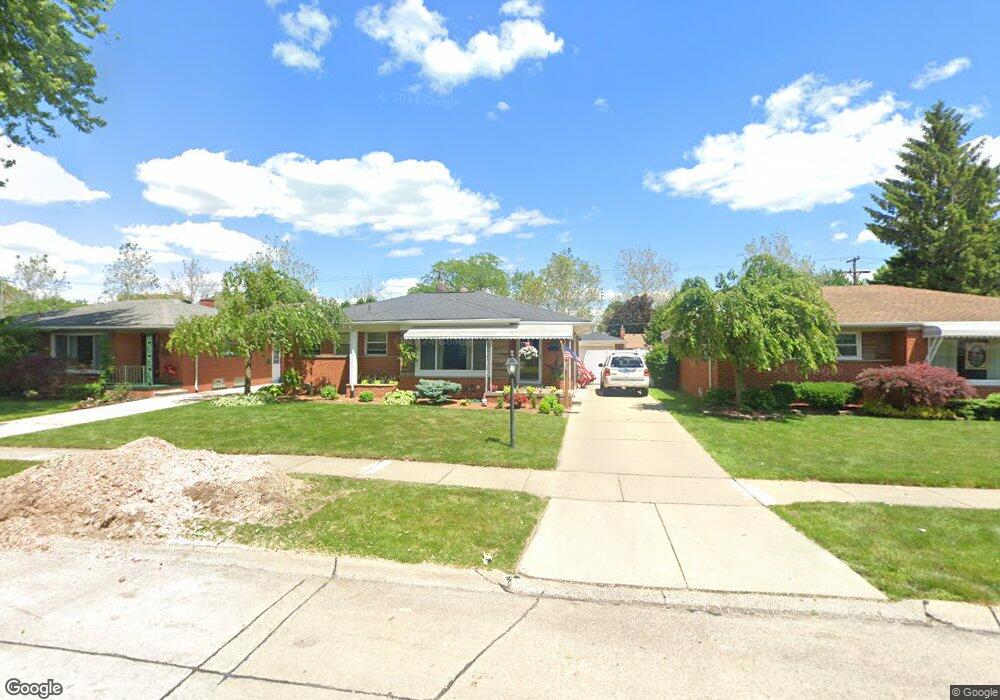
1915 E Longmeadow Rd Trenton, MI 48183
Estimated Value: $241,012 - $262,000
3
Beds
2
Baths
1,165
Sq Ft
$214/Sq Ft
Est. Value
About This Home
This home is located at 1915 E Longmeadow Rd, Trenton, MI 48183 and is currently estimated at $249,253, approximately $213 per square foot. 1915 E Longmeadow Rd is a home located in Wayne County with nearby schools including Jesse L. Anderson Elementary School, Boyd W. Arthurs Middle School, and Trenton High School.
Ownership History
Date
Name
Owned For
Owner Type
Purchase Details
Closed on
Oct 22, 2002
Sold by
Himick Faith R
Bought by
Springstead Dennis
Current Estimated Value
Purchase Details
Closed on
Jun 20, 1994
Sold by
Josephine M Cusin Est
Bought by
Faith R Himick
Home Financials for this Owner
Home Financials are based on the most recent Mortgage that was taken out on this home.
Original Mortgage
$72,800
Interest Rate
8.66%
Mortgage Type
New Conventional
Create a Home Valuation Report for This Property
The Home Valuation Report is an in-depth analysis detailing your home's value as well as a comparison with similar homes in the area
Home Values in the Area
Average Home Value in this Area
Purchase History
| Date | Buyer | Sale Price | Title Company |
|---|---|---|---|
| Springstead Dennis | -- | Multiple | |
| Faith R Himick | $91,000 | -- |
Source: Public Records
Mortgage History
| Date | Status | Borrower | Loan Amount |
|---|---|---|---|
| Previous Owner | Faith R Himick | $72,800 |
Source: Public Records
Tax History Compared to Growth
Tax History
| Year | Tax Paid | Tax Assessment Tax Assessment Total Assessment is a certain percentage of the fair market value that is determined by local assessors to be the total taxable value of land and additions on the property. | Land | Improvement |
|---|---|---|---|---|
| 2025 | $2,739 | $110,200 | $0 | $0 |
| 2024 | $2,739 | $101,300 | $0 | $0 |
| 2023 | $2,569 | $93,500 | $0 | $0 |
| 2022 | $3,492 | $85,100 | $0 | $0 |
| 2021 | $3,377 | $77,500 | $0 | $0 |
| 2020 | $3,412 | $74,000 | $0 | $0 |
| 2019 | $3,360 | $71,700 | $0 | $0 |
| 2018 | $2,222 | $66,800 | $0 | $0 |
| 2017 | $1,923 | $65,000 | $0 | $0 |
| 2016 | $2,999 | $64,100 | $0 | $0 |
| 2015 | $5,306 | $58,800 | $0 | $0 |
| 2013 | $5,140 | $53,300 | $0 | $0 |
| 2012 | $4,478 | $51,000 | $10,300 | $40,700 |
Source: Public Records
Map
Nearby Homes
- 1934 Pinetree Dr
- 1742 Lakeview St
- 1670 Yellowbrick Ct
- 1745 Newman St
- 1561 Glen Ln
- 21230 Mayfair St
- 3236 S Margarette Ct
- 3548 Woodmont Ave
- 1723 N Trenton Dr
- 22256 Monterey Dr
- 2430 Middlefield Rd
- 1659 Boxford St
- Vacant West Rd
- 2330 Ashby St
- 2935 Lakewood Dr Unit G29
- 2387 Ashby St
- 2501 King Rd
- 2211 Parkside St
- 2291 Glenwood St
- 3085 Grange Rd
- 1903 E Longmeadow Rd
- 1923 E Longmeadow Rd
- 1885 E Longmeadow Rd
- 1914 Grange Rd
- 1908 Grange Rd
- 1922 Grange Rd
- 3640 Richland St Unit Bldg-Unit
- 3640 Richland St
- 3630 Richland St
- 1894 Grange Rd
- 1950 Grange Rd
- 1873 E Longmeadow Rd
- 1914 E Longmeadow Rd Unit Bldg-Unit
- 1914 E Longmeadow Rd
- 1902 E Longmeadow Rd
- 1922 E Longmeadow Rd
- 1872 Grange Rd
- 1894 E Longmeadow Rd
- 1970 Grange Rd
- 3710 Richland St