Estimated Value: $386,832 - $417,000
3
Beds
3
Baths
2,526
Sq Ft
$158/Sq Ft
Est. Value
About This Home
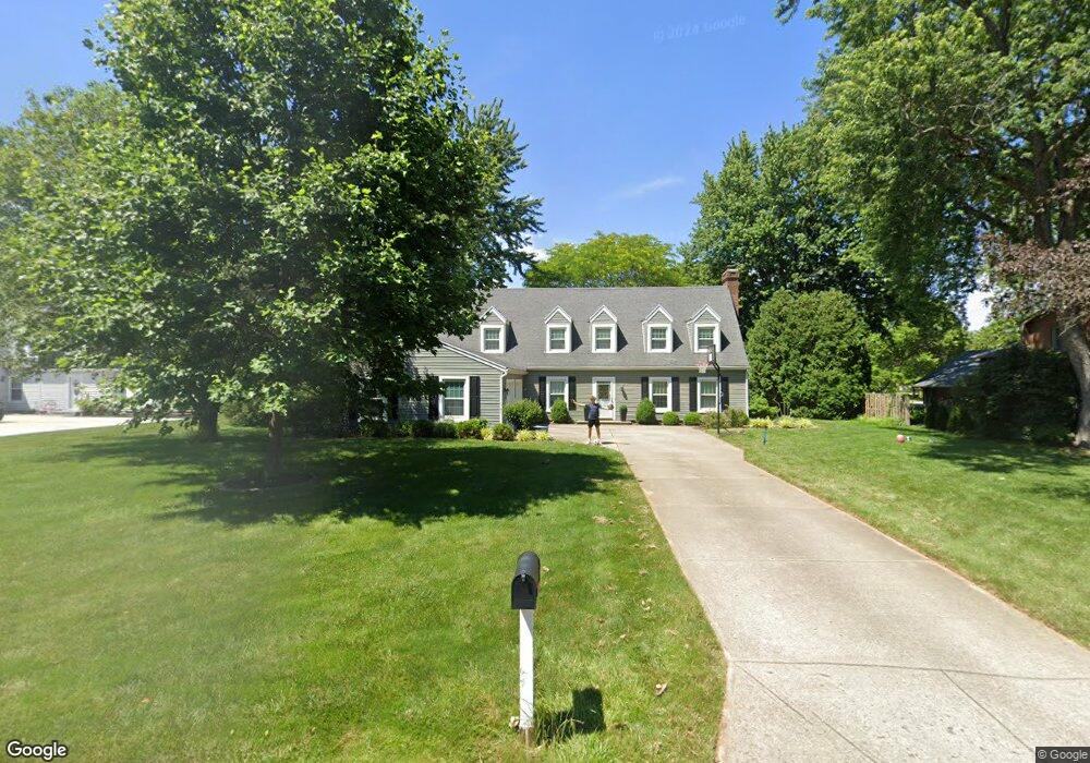
This home is located at 1915 Greenbriar Dr, Troy, OH 45373 and is currently estimated at $398,458, approximately $157 per square foot. 1915 Greenbriar Dr is a home located in Miami County with nearby schools including Concord Elementary School, Van Cleve Elementary School, and Troy Junior High School.
Ownership History
Date
Name
Owned For
Owner Type
Purchase Details
Closed on
Dec 22, 2005
Sold by
Corio Lawrence F and Corio Kathy J
Bought by
Francis Mark D and Francis Marie L
Current Estimated Value
Home Financials for this Owner
Home Financials are based on the most recent Mortgage that was taken out on this home.
Original Mortgage
$166,000
Outstanding Balance
$93,923
Interest Rate
6.48%
Mortgage Type
New Conventional
Estimated Equity
$304,535
Purchase Details
Closed on
Mar 11, 1994
Bought by
Brazie Ii Melvin
Create a Home Valuation Report for This Property
The Home Valuation Report is an in-depth analysis detailing your home's value as well as a comparison with similar homes in the area
Home Values in the Area
Average Home Value in this Area
Purchase History
| Date | Buyer | Sale Price | Title Company |
|---|---|---|---|
| Francis Mark D | $207,500 | -- | |
| Brazie Ii Melvin | $147,000 | -- |
Source: Public Records
Mortgage History
| Date | Status | Borrower | Loan Amount |
|---|---|---|---|
| Open | Francis Mark D | $166,000 |
Source: Public Records
Tax History Compared to Growth
Tax History
| Year | Tax Paid | Tax Assessment Tax Assessment Total Assessment is a certain percentage of the fair market value that is determined by local assessors to be the total taxable value of land and additions on the property. | Land | Improvement |
|---|---|---|---|---|
| 2024 | $3,471 | $88,060 | $21,910 | $66,150 |
| 2023 | $3,471 | $88,060 | $21,910 | $66,150 |
| 2022 | $2,916 | $88,060 | $21,910 | $66,150 |
| 2021 | $2,493 | $70,460 | $17,540 | $52,920 |
| 2020 | $2,495 | $70,460 | $17,540 | $52,920 |
| 2019 | $2,509 | $70,460 | $17,540 | $52,920 |
| 2018 | $2,169 | $57,860 | $16,590 | $41,270 |
| 2017 | $2,189 | $57,860 | $16,590 | $41,270 |
| 2016 | $2,159 | $57,860 | $16,590 | $41,270 |
| 2015 | $2,071 | $53,590 | $15,370 | $38,220 |
| 2014 | $2,071 | $53,590 | $15,370 | $38,220 |
| 2013 | $2,083 | $53,590 | $15,370 | $38,220 |
Source: Public Records
Map
Nearby Homes
- 1965 Quail Nest Ct
- 2206 Northbridge Trail
- 2295 Shenandoah Dr
- 1985 Fox Run
- 2537 Huntington Dr
- 1350 Winchester Dr
- 00 W
- 650 Swailes Rd
- 1550 Creekwood Dr
- 1118 Winchester Dr
- 2015 Merrimont Dr
- 2215 Merrimont Dr
- 1209 Spruce St
- Spruce Plan at Summit Landing
- Norway Plan at Summit Landing
- Chestnut Plan at Summit Landing
- Juniper Plan at Summit Landing
- Palmetto Plan at Summit Landing
- Ashton Plan at Summit Landing
- Empress Plan at Summit Landing
- 1935 Greenbriar Dr
- 2120 Seneca Dr
- 2090 Seneca Dr
- 1945 Greenbriar Dr
- 1920 Greenbriar Dr
- 1890 Greenbriar Dr
- 2125 Seneca Dr
- 2060 Seneca Dr
- 1965 Greenbriar Dr
- 2245 Rockingham Dr
- 1864 Swailes Rd
- 2095 Seneca Dr
- 2180 Seneca Dr
- 2175 Seneca Dr
- 1833 Greenbriar Dr
- 1995 Greenbriar Dr
- 2222 Rockingham Dr
- 2020 Seneca Dr
- 2265 Rockingham Dr
- 2065 Seneca Dr