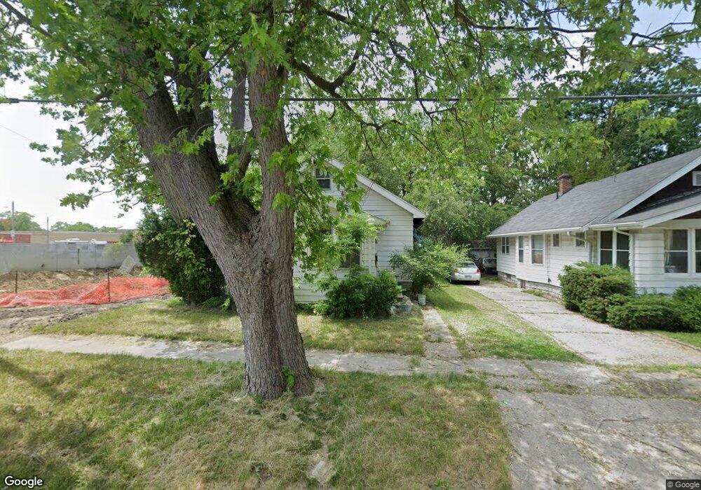
1915 N Vernon Ave Flint, MI 48506
Eastside NeighborhoodEstimated Value: $24,000 - $69,000
2
Beds
1
Bath
824
Sq Ft
$52/Sq Ft
Est. Value
About This Home
This home is located at 1915 N Vernon Ave, Flint, MI 48506 and is currently estimated at $42,609, approximately $51 per square foot. 1915 N Vernon Ave is a home located in Genesee County with nearby schools including Potter School, Flint Cultural Center Academy, and WAY Academy of Flint.
Ownership History
Date
Name
Owned For
Owner Type
Purchase Details
Closed on
Mar 23, 2021
Sold by
E & R Homes Llc
Bought by
Hoard Eugene and Hoard Sandra
Current Estimated Value
Purchase Details
Closed on
Feb 1, 2019
Sold by
E & R Homes Llc
Bought by
Neal Wayne and Luke Crystal
Home Financials for this Owner
Home Financials are based on the most recent Mortgage that was taken out on this home.
Original Mortgage
$28,500
Interest Rate
4.6%
Mortgage Type
Seller Take Back
Purchase Details
Closed on
Dec 7, 2017
Sold by
Deborah Floucei Michael and Deborah Floucei
Bought by
Denonme Tebedo Property Llc
Create a Home Valuation Report for This Property
The Home Valuation Report is an in-depth analysis detailing your home's value as well as a comparison with similar homes in the area
Home Values in the Area
Average Home Value in this Area
Purchase History
| Date | Buyer | Sale Price | Title Company |
|---|---|---|---|
| Hoard Eugene | -- | None Available | |
| Neal Wayne | $30,000 | Sargents Title Co | |
| E & R Homes Llc | $5,000 | None Available | |
| Denonme Tebedo Property Llc | -- | None Available |
Source: Public Records
Mortgage History
| Date | Status | Borrower | Loan Amount |
|---|---|---|---|
| Previous Owner | Neal Wayne | $28,500 |
Source: Public Records
Tax History Compared to Growth
Tax History
| Year | Tax Paid | Tax Assessment Tax Assessment Total Assessment is a certain percentage of the fair market value that is determined by local assessors to be the total taxable value of land and additions on the property. | Land | Improvement |
|---|---|---|---|---|
| 2025 | $1,080 | $12,300 | $0 | $0 |
| 2024 | $1,001 | $11,400 | $0 | $0 |
| 2023 | $624 | $9,900 | $0 | $0 |
| 2022 | $0 | $8,000 | $0 | $0 |
| 2021 | $642 | $7,600 | $0 | $0 |
| 2020 | $590 | $6,800 | $0 | $0 |
| 2019 | $1,027 | $6,800 | $0 | $0 |
| 2018 | $948 | $5,100 | $0 | $0 |
| 2017 | $593 | $0 | $0 | $0 |
| 2016 | $607 | $0 | $0 | $0 |
| 2015 | -- | $0 | $0 | $0 |
| 2014 | -- | $0 | $0 | $0 |
| 2012 | -- | $7,600 | $0 | $0 |
Source: Public Records
Map
Nearby Homes
- 1622 Arlington Ave
- 1510 N Vernon Ave
- 1501 Arlington Ave
- 2225 Arlington Ave
- 1805 Bennett Ave
- 1814 Mabel Ave
- 2301 Missouri Ave
- 1318 Cronk Ave
- 2211 Torrance St
- 2506 Arlington Ave
- 2426 Missouri Ave
- 2426 Hoff St
- 2610 Pennsylvania Ave
- 1644 Pennsylvania Ave
- 1605 Kearsley Park Blvd
- 1529 Broadway Blvd
- 1721 New York Ave
- 2605 Nebraska Ave
- 1622 New York Ave
- 1629 New York Ave
- 1911 N Vernon Ave
- 1919 N Vernon Ave
- 1923 N Vernon Ave
- 1912 Arlington Ave
- 1916 Arlington Ave
- 2001 N Vernon Ave
- 1920 Arlington Ave
- 2005 N Vernon Ave
- 1922 Arlington Ave
- 1916 N Vernon Ave
- 2125 Davison Rd
- 2007 N Vernon Ave
- 1924 N Vernon Ave
- 2002 Arlington Ave
- 1928 N Vernon Ave
- 2209 Davison Rd
- 2009 N Vernon Ave
- 1932 N Vernon Ave
- 2006 Arlington Ave
- 1915 Arlington Ave