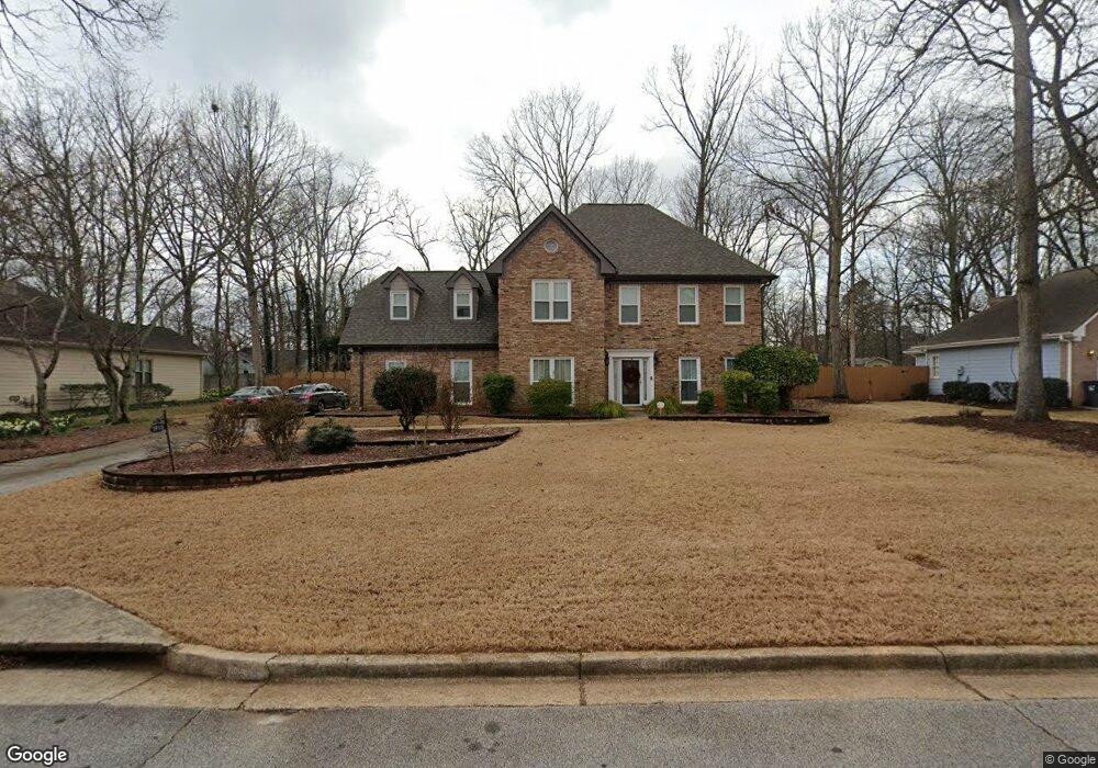
1915 Pennistone Way Unit 1 Snellville, GA 30078
Estimated Value: $438,000 - $499,000
4
Beds
3
Baths
2,503
Sq Ft
$187/Sq Ft
Est. Value
About This Home
This home is located at 1915 Pennistone Way Unit 1, Snellville, GA 30078 and is currently estimated at $468,961, approximately $187 per square foot. 1915 Pennistone Way Unit 1 is a home located in Gwinnett County with nearby schools including Brookwood Elementary School, Alton C. Crews Middle School, and Brookwood High School.
Ownership History
Date
Name
Owned For
Owner Type
Purchase Details
Closed on
Jun 26, 2025
Sold by
Jones Jamie Lynn
Bought by
Brewer Ansley and Mclaughlin Brandi
Current Estimated Value
Purchase Details
Closed on
May 26, 2000
Sold by
Jones Jamie L
Bought by
Jones Jamie L and Jones Scott C
Home Financials for this Owner
Home Financials are based on the most recent Mortgage that was taken out on this home.
Original Mortgage
$155,700
Interest Rate
8.14%
Mortgage Type
New Conventional
Create a Home Valuation Report for This Property
The Home Valuation Report is an in-depth analysis detailing your home's value as well as a comparison with similar homes in the area
Home Values in the Area
Average Home Value in this Area
Purchase History
| Date | Buyer | Sale Price | Title Company |
|---|---|---|---|
| Brewer Ansley | -- | -- | |
| Jones Jamie L | -- | -- | |
| Jones Jamie L | $173,000 | -- |
Source: Public Records
Mortgage History
| Date | Status | Borrower | Loan Amount |
|---|---|---|---|
| Previous Owner | Jones Jamie L | $155,700 |
Source: Public Records
Tax History Compared to Growth
Tax History
| Year | Tax Paid | Tax Assessment Tax Assessment Total Assessment is a certain percentage of the fair market value that is determined by local assessors to be the total taxable value of land and additions on the property. | Land | Improvement |
|---|---|---|---|---|
| 2024 | $3,635 | $146,200 | $36,000 | $110,200 |
| 2023 | $3,635 | $161,640 | $33,200 | $128,440 |
| 2022 | $3,968 | $161,640 | $33,200 | $128,440 |
| 2021 | $3,376 | $128,720 | $27,040 | $101,680 |
| 2020 | $3,178 | $95,720 | $18,800 | $76,920 |
| 2019 | $3,173 | $95,720 | $18,800 | $76,920 |
| 2018 | $3,187 | $95,720 | $18,800 | $76,920 |
| 2016 | $2,481 | $69,680 | $12,000 | $57,680 |
| 2015 | $2,488 | $69,680 | $12,000 | $57,680 |
| 2014 | -- | $69,680 | $12,000 | $57,680 |
Source: Public Records
Map
Nearby Homes
- 1900 Pennistone Way
- 2260 Burlington Ln Unit 1
- 2324 Blackberry Ct
- 1952 Colony Oaks Dr
- 2180 Stockton Walk Ln
- 2240 Stockton Walk Ln
- 2015 Clipper Straits
- 2392 Ivy Mountain Dr
- 2028 Harbour Oaks Dr
- 1935 Glenhurst Dr
- 1864 Gloucester Ct
- 2462 Chimney Top Ln
- 1855 Vintage Dr
- 2100 Glenhurst Dr
- 2055 Oak Rd
- 1838 Cates Ct
- 1905 Pennistone Way
- 1925 Pennistone Way
- 1912 Colony Oaks Dr
- 1910 Pennistone Way
- 1920 Pennistone Way
- 1895 Pennistone Way
- 1935 Pennistone Way
- 1932 Colony Oaks Dr
- 0 Colony Oaks Dr SW Unit 7346147
- 0 Colony Oaks Dr SW Unit 3172932
- 0 Colony Oaks Dr SW Unit 3126478
- 0 Colony Oaks Dr SW Unit 8237096
- 0 Colony Oaks Dr SW
- 1930 Pennistone Way Unit 1
- 1902 Colony Oaks Dr
- 1890 Pennistone Way
- 1942 Colony Oaks Dr
- 1875 Pennistone Way
- 2085 Stockton Walk Ln
- 2075 Stockton Walk Ln