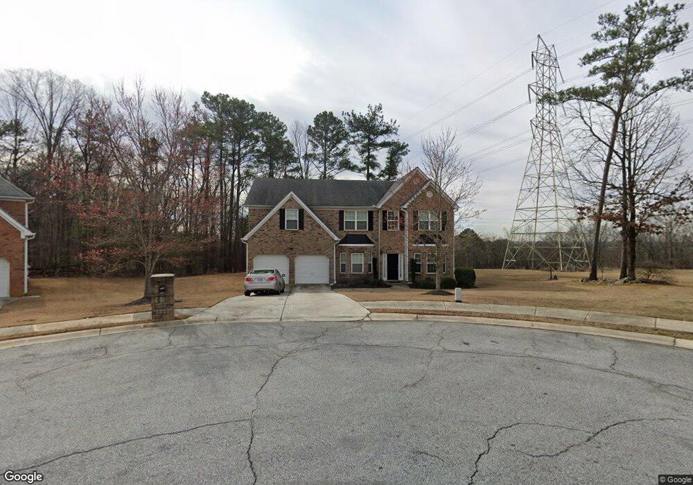
1915 Pius Dr Ellenwood, GA 30294
Southwest DeKalb NeighborhoodEstimated Value: $360,000 - $386,000
4
Beds
4
Baths
3,758
Sq Ft
$100/Sq Ft
Est. Value
About This Home
This home is located at 1915 Pius Dr, Ellenwood, GA 30294 and is currently estimated at $376,170, approximately $100 per square foot. 1915 Pius Dr is a home located in DeKalb County with nearby schools including Cedar Grove Elementary School, Cedar Grove Middle School, and Cedar Grove High School.
Ownership History
Date
Name
Owned For
Owner Type
Purchase Details
Closed on
Aug 19, 2005
Sold by
Silver Creek Communities Inc
Bought by
Jones Tarvorshae R and Jones Kelvon L
Current Estimated Value
Home Financials for this Owner
Home Financials are based on the most recent Mortgage that was taken out on this home.
Original Mortgage
$212,600
Outstanding Balance
$111,322
Interest Rate
5.61%
Mortgage Type
VA
Estimated Equity
$264,848
Create a Home Valuation Report for This Property
The Home Valuation Report is an in-depth analysis detailing your home's value as well as a comparison with similar homes in the area
Home Values in the Area
Average Home Value in this Area
Purchase History
| Date | Buyer | Sale Price | Title Company |
|---|---|---|---|
| Jones Tarvorshae R | $216,100 | -- |
Source: Public Records
Mortgage History
| Date | Status | Borrower | Loan Amount |
|---|---|---|---|
| Open | Jones Tarvorshae R | $212,600 |
Source: Public Records
Tax History Compared to Growth
Tax History
| Year | Tax Paid | Tax Assessment Tax Assessment Total Assessment is a certain percentage of the fair market value that is determined by local assessors to be the total taxable value of land and additions on the property. | Land | Improvement |
|---|---|---|---|---|
| 2025 | $4,888 | $149,400 | $16,000 | $133,400 |
| 2024 | $5,182 | $152,000 | $16,000 | $136,000 |
| 2023 | $5,182 | $145,760 | $14,000 | $131,760 |
| 2022 | $4,298 | $126,480 | $14,000 | $112,480 |
| 2021 | $3,431 | $101,280 | $16,000 | $85,280 |
| 2020 | $3,311 | $97,640 | $16,000 | $81,640 |
| 2019 | $2,766 | $82,720 | $8,720 | $74,000 |
| 2018 | $2,033 | $68,920 | $8,720 | $60,200 |
| 2017 | $2,425 | $70,200 | $8,720 | $61,480 |
| 2016 | $1,725 | $51,680 | $8,786 | $42,894 |
| 2014 | $1,453 | $51,680 | $8,720 | $42,960 |
Source: Public Records
Map
Nearby Homes
- 1910 Boulder Gate Dr
- 1974 Boulder Gate Dr
- 1957 Boulder Gate Dr
- 4042 Sautee Trail
- 4135 Moore Rd
- 2987 Bouldercrest Rd
- 3658 Boulder Ridge Ct
- 4134 James Lake Dr
- 4.2 + -Acres River Rd
- 1677 Cedar Grove Rd
- 3444 Sugar Creek Cove Unit 16
- 3871 Martin Dr
- 1775 Cedar Grove Rd
- 1993 Whitehall Forest Ct SE
- Everest III Plan at Cedar Grove Commons
- Westin Plan at Cedar Grove Commons
- Oakmont Plan at Cedar Grove Commons
- Zoey II Plan at Cedar Grove Commons
- 1997 Whitehall Forest Ct SE
- 2029 Cedar Grove Rd