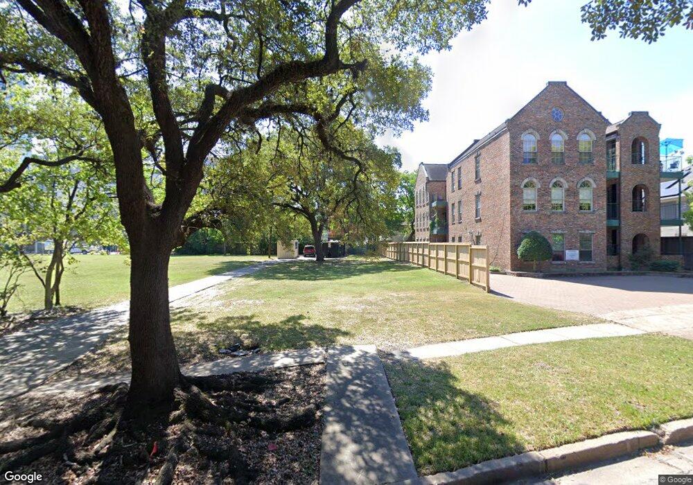
1915 University Blvd Unit 1 Houston, TX 77030
University Place NeighborhoodEstimated Value: $990,000
1
Bed
1
Bath
3,388
Sq Ft
$292/Sq Ft
Est. Value
About This Home
This home is located at 1915 University Blvd Unit 1, Houston, TX 77030 and is currently estimated at $990,000, approximately $292 per square foot. 1915 University Blvd Unit 1 is a home located in Harris County with nearby schools including Roberts Elementary School, Pershing Middle School, and Lamar High School.
Ownership History
Date
Name
Owned For
Owner Type
Purchase Details
Closed on
Mar 14, 2024
Sold by
William Marsh Rice University
Bought by
Chabad At Rice Inc
Current Estimated Value
Purchase Details
Closed on
Aug 20, 2021
Sold by
1915 University Blvd Llc
Bought by
Chabad At Rice Inc
Purchase Details
Closed on
Jun 21, 2019
Sold by
Chambers Patricia J
Bought by
1915 University Blvd Llc
Create a Home Valuation Report for This Property
The Home Valuation Report is an in-depth analysis detailing your home's value as well as a comparison with similar homes in the area
Home Values in the Area
Average Home Value in this Area
Purchase History
| Date | Buyer | Sale Price | Title Company |
|---|---|---|---|
| Chabad At Rice Inc | -- | Chicago Title | |
| Chabad At Rice Inc | -- | New Title Company Name | |
| 1915 University Blvd Llc | -- | Title Houston Holdings |
Source: Public Records
Tax History Compared to Growth
Tax History
| Year | Tax Paid | Tax Assessment Tax Assessment Total Assessment is a certain percentage of the fair market value that is determined by local assessors to be the total taxable value of land and additions on the property. | Land | Improvement |
|---|---|---|---|---|
| 2025 | $22,942 | -- | -- | -- |
| 2024 | $22,942 | $1,050,000 | $1,050,000 | -- |
| 2023 | $22,092 | $1,096,480 | $1,096,480 | $0 |
| 2022 | $18,656 | $847,280 | $847,280 | $0 |
| 2021 | $20,904 | $896,906 | $847,280 | $49,626 |
| 2020 | $21,682 | $895,385 | $847,280 | $48,105 |
| 2019 | $22,972 | $907,836 | $847,280 | $60,556 |
| 2018 | $22,360 | $883,643 | $847,280 | $36,363 |
| 2017 | $22,343 | $883,643 | $847,280 | $36,363 |
| 2016 | $18,059 | $714,187 | $677,824 | $36,363 |
| 2015 | $19,209 | $727,909 | $677,824 | $50,085 |
| 2014 | $19,209 | $747,342 | $677,824 | $69,518 |
Source: Public Records
Map
Nearby Homes
- 1961 Dryden Rd
- 2061 Southgate Blvd
- 2019 Mcclendon St
- 2065 Southgate Blvd
- 2019 Sheridan St
- 2111 Mcclendon St
- 2169 University Blvd
- 2213 Sheridan St
- 2203 Dorrington St Unit 301
- 2203 Dorrington St Unit 403
- 2203 Dorrington St Unit 406
- 2203 Dorrington St Unit 208
- 2302 Wordsworth St
- 2309 Shakespeare St
- 2218 Bellefontaine St Unit B
- 2131 Maroneal St
- 2346 Watts St
- 2400 Swift Blvd
- 2215 Dunstan Rd
- 2402 Southgate Blvd
- 1915 University Blvd Unit 4
- 1915 University Blvd
- 1919 University Blvd Unit BV
- 1919 University Blvd
- 1919 University Blvd
- 1919 University Blvd
- 1919 University Blvd
- 1919 University Blvd
- 1919 University Blvd
- 1919 University Blvd Unit BV
- 1919 University Blvd
- 1919 University Blvd Unit C-1
- 1905 University Blvd Unit 5
- 1923 University Blvd
- 1923 University Blvd Unit B
- 1938 Dryden Rd
- 1938 Dryden Rd Unit 10
- 1953 University Blvd
- 1938-1940 Dryden Rd
- 1932 Dryden Rd