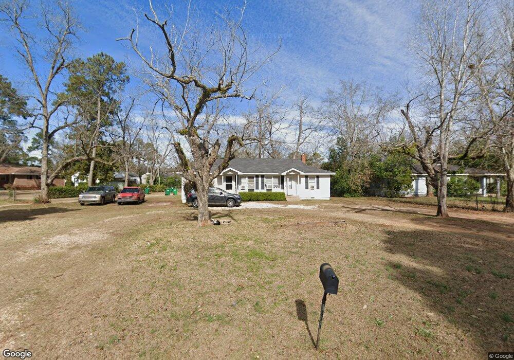
1915 W Broad Ave Albany, GA 31707
Estimated Value: $76,000 - $123,000
4
Beds
2
Baths
1,352
Sq Ft
$72/Sq Ft
Est. Value
About This Home
This home is located at 1915 W Broad Ave, Albany, GA 31707 and is currently estimated at $98,000, approximately $72 per square foot. 1915 W Broad Ave is a home located in Dougherty County with nearby schools including Live Oak Elementary School, Merry Acres Middle School, and Westover High School.
Ownership History
Date
Name
Owned For
Owner Type
Purchase Details
Closed on
Dec 28, 2005
Sold by
Frost Roy C
Bought by
Bridges James A
Current Estimated Value
Home Financials for this Owner
Home Financials are based on the most recent Mortgage that was taken out on this home.
Original Mortgage
$84,100
Interest Rate
6.18%
Mortgage Type
New Conventional
Purchase Details
Closed on
Aug 10, 1999
Sold by
Tinson Louise M U and Tinson Will
Bought by
Frost Roy C and Frost Judy
Purchase Details
Closed on
Jul 13, 1955
Bought by
Tison Tison K and Tison R
Create a Home Valuation Report for This Property
The Home Valuation Report is an in-depth analysis detailing your home's value as well as a comparison with similar homes in the area
Home Values in the Area
Average Home Value in this Area
Purchase History
| Date | Buyer | Sale Price | Title Company |
|---|---|---|---|
| Bridges James A | $84,000 | -- | |
| Frost Roy C | $17,500 | -- | |
| Tison Tison K | -- | -- |
Source: Public Records
Mortgage History
| Date | Status | Borrower | Loan Amount |
|---|---|---|---|
| Closed | Bridges James A | $84,100 |
Source: Public Records
Tax History Compared to Growth
Tax History
| Year | Tax Paid | Tax Assessment Tax Assessment Total Assessment is a certain percentage of the fair market value that is determined by local assessors to be the total taxable value of land and additions on the property. | Land | Improvement |
|---|---|---|---|---|
| 2024 | $849 | $17,800 | $3,600 | $14,200 |
| 2023 | $829 | $17,800 | $3,600 | $14,200 |
| 2022 | $832 | $17,800 | $3,600 | $14,200 |
| 2021 | $772 | $17,800 | $3,600 | $14,200 |
| 2020 | $774 | $17,800 | $3,600 | $14,200 |
| 2019 | $776 | $17,800 | $3,600 | $14,200 |
| 2018 | $780 | $17,800 | $3,600 | $14,200 |
| 2017 | $726 | $17,800 | $3,600 | $14,200 |
| 2016 | $727 | $17,800 | $3,600 | $14,200 |
| 2015 | $729 | $17,800 | $3,600 | $14,200 |
| 2014 | $720 | $17,800 | $3,600 | $14,200 |
Source: Public Records
Map
Nearby Homes
- 100 N Ingleside Dr
- 1916 W Broad Ave
- 200 N Ingleside Dr
- 2009 W Broad Ave
- 1926 W Oglethorpe Ave
- 2021 W Broad Ave
- 2026 Melrose Dr
- 1821 Samford Ave
- 1810 Edgerly Ave
- 1906 W Whitney Ave
- 1703 W Oglethorpe Ave
- 1804 W Whitney Ave
- 400 S Shadowlawn Dr
- 410 Endicott Ln
- 501 Endicott Ln
- 1700 Edgerly Ave
- 1711 Parker Ave
- 612 Russell Rd
- 1710 Myrtle Rd
- 2200 Gillionville Rd
- 102 N Ingleside Dr
- 104 N Ingleside Dr
- 1911 W Broad Ave
- 1910 Melrose Dr
- 106 N Ingleside Dr
- 1914 W Broad Ave
- 1909 W Broad Ave
- 1912 W Broad Ave
- 1908 Melrose Dr
- 1910 W Broad Ave
- 100 S Ingleside Dr
- 1907 W Broad Ave
- 1908 W Broad Ave
- 1906 Melrose Dr
- 102 S Ingleside Dr
- 103 N Ingleside Dr
- 1906 W Broad Ave
- 1905 W Broad Ave
- 105 N Ingleside Dr
- 1904 Melrose Dr