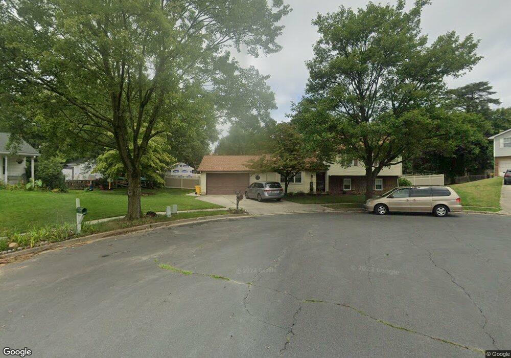
1915 Wamsutta Ln Hanover, MD 21076
Estimated Value: $512,706 - $586,000
--
Bed
3
Baths
1,936
Sq Ft
$287/Sq Ft
Est. Value
About This Home
This home is located at 1915 Wamsutta Ln, Hanover, MD 21076 and is currently estimated at $555,677, approximately $287 per square foot. 1915 Wamsutta Ln is a home located in Anne Arundel County with nearby schools including Jessup Elementary School, Meade Middle School, and Meade High School.
Ownership History
Date
Name
Owned For
Owner Type
Purchase Details
Closed on
Oct 3, 2014
Sold by
Magnuson Jon R and Magnuson Valerie A
Bought by
Magnuson Living Trust and Magnuson Valerie A
Current Estimated Value
Purchase Details
Closed on
Jan 7, 1980
Bought by
Magnuson Jon R and Magnuson Valerie A
Home Financials for this Owner
Home Financials are based on the most recent Mortgage that was taken out on this home.
Original Mortgage
$52,000
Interest Rate
12.85%
Create a Home Valuation Report for This Property
The Home Valuation Report is an in-depth analysis detailing your home's value as well as a comparison with similar homes in the area
Home Values in the Area
Average Home Value in this Area
Purchase History
| Date | Buyer | Sale Price | Title Company |
|---|---|---|---|
| Magnuson Living Trust | -- | None Available | |
| Magnuson Jon R | $81,700 | -- |
Source: Public Records
Mortgage History
| Date | Status | Borrower | Loan Amount |
|---|---|---|---|
| Closed | Magnuson Jon R | $52,000 |
Source: Public Records
Tax History Compared to Growth
Tax History
| Year | Tax Paid | Tax Assessment Tax Assessment Total Assessment is a certain percentage of the fair market value that is determined by local assessors to be the total taxable value of land and additions on the property. | Land | Improvement |
|---|---|---|---|---|
| 2025 | $3,716 | $442,900 | $194,800 | $248,100 |
| 2024 | $3,716 | $418,800 | $0 | $0 |
| 2023 | $3,598 | $394,700 | $0 | $0 |
| 2022 | $3,349 | $370,600 | $174,800 | $195,800 |
| 2021 | $3,193 | $362,467 | $0 | $0 |
| 2020 | $3,193 | $354,333 | $0 | $0 |
| 2019 | $3,140 | $346,200 | $149,200 | $197,000 |
| 2018 | $3,318 | $327,200 | $0 | $0 |
| 2017 | $2,933 | $308,200 | $0 | $0 |
| 2016 | -- | $289,200 | $0 | $0 |
| 2015 | -- | $289,200 | $0 | $0 |
| 2014 | -- | $289,200 | $0 | $0 |
Source: Public Records
Map
Nearby Homes
- 7908 S Cartier Ct
- 1905 Armor Ct
- 7907 Chalice Rd
- 7834 Citadel Dr
- 1915 Huguenot Place
- 7560 Newmanstown Dr
- 8221 Meadowood Dr
- 8206 Meadowood Dr
- 8357 Meadowood Dr
- 2616 Hardaway Cir
- Maguire Plan at Shipley Homestead
- The Julianne Plan at Shipley Homestead
- The Tessa Plan at Shipley Homestead
- The Jenkins Plan at Shipley Homestead
- 1865 Cedar Dr
- 1883 Cedar Dr
- 7147 Wedmore Ct
- 7611 Elmcrest Rd
- 1843 Disney Estates Cir
- 1835 Lasalle Place
- 1916 Wamsutta Ln
- 7819 Kawshek Path
- 1913 Wamsutta Ln
- 7821 Kawshek Path
- 1914 Wamsutta Ln
- 7817 Kawshek Path
- 1918 Pometacom Dr
- 1916 Pometacom Dr
- 1911 Wamsutta Ln
- 1912 Wamsutta Ln
- 7815 Kawshek Path
- 7820 Kawshek Path
- 1910 Wamsutta Ln
- 7818 Kawshek Path
- 1914 Pometacom Dr
- 1909 Wamsutta Ln
- 1919 Pometacom Dr
- 1921 Pometacom Dr
- 1917 Pometacom Dr
- 1924 Pometacom Dr