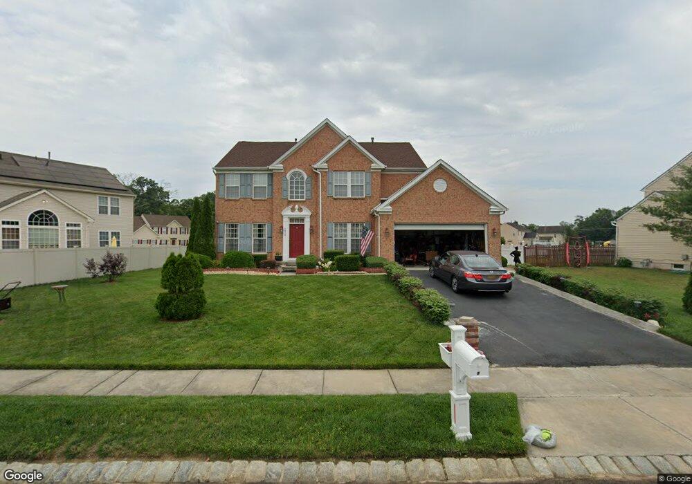
1916 Apache Ct Vineland, NJ 08361
Estimated Value: $463,632 - $612,000
4
Beds
2
Baths
3,033
Sq Ft
$175/Sq Ft
Est. Value
About This Home
This home is located at 1916 Apache Ct, Vineland, NJ 08361 and is currently estimated at $531,658, approximately $175 per square foot. 1916 Apache Ct is a home located in Cumberland County with nearby schools including Anthony Rossi Elementary School, John H. Winslow Elementary School, and Vineland Senior High School.
Ownership History
Date
Name
Owned For
Owner Type
Purchase Details
Closed on
Jul 30, 2009
Sold by
Han Seung H and Han Brenda Y
Bought by
Mcpherson Sharon
Current Estimated Value
Home Financials for this Owner
Home Financials are based on the most recent Mortgage that was taken out on this home.
Original Mortgage
$266,076
Outstanding Balance
$173,129
Interest Rate
5.17%
Mortgage Type
FHA
Estimated Equity
$358,529
Purchase Details
Closed on
Dec 21, 2007
Sold by
Nvr Inc
Bought by
Han Seung H and Han Brenda Y
Purchase Details
Closed on
Jul 31, 2007
Sold by
Spring Hollow No 1 Llc
Bought by
Nvr Inc
Create a Home Valuation Report for This Property
The Home Valuation Report is an in-depth analysis detailing your home's value as well as a comparison with similar homes in the area
Home Values in the Area
Average Home Value in this Area
Purchase History
| Date | Buyer | Sale Price | Title Company |
|---|---|---|---|
| Mcpherson Sharon | $270,000 | -- | |
| Han Seung H | $344,365 | -- | |
| Nvr Inc | $98,000 | -- |
Source: Public Records
Mortgage History
| Date | Status | Borrower | Loan Amount |
|---|---|---|---|
| Open | Mcpherson Sharon | $266,076 |
Source: Public Records
Tax History
| Year | Tax Paid | Tax Assessment Tax Assessment Total Assessment is a certain percentage of the fair market value that is determined by local assessors to be the total taxable value of land and additions on the property. | Land | Improvement |
|---|---|---|---|---|
| 2025 | $7,791 | $244,700 | $37,800 | $206,900 |
| 2024 | $7,791 | $244,700 | $37,800 | $206,900 |
| 2023 | $7,740 | $244,700 | $37,800 | $206,900 |
| 2022 | $7,510 | $244,700 | $37,800 | $206,900 |
| 2021 | $7,373 | $244,700 | $37,800 | $206,900 |
| 2020 | $7,162 | $244,700 | $37,800 | $206,900 |
| 2019 | $7,064 | $244,700 | $37,800 | $206,900 |
| 2018 | $6,879 | $244,700 | $37,800 | $206,900 |
| 2017 | $6,533 | $244,700 | $37,800 | $206,900 |
| 2016 | $6,303 | $244,700 | $37,800 | $206,900 |
| 2015 | $6,071 | $244,700 | $37,800 | $206,900 |
| 2014 | $5,741 | $244,700 | $37,800 | $206,900 |
Source: Public Records
Map
Nearby Homes
- 1550 S Lincoln Ave
- 2354 Dante Ave
- 1244 Garry Ave
- 2800 Perna Ln
- 2551 Edna Dr
- 1170 Rogers Ave
- 1466 E Sherman Ave
- 1737 Pats Ln
- 1288 Holmes Ave
- 1390 E Sherman Ave
- 1286 Harding Rd
- 2603 Valhalla Rd
- 2676 Medina St
- 2263 Edgewood Dr
- 1400 Magnolia Rd
- 2703 Inverness Rd
- 2073 Cottonwood Dr
- 1232 Harding Rd
- 1178 S Spring Rd
- 1314 Magnolia Rd
- 1922 Apache Ct
- 1897 Arrowhead Trail
- 1931 Arrowhead Trail
- 1932 Apache Ct
- 1911 Apache Ct
- 1843 Arrowhead Trail
- 1921 Apache Ct
- 1920 Arrowhead Trail
- 1902 Arrowhead Trail
- 1951 Arrowhead Trail
- 1944 Apache Ct
- 1866 Arrowhead Trail
- 1931 Apache Ct
- 1884 Arrowhead Trail
- 1825 Arrowhead Trail
- 1946 Arrowhead Trail
- 1848 Arrowhead Trail
- 1962 Apache Ct
- 1973 Arrowhead Trail
- 1935 Apache Ct
Your Personal Tour Guide
Ask me questions while you tour the home.