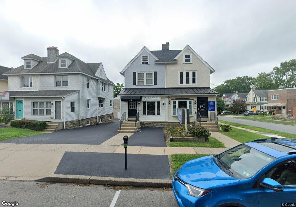
1916 Darby Rd Havertown, PA 19083
Estimated Value: $439,000 - $553,000
2
Beds
2
Baths
1,743
Sq Ft
$295/Sq Ft
Est. Value
About This Home
This home is located at 1916 Darby Rd, Havertown, PA 19083 and is currently estimated at $514,020, approximately $294 per square foot. 1916 Darby Rd is a home located in Delaware County with nearby schools including Lynnewood El School, Haverford Middle School, and Haverford Senior High School.
Ownership History
Date
Name
Owned For
Owner Type
Purchase Details
Closed on
Jun 28, 2005
Sold by
Fay James and Fay Maureen
Bought by
Halpern Leonard and Halpern Sheila
Current Estimated Value
Home Financials for this Owner
Home Financials are based on the most recent Mortgage that was taken out on this home.
Original Mortgage
$218,000
Outstanding Balance
$114,313
Interest Rate
5.73%
Mortgage Type
Purchase Money Mortgage
Estimated Equity
$399,707
Purchase Details
Closed on
Jul 8, 2002
Sold by
Mccrystal Patrick H
Bought by
Fay James and Fay Maureen
Home Financials for this Owner
Home Financials are based on the most recent Mortgage that was taken out on this home.
Original Mortgage
$84,750
Interest Rate
6.24%
Purchase Details
Closed on
Feb 29, 1996
Sold by
Mccrystal Patrick H
Bought by
Mccrystal Patrick
Create a Home Valuation Report for This Property
The Home Valuation Report is an in-depth analysis detailing your home's value as well as a comparison with similar homes in the area
Home Values in the Area
Average Home Value in this Area
Purchase History
| Date | Buyer | Sale Price | Title Company |
|---|---|---|---|
| Halpern Leonard | $272,500 | Commonwealth Title | |
| Fay James | $113,000 | -- | |
| Mccrystal Patrick | -- | -- |
Source: Public Records
Mortgage History
| Date | Status | Borrower | Loan Amount |
|---|---|---|---|
| Open | Halpern Leonard | $218,000 | |
| Previous Owner | Fay James | $84,750 |
Source: Public Records
Tax History Compared to Growth
Tax History
| Year | Tax Paid | Tax Assessment Tax Assessment Total Assessment is a certain percentage of the fair market value that is determined by local assessors to be the total taxable value of land and additions on the property. | Land | Improvement |
|---|---|---|---|---|
| 2025 | $7,823 | $304,250 | $94,370 | $209,880 |
| 2024 | $7,823 | $304,250 | $94,370 | $209,880 |
| 2023 | $7,601 | $304,250 | $94,370 | $209,880 |
| 2022 | $7,423 | $304,250 | $94,370 | $209,880 |
| 2021 | $12,093 | $304,250 | $94,370 | $209,880 |
| 2020 | $6,160 | $132,540 | $47,790 | $84,750 |
| 2019 | $6,047 | $132,540 | $47,790 | $84,750 |
| 2018 | $5,943 | $132,540 | $0 | $0 |
| 2017 | $5,817 | $132,540 | $0 | $0 |
| 2016 | $727 | $132,540 | $0 | $0 |
| 2015 | $742 | $132,540 | $0 | $0 |
| 2014 | $742 | $132,540 | $0 | $0 |
Source: Public Records
Map
Nearby Homes
- 26 E Turnbull Ave
- 32 E Benedict Ave
- 25 Oak Ln
- 2300 Oakmont Ave
- 41 W Hillcrest Ave
- 143 Campbell Ave
- 2424 Delchester Ave
- 13 Princeton Rd
- 231 Hastings Ave
- 16 Chelten Rd
- 101 Rockland Rd
- 2423 Hollis Rd
- 1216 Darby Rd
- 100 Brookline Blvd
- 664 Washington Ave
- 2616 Prescott Rd
- 164 Woodbine Rd
- 324 Brookline Blvd
- 1612 Earlington Rd
- 100 E Manoa Rd
- 1918 Darby Rd
- 1912 Darby Rd
- 1910 Darby Rd
- 1908 Darby Rd
- 1908 Darby Rd Unit 1
- 1908 Darby Rd Unit 2
- 1 W Turnbull Ave Unit A
- 1 W Turnbull Ave
- 1 W Turnbull Ave Unit FIRST FLR
- 1906 Darby Rd
- 5 W Turnbull Ave
- 1 1/2 W Turnbull Ave
- 1904 Darby Rd
- 7 W Turnbull Ave
- 2 W Turnbull Ave
- 2 W Turnbull Ave
- 2 W Turnbull Ave
- 2 W Turnbull Ave
- 2 W Turnbull Ave
- 1902 Darby Rd