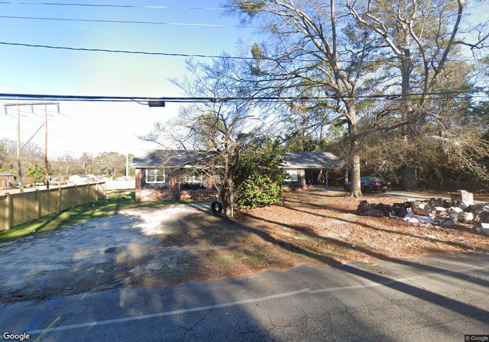
1916 Holland St West Columbia, SC 29169
Estimated Value: $218,000 - $303,000
4
Beds
3
Baths
2,199
Sq Ft
$117/Sq Ft
Est. Value
About This Home
This home is located at 1916 Holland St, West Columbia, SC 29169 and is currently estimated at $258,058, approximately $117 per square foot. 1916 Holland St is a home located in Lexington County with nearby schools including Riverbank Elementary, Northside Middle, and Brookland-Cayce High School.
Ownership History
Date
Name
Owned For
Owner Type
Purchase Details
Closed on
Jan 17, 2020
Sold by
Baker Jocelyn Y
Bought by
Peeples Jason W and Peeples Nina L
Current Estimated Value
Purchase Details
Closed on
Sep 23, 2005
Sold by
Armstrong Jon D and Brooks Rebecca L
Bought by
Baker Jocelyn Y
Home Financials for this Owner
Home Financials are based on the most recent Mortgage that was taken out on this home.
Original Mortgage
$107,550
Interest Rate
8.34%
Mortgage Type
Adjustable Rate Mortgage/ARM
Purchase Details
Closed on
Feb 3, 1999
Sold by
First Church Nazarene W C
Bought by
Armstrong Jon D
Create a Home Valuation Report for This Property
The Home Valuation Report is an in-depth analysis detailing your home's value as well as a comparison with similar homes in the area
Home Values in the Area
Average Home Value in this Area
Purchase History
| Date | Buyer | Sale Price | Title Company |
|---|---|---|---|
| Peeples Jason W | $121,923 | None Available | |
| Baker Jocelyn Y | $119,500 | -- | |
| Armstrong Jon D | $97,000 | -- |
Source: Public Records
Mortgage History
| Date | Status | Borrower | Loan Amount |
|---|---|---|---|
| Previous Owner | Baker Jocelyn Y | $107,550 |
Source: Public Records
Tax History Compared to Growth
Tax History
| Year | Tax Paid | Tax Assessment Tax Assessment Total Assessment is a certain percentage of the fair market value that is determined by local assessors to be the total taxable value of land and additions on the property. | Land | Improvement |
|---|---|---|---|---|
| 2024 | $2,716 | $7,315 | $1,350 | $5,965 |
| 2023 | $2,528 | $7,315 | $1,350 | $5,965 |
| 2022 | $2,362 | $7,315 | $1,350 | $5,965 |
| 2020 | $2,586 | $7,583 | $1,320 | $6,263 |
| 2019 | $634 | $4,396 | $900 | $3,496 |
| 2018 | $643 | $4,396 | $900 | $3,496 |
| 2017 | $618 | $4,396 | $900 | $3,496 |
| 2016 | $636 | $4,396 | $900 | $3,496 |
| 2014 | $391 | $3,970 | $900 | $3,070 |
| 2013 | -- | $3,970 | $900 | $3,070 |
Source: Public Records
Map
Nearby Homes
- 2004 Dew Ave
- 165 Cavendish Dr
- 617 Holland Cir
- 1615 Holland St
- 106 Earl Ct
- 207 Woodhaven Dr
- 215 Sandel Ln
- 0 Platt Springs Rd Unit 606355
- 623 Hook Ave
- 1513 Gambrell St
- 1734 C Ave
- 324 N Parson St
- 1715 Gilvie Ave
- 1344 Gilmore St
- 529 Finnegan Ln
- 638 Carrington Dr
- 212 Alexandria St
- 1802 D Ave
- 1452 C Ave
- 1235 Jensen St
- 1912 Holland St
- 1925 Holland St
- 305 Greenwood Rd Unit ID1043735P
- 305 Greenwood Rd
- 1900 Holland St Unit ID1043812P
- 1900 Holland St Unit ID1043813P
- 1900 Holland St
- 1919 Holland St
- 1907 Holland St
- 1903 Holland St
- 335 Greenwood Rd
- 221 Greenwood Rd
- 1946 Holland St
- 1829 Holland St
- 1945 Dew Ave
- 320 Greenwood Rd
- 1827 Holland St
- 1906 Ann St
- 1910 Ann St
- 1947 Holland St