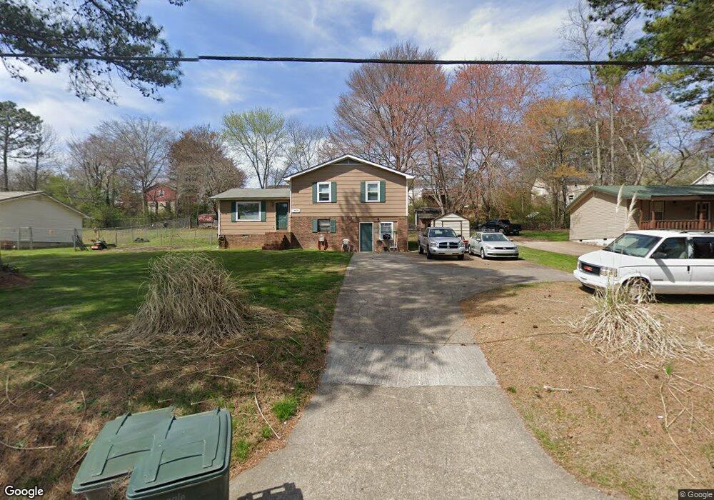
1916 Peavine Rd Rock Spring, GA 30739
Rock Spring NeighborhoodEstimated Value: $165,238 - $253,000
--
Bed
2
Baths
1,066
Sq Ft
$183/Sq Ft
Est. Value
About This Home
This home is located at 1916 Peavine Rd, Rock Spring, GA 30739 and is currently estimated at $195,560, approximately $183 per square foot. 1916 Peavine Rd is a home located in Walker County with nearby schools including Rock Spring Elementary School, Lafayette High School, and Alice M Daley Adventist School.
Ownership History
Date
Name
Owned For
Owner Type
Purchase Details
Closed on
Sep 30, 1992
Sold by
Robbs Steven M and Robbs Jennifer
Bought by
Lawhorn Roger S and Lawhorn Guen I
Current Estimated Value
Purchase Details
Closed on
Nov 30, 1988
Sold by
Hagan Tina G
Bought by
Robbs Steven M and Robbs Jennifer
Purchase Details
Closed on
Dec 28, 1984
Sold by
Baker Jimmy H and Pete Summers
Bought by
Hagan Tina G
Purchase Details
Closed on
Dec 1, 1983
Bought by
Baker Jimmy H and Pete Summers
Create a Home Valuation Report for This Property
The Home Valuation Report is an in-depth analysis detailing your home's value as well as a comparison with similar homes in the area
Home Values in the Area
Average Home Value in this Area
Purchase History
| Date | Buyer | Sale Price | Title Company |
|---|---|---|---|
| Lawhorn Roger S | -- | -- | |
| Robbs Steven M | $44,900 | -- | |
| Hagan Tina G | $36,500 | -- | |
| Baker Jimmy H | -- | -- |
Source: Public Records
Tax History Compared to Growth
Tax History
| Year | Tax Paid | Tax Assessment Tax Assessment Total Assessment is a certain percentage of the fair market value that is determined by local assessors to be the total taxable value of land and additions on the property. | Land | Improvement |
|---|---|---|---|---|
| 2024 | $1,351 | $67,604 | $4,923 | $62,681 |
| 2023 | $1,306 | $64,172 | $4,923 | $59,249 |
| 2022 | $1,211 | $55,748 | $4,923 | $50,825 |
| 2021 | $1,017 | $37,402 | $4,923 | $32,479 |
| 2020 | $872 | $30,661 | $4,923 | $25,738 |
| 2019 | $886 | $30,661 | $4,923 | $25,738 |
| 2018 | $811 | $30,661 | $4,923 | $25,738 |
| 2017 | $971 | $30,661 | $4,923 | $25,738 |
| 2016 | $831 | $30,661 | $4,923 | $25,738 |
| 2015 | $793 | $27,473 | $4,924 | $22,549 |
| 2014 | $708 | $27,473 | $4,924 | $22,549 |
| 2013 | -- | $27,473 | $4,924 | $22,549 |
Source: Public Records
Map
Nearby Homes
- 36 Pheonix Cir
- 285 Cooper Rd
- 195 Honeysuckle Dr
- 788 Long Hollow Rd
- 1121 Arnold Rd
- 294 E Long Hollow Rd
- 1902 Long Hollow Rd
- 1476 Arnold Rd
- 183 Long Hollow Rd
- 87 Peavine Rd
- 100 Deer Ridge Ln
- 453 Harvest Ln
- 103 Deer Ridge Ln
- 186 Henry Dr
- 200 Hunting Ridge Cir
- 5602 Georgia 95
- 00 Georgia 95
- 379 N Beaumont Rd
- 140 Fieldstone Commons
- 124 Fieldstone Commons
- 1938 Peavine Rd
- 1908 Peavine Rd
- 171 Dogwood Cir
- 145 Dogwood Cir
- 1921 Peavine Rd
- 1884 Peavine Rd
- 177 Dogwood Cir
- 1956 Peavine Rd
- 125 Dogwood Cir
- 1959 Peavine Rd
- 1976 Peavine Rd
- 1862 Peavine Rd
- 113 Dogwood Cir
- 1913 Peavine Rd
- Lot 4 Peavine Rd
- 0 Peavine Rd Unit 1288059
- 0 Peavine Rd Unit RTC2723918
- 85 Peavine Rd
- 0 Peavine Rd Unit 1074879
- 0 Peavine Rd Unit 1315862