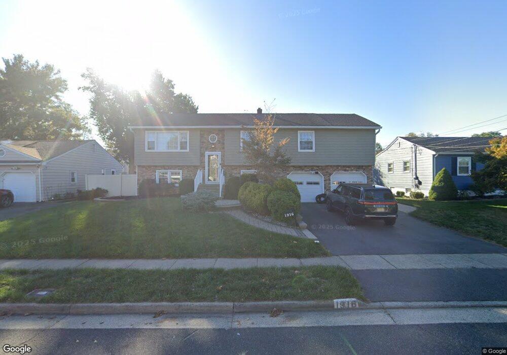
1916 Pershing Place South Plainfield, NJ 07080
Estimated Value: $684,000
4
Beds
3
Baths
--
Sq Ft
7,405
Sq Ft Lot
About This Home
This home is located at 1916 Pershing Place, South Plainfield, NJ 07080 and is currently estimated at $684,000. 1916 Pershing Place is a home located in Middlesex County with nearby schools including South Plainfield High School, The Queen City Academy Charter School, and Koinonia Academy.
Ownership History
Date
Name
Owned For
Owner Type
Purchase Details
Closed on
Dec 13, 2018
Sold by
Laureiro Guillermo and Laureiro Julia G
Current Estimated Value
Home Financials for this Owner
Home Financials are based on the most recent Mortgage that was taken out on this home.
Original Mortgage
$406,170
Outstanding Balance
$363,476
Interest Rate
5.62%
Mortgage Type
FHA
Estimated Equity
$320,524
Purchase Details
Closed on
Feb 24, 2015
Sold by
Wells Fargo Bank Na
Bought by
Laureiro Guillermo and Laureiro Julia G
Purchase Details
Closed on
Nov 13, 2013
Sold by
Brooks William R and Brooks Sean
Bought by
Wells Fargo Bank Na
Create a Home Valuation Report for This Property
The Home Valuation Report is an in-depth analysis detailing your home's value as well as a comparison with similar homes in the area
Home Values in the Area
Average Home Value in this Area
Purchase History
| Date | Buyer | Sale Price | Title Company |
|---|---|---|---|
| -- | $413,664 | Westcor Land Title Ins Co | |
| Laureiro Guillermo | $300,500 | East Coast Title Agency | |
| Wells Fargo Bank Na | $6,080 | None Available |
Source: Public Records
Mortgage History
| Date | Status | Borrower | Loan Amount |
|---|---|---|---|
| Open | -- | $406,170 |
Source: Public Records
Tax History Compared to Growth
Tax History
| Year | Tax Paid | Tax Assessment Tax Assessment Total Assessment is a certain percentage of the fair market value that is determined by local assessors to be the total taxable value of land and additions on the property. | Land | Improvement |
|---|---|---|---|---|
| 2025 | $9,141 | $140,720 | $32,600 | $108,120 |
| 2024 | $8,743 | $130,920 | $32,600 | $98,320 |
| 2023 | $8,743 | $130,920 | $32,600 | $98,320 |
| 2022 | $8,634 | $130,920 | $32,600 | $98,320 |
| 2021 | $8,431 | $130,920 | $32,600 | $98,320 |
| 2020 | $8,308 | $130,920 | $32,600 | $98,320 |
| 2019 | $7,972 | $130,920 | $32,600 | $98,320 |
| 2018 | $7,766 | $130,920 | $32,600 | $98,320 |
| 2017 | $7,667 | $130,920 | $32,600 | $98,320 |
| 2016 | $7,391 | $127,500 | $32,600 | $94,900 |
| 2015 | $7,264 | $127,500 | $32,600 | $94,900 |
| 2014 | $7,055 | $127,500 | $32,600 | $94,900 |
Source: Public Records
Map
Nearby Homes
- 551 Melrose Ave
- 1210 Maltby Ave
- 917 Tompkins Ave
- 1143 Worth Dr
- 105 Firth St
- 139 Palmer Ave
- 1453 Tooz Place
- 480 Sampton Ave
- 1221 Grant Ave Unit 23
- 241 Van Fleet Ave
- 1726 Kenyon Ave
- 131 Martin Dr
- 1712 Kenyon Ave
- 909 Sherman Ave
- 260 Merchants Ave
- 1119 S 9th St
- 1210 Field Ave
- 916 Sherman Ave
- 1533 Clinton Ave
- 814 Sherman Ave Unit 18
- 1914 Pershing Place
- 1918 Pershing Place
- 1929 Grant Ave
- 1933 Grant Ave
- 1925 Grant Ave
- 1912 Pershing Place
- 1920 Pershing Place
- 1917 Pershing Place
- 1937 Grant Ave
- 1915 Pershing Place
- 1919 Pershing Place
- 1921 Grant Ave
- 1913 Pershing Place
- 1921 Pershing Place
- 1908 Pershing Place
- 1922 Pershing Place
- 404 Franklin Ave
- 31 Delaney Ct
- 33 Delaney Ct
- 1934 Grant Ave