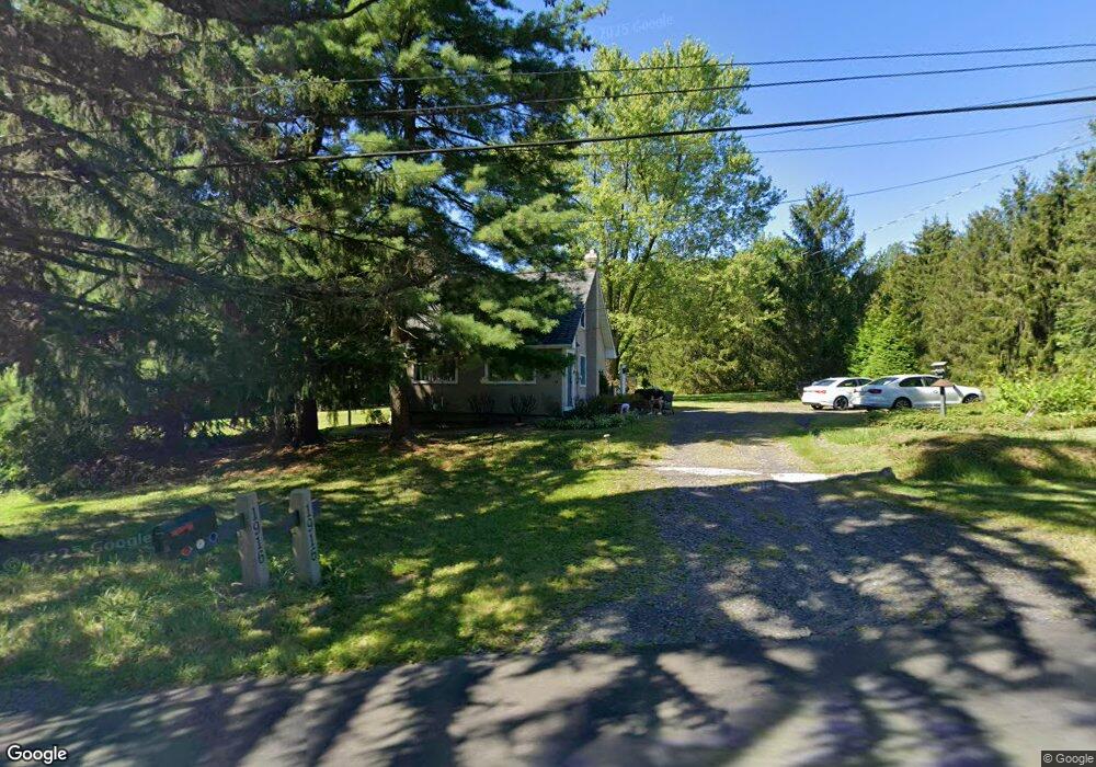
1916 Route 313 Perkasie, PA 18944
East Rockhill NeighborhoodEstimated Value: $363,000 - $413,000
4
Beds
1
Bath
1,234
Sq Ft
$306/Sq Ft
Est. Value
About This Home
This home is located at 1916 Route 313, Perkasie, PA 18944 and is currently estimated at $377,564, approximately $305 per square foot. 1916 Route 313 is a home located in Bucks County with nearby schools including Pennridge High School, Quakertown Christian School, and Upper Bucks Christian School.
Ownership History
Date
Name
Owned For
Owner Type
Purchase Details
Closed on
May 18, 2023
Sold by
Wildnauer John P and Wildnauer Jean Ann
Bought by
Mcdermott Stephen Patrick and Mcdermott Michelle V
Current Estimated Value
Home Financials for this Owner
Home Financials are based on the most recent Mortgage that was taken out on this home.
Original Mortgage
$291,000
Outstanding Balance
$282,908
Interest Rate
6.39%
Mortgage Type
New Conventional
Estimated Equity
$94,656
Purchase Details
Closed on
Nov 16, 2010
Sold by
Wildnauer John P
Bought by
Wildnauer John P and Wildnauer Jean Ann Toney
Purchase Details
Closed on
Jan 24, 1986
Bought by
Wildnauer John P
Create a Home Valuation Report for This Property
The Home Valuation Report is an in-depth analysis detailing your home's value as well as a comparison with similar homes in the area
Home Values in the Area
Average Home Value in this Area
Purchase History
| Date | Buyer | Sale Price | Title Company |
|---|---|---|---|
| Mcdermott Stephen Patrick | $300,000 | Professional Group Abstract | |
| Wildnauer John P | -- | None Available | |
| Wildnauer John P | $50,000 | -- |
Source: Public Records
Mortgage History
| Date | Status | Borrower | Loan Amount |
|---|---|---|---|
| Open | Mcdermott Stephen Patrick | $291,000 |
Source: Public Records
Tax History Compared to Growth
Tax History
| Year | Tax Paid | Tax Assessment Tax Assessment Total Assessment is a certain percentage of the fair market value that is determined by local assessors to be the total taxable value of land and additions on the property. | Land | Improvement |
|---|---|---|---|---|
| 2025 | $3,149 | $18,000 | $8,400 | $9,600 |
| 2024 | $3,149 | $18,000 | $8,400 | $9,600 |
| 2023 | $3,113 | $18,000 | $8,400 | $9,600 |
| 2022 | $3,113 | $18,000 | $8,400 | $9,600 |
| 2021 | $3,113 | $18,000 | $8,400 | $9,600 |
| 2020 | $3,113 | $18,000 | $8,400 | $9,600 |
| 2019 | $3,095 | $18,000 | $8,400 | $9,600 |
| 2018 | $3,059 | $18,000 | $8,400 | $9,600 |
| 2017 | $3,036 | $18,000 | $8,400 | $9,600 |
| 2016 | $3,036 | $18,000 | $8,400 | $9,600 |
| 2015 | -- | $18,000 | $8,400 | $9,600 |
| 2014 | -- | $18,000 | $8,400 | $9,600 |
Source: Public Records
Map
Nearby Homes
- 1720 Route 313
- 5520 Clymer Rd
- 805 Rock Hill Rd
- 0 Old Bethlehem Rd
- 4363 Axe Handle Rd
- 4503 Axe Handle Rd
- 68 Rock Hill Rd
- 2004 Evergreen Dr
- 1133 Mariwill Dr
- 1229 N Ridge Rd
- 137 Sunnyside Ln
- 28 Bryant Dr
- 584 Campus Dr
- 1033 Glen Manor Dr
- 512 Campus Dr
- Woodford Plan at Everleigh Woods
- Manchester Plan at Everleigh Woods
- Arcadia Plan at Everleigh Woods
- Parker Plan at Everleigh Woods
- Sebastian Plan at Everleigh Woods
- 1929 Route 313
- 1928 Route 313
- 1921 Route 313
- 1815 Route 313
- 2060 W Rock Rd
- 1034 Mountainview Dr Unit LOT 2
- 1034 Mountainview Dr
- 1938 Route 313
- 1815 Dublin Pike
- 2044 W Rock Rd
- 1815 Pennsylvania 313
- 2083 W Rock Rd
- 2050 W Rock Rd
- 2045 W Rock Rd
- 2077 W Rock Rd
- 2040 W Rock Rd
- 2314 E Rock Rd
- 2065 W Rock Rd
- 2043 W Rock Rd
- 5100 Clymer Rd