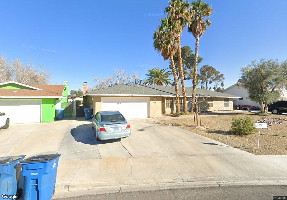
1916 Stonehaven Cir Las Vegas, NV 89108
Twin Lakes NeighborhoodEstimated Value: $458,478 - $514,000
3
Beds
2
Baths
1,954
Sq Ft
$253/Sq Ft
Est. Value
About This Home
This home is located at 1916 Stonehaven Cir, Las Vegas, NV 89108 and is currently estimated at $494,870, approximately $253 per square foot. 1916 Stonehaven Cir is a home located in Clark County with nearby schools including Twin Lakes Elementary School, J. Harold Brinley Middle School, and Western High School.
Ownership History
Date
Name
Owned For
Owner Type
Purchase Details
Closed on
Oct 18, 2019
Sold by
Robinson Holly Ann and Robinson Holly A
Bought by
Robinson Holly Ann and Naranjo Consuelo Mendoza
Current Estimated Value
Purchase Details
Closed on
Aug 8, 2018
Sold by
Mendoza Naranjo Consuelo
Bought by
Robinson Holly A
Home Financials for this Owner
Home Financials are based on the most recent Mortgage that was taken out on this home.
Original Mortgage
$129,000
Outstanding Balance
$112,031
Interest Rate
4.5%
Mortgage Type
New Conventional
Estimated Equity
$382,839
Purchase Details
Closed on
Sep 29, 2017
Sold by
Randall Jason A and Corral Lucretia
Bought by
Robinson Holly A
Home Financials for this Owner
Home Financials are based on the most recent Mortgage that was taken out on this home.
Original Mortgage
$100,000
Interest Rate
3.89%
Mortgage Type
Commercial
Purchase Details
Closed on
Sep 19, 2017
Sold by
Naraanjo Consuelo Mendoza
Bought by
Robinson Holly
Home Financials for this Owner
Home Financials are based on the most recent Mortgage that was taken out on this home.
Original Mortgage
$100,000
Interest Rate
3.89%
Mortgage Type
Commercial
Purchase Details
Closed on
Aug 7, 2002
Sold by
Mitchell Linda L and Oberman Kim
Bought by
Randall Jason A and Corral Lucretia
Home Financials for this Owner
Home Financials are based on the most recent Mortgage that was taken out on this home.
Original Mortgage
$168,000
Interest Rate
6.51%
Purchase Details
Closed on
May 8, 1995
Sold by
Veron John E and Veron Carole J
Bought by
Mitchell Linda L and Oberman Kim
Home Financials for this Owner
Home Financials are based on the most recent Mortgage that was taken out on this home.
Original Mortgage
$157,000
Interest Rate
7.92%
Mortgage Type
Assumption
Purchase Details
Closed on
May 10, 1994
Sold by
Wilson Matthew H
Bought by
Veron John E and Veron Carole J
Create a Home Valuation Report for This Property
The Home Valuation Report is an in-depth analysis detailing your home's value as well as a comparison with similar homes in the area
Home Values in the Area
Average Home Value in this Area
Purchase History
| Date | Buyer | Sale Price | Title Company |
|---|---|---|---|
| Robinson Holly Ann | -- | None Available | |
| Robinson Holly A | -- | Fidelity National Title | |
| Robinson Holly A | $299,000 | Fidelity National Title | |
| Randall Jason A | -- | Fidelity National Title | |
| Robinson Holly | -- | Fidelity National Title | |
| Randall Jason A | $210,000 | United Title | |
| Mitchell Linda L | $157,000 | Old Republic Title Company | |
| Veron John E | $135,000 | Fidelity National Title |
Source: Public Records
Mortgage History
| Date | Status | Borrower | Loan Amount |
|---|---|---|---|
| Open | Robinson Holly A | $129,000 | |
| Previous Owner | Robinson Holly A | $100,000 | |
| Previous Owner | Randall Jason A | $168,000 | |
| Previous Owner | Mitchell Linda L | $157,000 | |
| Closed | Randall Jason A | $21,000 |
Source: Public Records
Tax History Compared to Growth
Tax History
| Year | Tax Paid | Tax Assessment Tax Assessment Total Assessment is a certain percentage of the fair market value that is determined by local assessors to be the total taxable value of land and additions on the property. | Land | Improvement |
|---|---|---|---|---|
| 2025 | $1,668 | $75,305 | $37,100 | $38,205 |
| 2024 | $1,620 | $75,305 | $37,100 | $38,205 |
| 2023 | $1,620 | $75,952 | $39,550 | $36,402 |
| 2022 | $1,573 | $74,168 | $39,550 | $34,618 |
| 2021 | $1,597 | $68,523 | $34,650 | $33,873 |
| 2020 | $1,480 | $64,940 | $30,450 | $34,490 |
| 2019 | $1,387 | $62,482 | $27,650 | $34,832 |
| 2018 | $1,324 | $57,626 | $23,100 | $34,526 |
| 2017 | $1,936 | $59,042 | $23,100 | $35,942 |
| 2016 | $1,240 | $55,459 | $18,200 | $37,259 |
| 2015 | $1,556 | $51,601 | $14,350 | $37,251 |
| 2014 | $1,198 | $35,460 | $9,800 | $25,660 |
Source: Public Records
Map
Nearby Homes
- 1885 Valley Dr
- 4200 Coran Ln
- 1912 Parkchester Dr
- 1825 Stonehaven Dr
- 1920 Parkchester Dr
- 2030 Rancho Lake Dr Unit 201
- 4406 Parkchester Cir
- 2041 Hussium Hills St Unit 103
- 2019 Rancho Lake Dr Unit 104
- 4228 Gaye Ln
- 2011 Sue Ct Unit 105
- 2011 Sue Ct Unit 203
- 2141 Hussium Hills St Unit 108
- 4412 Edward Ave
- 1825 Ann Greta Dr
- 1817 Ann Greta Dr
- 0 N Rancho Dr
- 1732 Yellow Rose St
- 1936 Saint Lawrence Dr
- 1832 N Decatur Blvd Unit 104
- 1916 Stonehaven Dr
- 1908 Stonehaven Cir
- 1920 Stonehaven Cir
- 1963 Valley Dr
- 1925 Stonehaven Dr
- 1924 Stonehaven Cir
- 1909 Stonehaven Cir
- 1904 Stonehaven Cir
- 1989 Valley Dr
- 1929 Stonehaven Dr
- 1921 Stonehaven Dr
- 1905 Stonehaven Cir
- 1908 Stonehaven Dr
- 4221 Coran Ln
- 1900 Stonehaven Cir
- 1964 Valley Dr
- 1904 Stonehaven Dr
- 1901 Stonehaven Cir
- 4208 Coran Ln