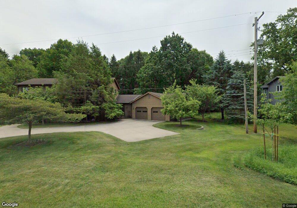
1916 W 32nd St Holland, MI 49423
South Holland NeighborhoodEstimated Value: $446,407 - $535,000
3
Beds
2
Baths
3,028
Sq Ft
$160/Sq Ft
Est. Value
About This Home
This home is located at 1916 W 32nd St, Holland, MI 49423 and is currently estimated at $485,602, approximately $160 per square foot. 1916 W 32nd St is a home located in Allegan County with nearby schools including Holland High School, Pine Ridge Christian School, and Calvary Schools of Holland - Plasman Campus.
Ownership History
Date
Name
Owned For
Owner Type
Purchase Details
Closed on
Oct 23, 2024
Sold by
Olgers Earl Bernard
Bought by
Olgers Earl Bernard
Current Estimated Value
Purchase Details
Closed on
Dec 19, 2018
Sold by
Olgers Earl Bernard and Olgers Mary Ellen
Bought by
Olgers Earl Bernard and Olgers Mary Ellen
Purchase Details
Closed on
Jun 12, 2018
Sold by
Olgers Earl B and Olgers Mary E
Bought by
Olgers Earl Bernard and Olgers Mary Ellen
Purchase Details
Closed on
Dec 1, 1992
Bought by
Earl"
Create a Home Valuation Report for This Property
The Home Valuation Report is an in-depth analysis detailing your home's value as well as a comparison with similar homes in the area
Home Values in the Area
Average Home Value in this Area
Purchase History
| Date | Buyer | Sale Price | Title Company |
|---|---|---|---|
| Olgers Earl Bernard | -- | None Listed On Document | |
| Olgers Earl Bernard | -- | None Listed On Document | |
| Olgers Earl Bernard | -- | None Available | |
| Olgers Earl Bernard | -- | None Available | |
| Olgers Earl Bernard | -- | None Available | |
| Earl" | $25,500 | -- |
Source: Public Records
Tax History Compared to Growth
Tax History
| Year | Tax Paid | Tax Assessment Tax Assessment Total Assessment is a certain percentage of the fair market value that is determined by local assessors to be the total taxable value of land and additions on the property. | Land | Improvement |
|---|---|---|---|---|
| 2024 | $2,906 | $201,200 | $44,400 | $156,800 |
| 2023 | $2,906 | $196,100 | $44,400 | $151,700 |
| 2022 | $2,906 | $198,200 | $57,400 | $140,800 |
| 2021 | $2,607 | $148,300 | $39,700 | $108,600 |
| 2020 | $2,607 | $135,000 | $39,700 | $95,300 |
| 2019 | $0 | $112,700 | $25,300 | $87,400 |
| 2018 | $0 | $104,400 | $25,300 | $79,100 |
| 2017 | $0 | $100,300 | $21,500 | $78,800 |
| 2016 | $0 | $92,300 | $21,500 | $70,800 |
| 2015 | -- | $92,300 | $21,500 | $70,800 |
| 2014 | -- | $83,700 | $21,500 | $62,200 |
| 2013 | -- | $78,900 | $21,500 | $57,400 |
Source: Public Records
Map
Nearby Homes
- 1968 S Shorewood Ln Unit 14
- 1991 N Shorewood Ln Unit 4
- The Andover 3 Plan at Shorewood Lane
- The Andover 2 Plan at Shorewood Lane
- Andover Plan at Shorewood Lane
- 1981 N Shorewood Ln Unit 6
- 1995 N Shorewood Ln Unit 2
- 1982 S Shore Dr Unit 2
- 1992 S Shore Dr Unit 2
- 1992 S Shore Dr Unit 3
- 1933 S Shore Dr
- 6579 Partridge Ln
- 1761 S Shore Dr
- 1704 Summit St
- 6621 Forest Beach Dr
- 645 Harrington Ave
- 4679 Forest Ridge Dr Unit 29
- 4681 Forest Ridge Dr
- 2312 Maksaba Trail
- 4732 Northern Ct Unit 18
- 1930 W 32nd St
- 1923 W 32nd St
- 1902 W 32nd St
- 1933 W 32nd St
- 1913 W 32nd St
- 1907 W 32nd St
- 1899 W 32nd St
- 1898 W 32nd St
- 1943 W 32nd St
- 1953 W 32nd St
- 1885 W 32nd St
- 1968 W 32nd St
- 1963 W 32nd St
- 756 Saunders Ave
- 1978 W 32nd St
- 1967 W 32nd St
- 4764 65th St
- 746 Saunders Ave
- 733 E Shorewood Ln Unit 12
- 1969 W 32nd St