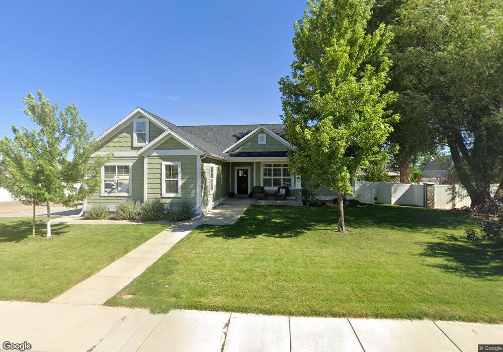
1916 W 4675 N Cedar City, UT 84721
Estimated Value: $464,935 - $531,000
4
Beds
2
Baths
3,448
Sq Ft
$146/Sq Ft
Est. Value
About This Home
This home is located at 1916 W 4675 N, Cedar City, UT 84721 and is currently estimated at $501,984, approximately $145 per square foot. 1916 W 4675 N is a home located in Iron County with nearby schools including Three Peaks School, Cedar Middle School, and Cedar City High School.
Ownership History
Date
Name
Owned For
Owner Type
Purchase Details
Closed on
Aug 9, 2021
Sold by
Bentley Burns John Harlan
Bought by
Burns Family Trust
Current Estimated Value
Purchase Details
Closed on
Aug 21, 2020
Sold by
Burns John Harlan Bentley
Bought by
Burns John Harlan Bentley and Burns Arianne Wray
Home Financials for this Owner
Home Financials are based on the most recent Mortgage that was taken out on this home.
Original Mortgage
$144,506
Interest Rate
2.9%
Mortgage Type
New Conventional
Purchase Details
Closed on
Mar 27, 2009
Sold by
Hulet Jake D and Hulet Sandy K
Bought by
Bentley John Harlan and Burns Arianne Wray
Home Financials for this Owner
Home Financials are based on the most recent Mortgage that was taken out on this home.
Original Mortgage
$209,000
Interest Rate
5.15%
Mortgage Type
New Conventional
Purchase Details
Closed on
Apr 16, 2008
Sold by
Keystone Developers Inc
Bought by
Hulet Jake D and Hulet Sandy K
Create a Home Valuation Report for This Property
The Home Valuation Report is an in-depth analysis detailing your home's value as well as a comparison with similar homes in the area
Home Values in the Area
Average Home Value in this Area
Purchase History
| Date | Buyer | Sale Price | Title Company |
|---|---|---|---|
| Burns Family Trust | -- | Barney Mckenna & Olmstead Pc | |
| Burns John Harlan Bentley | -- | Cedar Land Title Inc | |
| Burns John Harlan Bentley | -- | Cedar Land Title Inc | |
| Bentley John Harlan | -- | -- | |
| Hulet Jake D | -- | -- |
Source: Public Records
Mortgage History
| Date | Status | Borrower | Loan Amount |
|---|---|---|---|
| Previous Owner | Burns John Harlan Bentley | $144,506 | |
| Previous Owner | Bentley John Harlan | $209,000 |
Source: Public Records
Tax History Compared to Growth
Tax History
| Year | Tax Paid | Tax Assessment Tax Assessment Total Assessment is a certain percentage of the fair market value that is determined by local assessors to be the total taxable value of land and additions on the property. | Land | Improvement |
|---|---|---|---|---|
| 2025 | $2,151 | $275,958 | $47,129 | $228,829 |
| 2023 | $2,290 | $300,065 | $40,980 | $259,085 |
| 2022 | $2,081 | $232,640 | $30,990 | $201,650 |
| 2021 | $1,665 | $186,160 | $18,075 | $168,085 |
| 2020 | $1,572 | $155,645 | $16,395 | $139,250 |
| 2019 | $1,557 | $147,750 | $15,120 | $132,630 |
| 2018 | $1,441 | $133,600 | $15,120 | $118,480 |
| 2017 | $1,438 | $133,600 | $15,120 | $118,480 |
| 2016 | $1,292 | $108,325 | $12,995 | $95,330 |
| 2015 | $1,355 | $108,325 | $0 | $0 |
| 2014 | $1,231 | $92,910 | $0 | $0 |
Source: Public Records
Map
Nearby Homes
- 6001 W 4675 N
- 1968 W 4700 N
- 1993 W 4700 N
- 1941 W 4750 N
- 4701 N 2000 W
- 1966 W 4750 N Unit LOT 7
- 1966 W 4750 N
- 4836 N 2350 W Unit 3
- 4836 N 2350 W
- 4836 N 2350 W Unit Lot 3
- 2424 W 4390 N
- 4346 N 2400 W
- 4784 N 2525 W
- 4552 N 2525 W
- 4262 N 2325 W
- 5268 N 2300 W
- 4726 N 2650 W
- 4738 N 2650 W
- 5241 N 2300 W
- 2390 W 5190 N Unit 4
- 1994 W 4675 N
- 1970 W 4675 N
- 1945 W 4675 N
- 1969 W 4675 N
- 1878 W 4675 N
- 1946 W 4675
- 1885 W 4700 N Unit 1
- 1885 W 4700 N Unit lot 28
- 1885 W 4700 N
- 1946 W 4675 N
- 1946 W 4675 N Unit 2A
- 6086 W 4675 N
- 1867 W 4700 N Unit lot 29
- 1867 W 4700 N
- 1848 W 4675 N
- 1845 W 4700 N
- 1845 W 4700 N Unit Phase 1
- 0.15 Ac. at the Parks at Deer Hollow
- 1914 W 4700 N
- 1942 W 4700 N