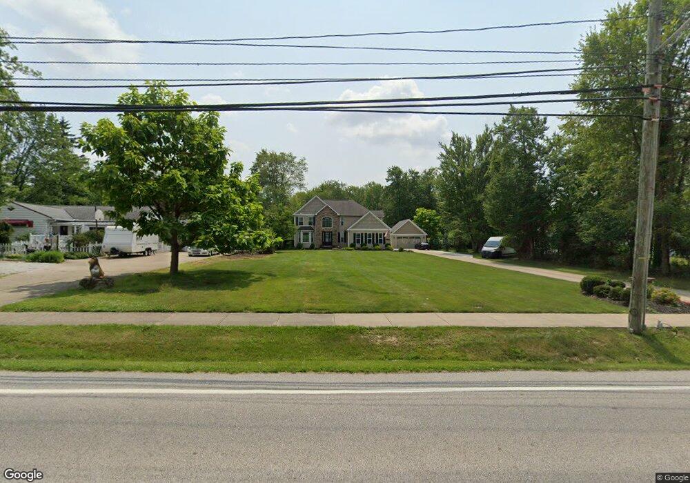
19167 Lunn Rd Strongsville, OH 44149
Estimated Value: $480,000 - $579,832
4
Beds
3
Baths
3,020
Sq Ft
$178/Sq Ft
Est. Value
About This Home
This home is located at 19167 Lunn Rd, Strongsville, OH 44149 and is currently estimated at $537,708, approximately $178 per square foot. 19167 Lunn Rd is a home located in Cuyahoga County with nearby schools including Strongsville High School, Strongsville Academy, and Sts Joseph & John Interparochial School.
Ownership History
Date
Name
Owned For
Owner Type
Purchase Details
Closed on
Mar 29, 2017
Sold by
Fannie Mae
Bought by
Belt Kevin T and Belt Josan
Current Estimated Value
Purchase Details
Closed on
Jan 31, 2002
Sold by
Frank John M and Frank Hazel E
Bought by
Baldwin Anne E and Frank Qualified Personal Residence Trust
Purchase Details
Closed on
Aug 17, 2001
Sold by
Frank John M and Frank Hazel E
Bought by
Frank John M and Frank Hazel E
Purchase Details
Closed on
Jan 23, 1979
Sold by
Frank John M
Bought by
John M Frank
Purchase Details
Closed on
Jan 1, 1975
Bought by
Frank John M
Create a Home Valuation Report for This Property
The Home Valuation Report is an in-depth analysis detailing your home's value as well as a comparison with similar homes in the area
Home Values in the Area
Average Home Value in this Area
Purchase History
| Date | Buyer | Sale Price | Title Company |
|---|---|---|---|
| Belt Kevin T | -- | None Available | |
| Baldwin Anne E | -- | -- | |
| Frank John M | -- | -- | |
| John M Frank | -- | -- | |
| Frank John M | -- | -- |
Source: Public Records
Tax History Compared to Growth
Tax History
| Year | Tax Paid | Tax Assessment Tax Assessment Total Assessment is a certain percentage of the fair market value that is determined by local assessors to be the total taxable value of land and additions on the property. | Land | Improvement |
|---|---|---|---|---|
| 2024 | $8,171 | $174,020 | $21,875 | $152,145 |
| 2023 | $8,703 | $138,880 | $17,290 | $121,590 |
| 2022 | $8,639 | $138,880 | $17,290 | $121,590 |
| 2021 | $8,347 | $135,240 | $17,290 | $117,950 |
| 2020 | $8,276 | $118,620 | $15,160 | $103,460 |
| 2019 | $8,033 | $338,900 | $43,300 | $295,600 |
| 2018 | $7,083 | $118,620 | $15,160 | $103,460 |
| 2017 | $7,002 | $105,460 | $12,320 | $93,140 |
| 2016 | $6,945 | $105,460 | $12,320 | $93,140 |
| 2015 | $6,838 | $105,460 | $12,320 | $93,140 |
| 2014 | $6,838 | $102,380 | $11,970 | $90,410 |
Source: Public Records
Map
Nearby Homes
- 18630 Shurmer Rd
- 19513 Lunn Rd
- 19160 Wheelers Ln
- 18162 Fawn Cir
- 19620 Porters Ln Unit 15F
- 14112 Settlers Way
- 19311 Bradford Ct
- 17069 Partridge Dr
- 20078 Trapper Trail
- 19297 Lauren Way
- 19908 Stoughton Dr
- 15279 Walnut Creek Dr
- 17259 Woodshire Dr
- 15017 Regency Dr
- 20393 Wildwood Ln
- 13156 Olympus Way
- 20678 Spruce Dr
- 13099 Olympus Way
- 13066 Olympus Way
- 14896 Britannia Ct