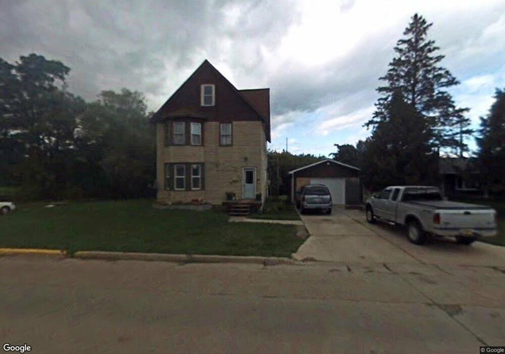
1917 6th St W Ashland, WI 54806
Estimated Value: $145,000 - $281,000
--
Bed
--
Bath
--
Sq Ft
7,405
Sq Ft Lot
About This Home
This home is located at 1917 6th St W, Ashland, WI 54806 and is currently estimated at $194,288. 1917 6th St W is a home located in Ashland County with nearby schools including Ashland High School, Lake Superior High, and Our Lady of the Lake Catholic School.
Ownership History
Date
Name
Owned For
Owner Type
Purchase Details
Closed on
Feb 8, 2016
Sold by
Hebert Robert F
Bought by
Hebert Robert S and Hebert Brenda
Current Estimated Value
Purchase Details
Closed on
Oct 9, 2009
Sold by
Martinsen Investment & Land Co Inc
Bought by
Hebert Robert F
Home Financials for this Owner
Home Financials are based on the most recent Mortgage that was taken out on this home.
Original Mortgage
$74,623
Interest Rate
5.15%
Mortgage Type
FHA
Create a Home Valuation Report for This Property
The Home Valuation Report is an in-depth analysis detailing your home's value as well as a comparison with similar homes in the area
Home Values in the Area
Average Home Value in this Area
Purchase History
| Date | Buyer | Sale Price | Title Company |
|---|---|---|---|
| Hebert Robert S | $136,500 | Robert Hebert | |
| Hebert Robert F | -- | None Available |
Source: Public Records
Mortgage History
| Date | Status | Borrower | Loan Amount |
|---|---|---|---|
| Previous Owner | Hebert Robert F | $74,623 |
Source: Public Records
Tax History Compared to Growth
Tax History
| Year | Tax Paid | Tax Assessment Tax Assessment Total Assessment is a certain percentage of the fair market value that is determined by local assessors to be the total taxable value of land and additions on the property. | Land | Improvement |
|---|---|---|---|---|
| 2024 | $2,536 | $92,600 | $17,700 | $74,900 |
| 2023 | $2,057 | $92,600 | $17,700 | $74,900 |
| 2022 | $2,021 | $92,600 | $17,700 | $74,900 |
| 2021 | $1,900 | $92,600 | $17,700 | $74,900 |
| 2020 | $1,910 | $81,400 | $15,500 | $65,900 |
| 2019 | $1,857 | $81,400 | $15,500 | $65,900 |
| 2018 | $1,794 | $81,400 | $15,500 | $65,900 |
| 2017 | $1,840 | $81,400 | $15,500 | $65,900 |
| 2016 | $1,888 | $81,400 | $15,500 | $65,900 |
| 2015 | $2,000 | $81,400 | $15,500 | $65,900 |
| 2014 | $1,811 | $81,400 | $15,500 | $65,900 |
| 2013 | $1,933 | $81,400 | $15,500 | $65,900 |
Source: Public Records
Map
Nearby Homes
- 600 15th Ave W
- 123 22nd Ave W
- 2507 Junction Rd
- xx Sanborn Ave Unit Parcel 201-04811-000
- 917 Beaser Ave
- 1306 Lake Shore Dr W
- 28XX Junction Rd
- 1122 6th St W
- 0 Prentice Heights Rd
- 320 12th Ave W
- 1218 & 1222 Lake Shore Dr W
- 3xx 12th Ave W
- 1200 Lake Shore Dr W
- 2812 Fellman Dr
- 801 9th Ave W
- 1707 Beaser Ave
- 48424 Beaser Ave
- 2213 Maple Ln
- 0000 City Heights Rd
- Lot 2 Golf Course Rd