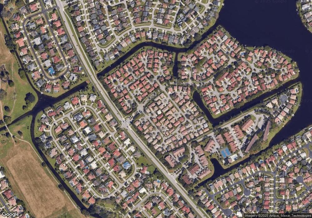
1917 Capeside Cir Wellington, FL 33414
Estimated Value: $509,000 - $536,000
4
Beds
3
Baths
2,108
Sq Ft
$248/Sq Ft
Est. Value
About This Home
This home is located at 1917 Capeside Cir, Wellington, FL 33414 and is currently estimated at $523,428, approximately $248 per square foot. 1917 Capeside Cir is a home located in Palm Beach County with nearby schools including New Horizons Elementary School, Polo Park Middle School, and Wellington High School.
Ownership History
Date
Name
Owned For
Owner Type
Purchase Details
Closed on
Jun 5, 2003
Sold by
Manning Linda
Bought by
Gillette Christopher Robert and Gillette Dana Ingram
Current Estimated Value
Home Financials for this Owner
Home Financials are based on the most recent Mortgage that was taken out on this home.
Original Mortgage
$156,320
Outstanding Balance
$67,979
Interest Rate
5.68%
Mortgage Type
Purchase Money Mortgage
Estimated Equity
$455,449
Purchase Details
Closed on
Mar 5, 1998
Sold by
Wellington Transeastern
Bought by
Manning Linda
Home Financials for this Owner
Home Financials are based on the most recent Mortgage that was taken out on this home.
Original Mortgage
$74,000
Interest Rate
6.95%
Mortgage Type
New Conventional
Create a Home Valuation Report for This Property
The Home Valuation Report is an in-depth analysis detailing your home's value as well as a comparison with similar homes in the area
Home Values in the Area
Average Home Value in this Area
Purchase History
| Date | Buyer | Sale Price | Title Company |
|---|---|---|---|
| Gillette Christopher Robert | $195,400 | Phoenix Title Insurance Corp | |
| Manning Linda | $130,000 | -- |
Source: Public Records
Mortgage History
| Date | Status | Borrower | Loan Amount |
|---|---|---|---|
| Open | Gillette Christopher Robert | $156,320 | |
| Previous Owner | Manning Linda | $77,500 | |
| Previous Owner | Manning Linda | $74,000 |
Source: Public Records
Tax History Compared to Growth
Tax History
| Year | Tax Paid | Tax Assessment Tax Assessment Total Assessment is a certain percentage of the fair market value that is determined by local assessors to be the total taxable value of land and additions on the property. | Land | Improvement |
|---|---|---|---|---|
| 2024 | $8,175 | $382,681 | -- | -- |
| 2023 | $7,761 | $347,892 | $0 | $0 |
| 2022 | $6,956 | $316,265 | $0 | $0 |
| 2021 | $6,283 | $287,514 | $88,810 | $198,704 |
| 2020 | $5,839 | $264,946 | $90,000 | $174,946 |
| 2019 | $5,781 | $259,000 | $0 | $259,000 |
| 2018 | $5,246 | $239,000 | $0 | $239,000 |
| 2017 | $5,064 | $239,000 | $0 | $0 |
| 2016 | $4,823 | $200,981 | $0 | $0 |
| 2015 | $4,643 | $182,710 | $0 | $0 |
| 2014 | $4,132 | $166,100 | $0 | $0 |
Source: Public Records
Map
Nearby Homes
- 12725 Shoreline Dr Unit 6C
- 1780 Pierside Cir
- 1752 Shoreside Cir
- 1773 Harborside Cir
- 12628 Shoreline Dr Unit 9E
- 1736 Pierside Cir
- 12692 Shoreline Dr Unit 3B
- 1759 Harborside Cir
- 1874 Newhaven Ave
- 2006 Cross Breeze Dr
- 12568 Shoreline Dr Unit G103
- 1901 Lynton Cir
- 12524 Shoreline Dr Unit H101
- 12524 Shoreline Dr Unit H104
- 1712 Shoreside Cir
- 1878 Lynton Cir
- 12709 White Coral Dr
- 12703 White Coral Dr
- 2024 White Coral Ct
- 12820 Leeds Ct
- 1915 Capeside Cir
- 1919 Capeside Cir
- 1829 Capeside Cir
- 1827 Capeside Cir
- 1913 Capeside Cir
- 1831 Capeside Cir
- 1911 Capeside Cir
- 1843 Capeside Cir
- 1907 Capeside Cir
- 1833 Capeside Cir
- 1823 Capeside Cir
- 1909 Capeside Cir
- 1845 Capeside Cir
- 1910 Capeside Cir
- 1905 Capeside Cir
- 1841 Capeside Cir
- 1789 Pierside Cir
- 1791 Pierside Cir
- 1703 Pierside Cir
- 1908 Capeside Cir
