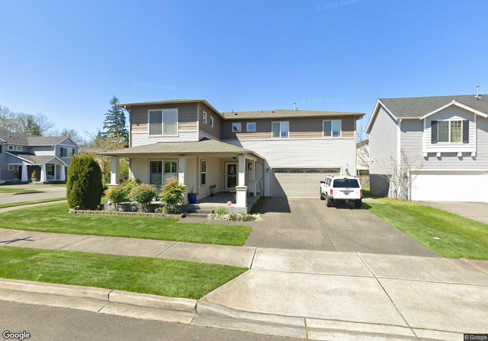
1917 Chaffee Ave Dupont, WA 98327
Estimated Value: $703,831 - $726,000
4
Beds
3
Baths
3,272
Sq Ft
$219/Sq Ft
Est. Value
About This Home
This home is located at 1917 Chaffee Ave, Dupont, WA 98327 and is currently estimated at $715,958, approximately $218 per square foot. 1917 Chaffee Ave is a home located in Pierce County with nearby schools including Chloe Clark Elementary School, Saltars Point Elementary School, and Pioneer Middle School.
Ownership History
Date
Name
Owned For
Owner Type
Purchase Details
Closed on
Feb 21, 2006
Sold by
The Quadrant Corp
Bought by
Stuart Steven W and Stuart Marta J
Current Estimated Value
Home Financials for this Owner
Home Financials are based on the most recent Mortgage that was taken out on this home.
Original Mortgage
$296,956
Outstanding Balance
$174,987
Interest Rate
7%
Mortgage Type
New Conventional
Estimated Equity
$540,971
Create a Home Valuation Report for This Property
The Home Valuation Report is an in-depth analysis detailing your home's value as well as a comparison with similar homes in the area
Home Values in the Area
Average Home Value in this Area
Purchase History
| Date | Buyer | Sale Price | Title Company |
|---|---|---|---|
| Stuart Steven W | $371,195 | Chicago Title |
Source: Public Records
Mortgage History
| Date | Status | Borrower | Loan Amount |
|---|---|---|---|
| Open | Stuart Steven W | $296,956 |
Source: Public Records
Tax History Compared to Growth
Tax History
| Year | Tax Paid | Tax Assessment Tax Assessment Total Assessment is a certain percentage of the fair market value that is determined by local assessors to be the total taxable value of land and additions on the property. | Land | Improvement |
|---|---|---|---|---|
| 2025 | $4,948 | $673,500 | $235,400 | $438,100 |
| 2024 | $4,948 | $641,300 | $226,800 | $414,500 |
| 2023 | $4,948 | $615,200 | $220,600 | $394,600 |
| 2022 | $4,957 | $627,800 | $220,600 | $407,200 |
| 2021 | $4,722 | $469,300 | $140,100 | $329,200 |
| 2019 | $4,241 | $430,100 | $116,800 | $313,300 |
| 2018 | $4,586 | $415,000 | $116,800 | $298,200 |
| 2017 | $4,123 | $393,100 | $102,300 | $290,800 |
| 2016 | $3,941 | $357,100 | $86,300 | $270,800 |
| 2014 | $3,775 | $350,300 | $86,300 | $264,000 |
| 2013 | $3,775 | $321,900 | $87,800 | $234,100 |
Source: Public Records
Map
Nearby Homes
- 2420 Simmons St Unit B
- 2055 Garry Oaks Ave Unit B
- 1975 Garry Oaks Ave Unit C
- 1856 Spencer Ct Unit 12F
- 1607 Kincaid St Unit E-8
- 2176 McDonald Ave
- 1680 Kennedy Place Unit A4
- 3114 Walker Rd
- 2237 Tolmie St
- 2176 Palisade Blvd Unit F-3
- 2147 Hammond Ave Unit B10
- 3073 Hoffman Hill Blvd
- 1375 Foreman Rd
- 3178 Hoffman Hill Blvd
- 1373 Hudson St Unit 1373
- 1331 Rowan Ct Unit 1331
- 3172 Sheaser Way
- 1335 Foreman Rd
- 1285 Griggs St
- 1305 Foreman Rd
- 1933 Chaffee Ave
- 1910 Homan Ave
- 1926 Homan Ave
- 1952 Homan Ave
- 2325 Wallace St
- 1914 Chaffee Ave
- 1930 Chaffee Ave
- 1965 Chaffee Ave
- 1946 Chaffee Ave
- 2301 Wallace St
- 1974 Homan Ave
- 1962 Chaffee Ave
- 2419 Wallace St
- 1981 Chaffee Ave
- 1978 Chaffee Ave
- 1988 Homan Ave
- 1913 Homan Ave
- 2280 Bobs Hollow Ln Unit C
- 2280 Bobs Hollow Ln Unit B