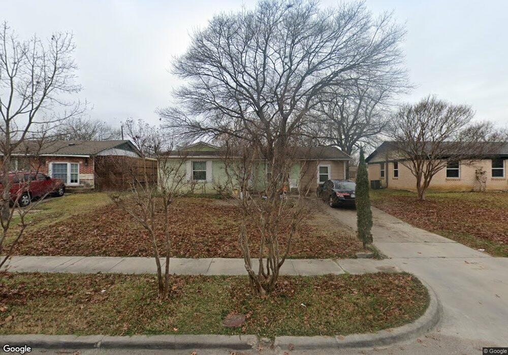
1917 Del Oak Dr Mesquite, TX 75149
Estimated Value: $183,736 - $220,000
3
Beds
1
Bath
939
Sq Ft
$219/Sq Ft
Est. Value
About This Home
This home is located at 1917 Del Oak Dr, Mesquite, TX 75149 and is currently estimated at $205,934, approximately $219 per square foot. 1917 Del Oak Dr is a home located in Dallas County with nearby schools including Mcwhorter Elementary School, Lanny Frasier Middle, and West Mesquite High School.
Ownership History
Date
Name
Owned For
Owner Type
Purchase Details
Closed on
May 15, 2006
Sold by
Waters Kevin and Waters Maria D
Bought by
Patlan Manuel Garcia and Patlan Juliana
Current Estimated Value
Home Financials for this Owner
Home Financials are based on the most recent Mortgage that was taken out on this home.
Original Mortgage
$63,050
Outstanding Balance
$36,516
Interest Rate
6.4%
Mortgage Type
Purchase Money Mortgage
Estimated Equity
$169,418
Purchase Details
Closed on
Sep 17, 2004
Sold by
Gomez Artemio and Gomez Ana M
Bought by
Patlan Manuel Garcia and Patlan Juliana
Home Financials for this Owner
Home Financials are based on the most recent Mortgage that was taken out on this home.
Original Mortgage
$63,050
Interest Rate
5.81%
Mortgage Type
Purchase Money Mortgage
Create a Home Valuation Report for This Property
The Home Valuation Report is an in-depth analysis detailing your home's value as well as a comparison with similar homes in the area
Home Values in the Area
Average Home Value in this Area
Purchase History
| Date | Buyer | Sale Price | Title Company |
|---|---|---|---|
| Patlan Manuel Garcia | -- | None Available | |
| Patlan Manuel Garcia | -- | -- |
Source: Public Records
Mortgage History
| Date | Status | Borrower | Loan Amount |
|---|---|---|---|
| Open | Patlan Manuel Garcia | $63,050 | |
| Previous Owner | Patlan Manuel Garcia | $63,050 |
Source: Public Records
Tax History Compared to Growth
Tax History
| Year | Tax Paid | Tax Assessment Tax Assessment Total Assessment is a certain percentage of the fair market value that is determined by local assessors to be the total taxable value of land and additions on the property. | Land | Improvement |
|---|---|---|---|---|
| 2025 | $1,558 | $183,640 | $55,000 | $128,640 |
| 2024 | $1,558 | $183,640 | $55,000 | $128,640 |
| 2023 | $1,558 | $164,750 | $40,000 | $124,750 |
| 2022 | $4,139 | $164,750 | $40,000 | $124,750 |
| 2021 | $3,300 | $125,120 | $30,000 | $95,120 |
| 2020 | $2,995 | $107,160 | $30,000 | $77,160 |
| 2019 | $3,119 | $107,160 | $30,000 | $77,160 |
| 2018 | $2,512 | $89,600 | $26,000 | $63,600 |
| 2017 | $2,026 | $72,300 | $15,000 | $57,300 |
| 2016 | $1,619 | $57,800 | $15,000 | $42,800 |
| 2015 | $1,102 | $50,870 | $15,000 | $35,870 |
| 2014 | $1,102 | $50,870 | $15,000 | $35,870 |
Source: Public Records
Map
Nearby Homes
- 1325 Woodcrest Dr
- 1410 Athens Dr
- 1309 Woodcrest Dr
- Lot 15 Central Park Ct
- Lot 14 Central Park Ct
- 1222 Athens Dr
- 1229 Greenbrier Dr
- 11915 Carson Dr
- 2441 Lindale Ln
- 1505 W Bruton Rd
- 1317 W Bruton Rd
- 1300 Develon Dr
- 2429 Hickory Tree Rd
- 1905 Blossom Trail
- 1901 Blossom Trail
- 1756 Julie Ct
- 1301 Cedarcrest Dr
- 2510 Lora Ln
- 1726 Hillcrest Ct
- 1705 Magnolia Dr
- 1921 Del Oak Dr
- 1913 Del Oak Dr
- 2001 Del Oak Dr
- 1920 Mount Pleasant Dr
- 1909 Del Oak Dr
- 2000 Mount Pleasant Dr
- 1916 Mount Pleasant Dr
- 2004 Mount Pleasant Dr
- 1918 Del Oak Dr
- 1914 Del Oak Dr
- 2005 Del Oak Dr
- 1912 Mount Pleasant Dr
- 1910 Del Oak Dr
- 1905 Del Oak Dr
- 2000 Del Oak Dr
- 2008 Mount Pleasant Dr
- 1906 Del Oak Dr
- 1908 Mount Pleasant Dr
- 2004 Del Oak Dr
- 101 S Senter