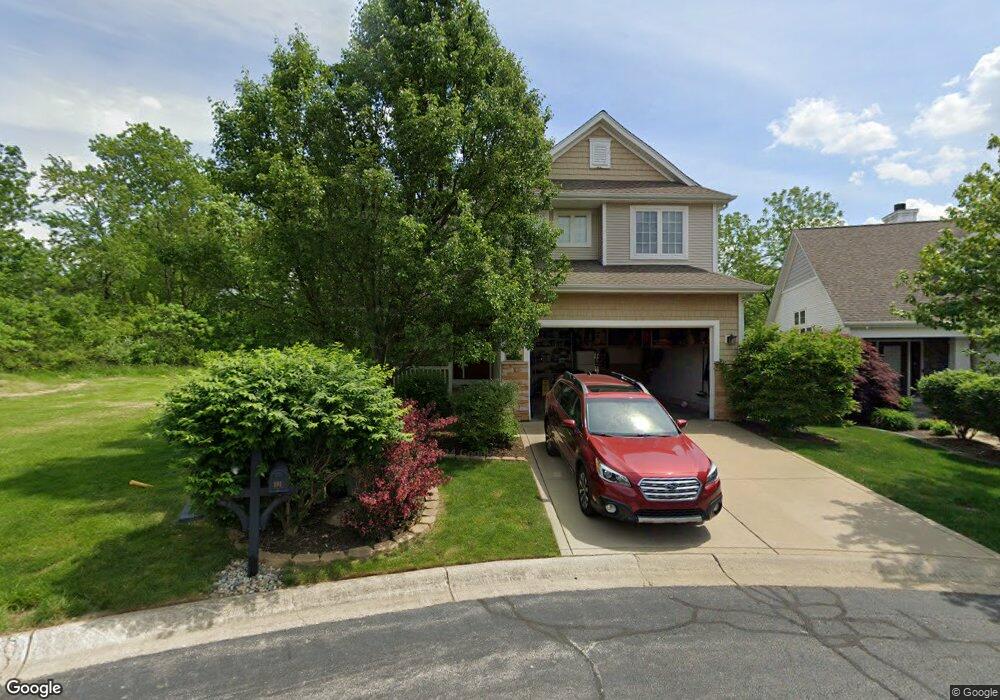
1917 Garland Cir Valparaiso, IN 46383
Estimated Value: $451,000 - $486,000
3
Beds
4
Baths
2,108
Sq Ft
$223/Sq Ft
Est. Value
About This Home
This home is located at 1917 Garland Cir, Valparaiso, IN 46383 and is currently estimated at $470,112, approximately $223 per square foot. 1917 Garland Cir is a home located in Porter County with nearby schools including Flint Lake Elementary School, Thomas Jefferson Middle School, and Valparaiso High School.
Ownership History
Date
Name
Owned For
Owner Type
Purchase Details
Closed on
May 15, 2020
Sold by
Tumuluri Vinay C and Kolluri Harini
Bought by
The Justin H Mccurdy Trust
Current Estimated Value
Purchase Details
Closed on
Sep 29, 2005
Sold by
Tumuluri Vinay C
Bought by
Tumuluri Vinay C and Kolluri Harini
Home Financials for this Owner
Home Financials are based on the most recent Mortgage that was taken out on this home.
Original Mortgage
$257,241
Interest Rate
5.37%
Mortgage Type
Fannie Mae Freddie Mac
Purchase Details
Closed on
Sep 28, 2005
Sold by
Mercantile National Bank Of Indiana
Bought by
Tumuluri Vinay C
Home Financials for this Owner
Home Financials are based on the most recent Mortgage that was taken out on this home.
Original Mortgage
$257,241
Interest Rate
5.37%
Mortgage Type
Fannie Mae Freddie Mac
Create a Home Valuation Report for This Property
The Home Valuation Report is an in-depth analysis detailing your home's value as well as a comparison with similar homes in the area
Home Values in the Area
Average Home Value in this Area
Purchase History
| Date | Buyer | Sale Price | Title Company |
|---|---|---|---|
| The Justin H Mccurdy Trust | $330,000 | Chicago Title Company Llc | |
| Tumuluri Vinay C | -- | Ticor Title Insurance | |
| Tumuluri Vinay C | -- | Ticor Title Insurance |
Source: Public Records
Mortgage History
| Date | Status | Borrower | Loan Amount |
|---|---|---|---|
| Previous Owner | Tumuluri Vinay C | $257,241 |
Source: Public Records
Tax History Compared to Growth
Tax History
| Year | Tax Paid | Tax Assessment Tax Assessment Total Assessment is a certain percentage of the fair market value that is determined by local assessors to be the total taxable value of land and additions on the property. | Land | Improvement |
|---|---|---|---|---|
| 2024 | $3,810 | $422,300 | $59,500 | $362,800 |
| 2023 | $3,756 | $402,000 | $55,600 | $346,400 |
| 2022 | $3,309 | $363,200 | $55,600 | $307,600 |
| 2021 | $3,656 | $330,000 | $55,600 | $274,400 |
| 2020 | $4,020 | $354,300 | $53,000 | $301,300 |
| 2019 | $4,183 | $357,700 | $53,000 | $304,700 |
| 2018 | $4,131 | $352,300 | $53,000 | $299,300 |
| 2017 | $3,948 | $345,800 | $53,000 | $292,800 |
| 2016 | $3,656 | $341,000 | $51,500 | $289,500 |
| 2014 | $3,349 | $352,800 | $50,700 | $302,100 |
| 2013 | -- | $331,600 | $50,700 | $280,900 |
Source: Public Records
Map
Nearby Homes
- 1808 Crimson Dr
- 2305 Thomas Rd
- 636 N Calumet Ave
- 122 E 632 N
- 2205 Charlotte Ln
- 5001 Sunny Ln
- 4805 Princess Dr
- 602 N Scott Dr
- 4707 Downing Dr
- 74 E 600 N
- 208 E 650 N
- 4409 Masters Rd
- 633 N 70 E
- 4403 Flint Lake Gateway
- 4513 Bear Ln
- 5402 Garden Gateway Rd
- Lot #23 John St
- 1401 Oriole Rd
- 4111 Wildwood Rd
- 01 Wildwood Ave
- 1917 Garland Circle Dr
- 1919 Garland Circle Dr
- 1919 Garland Cir
- 1913 Garland Cir
- 1913 Garland Circle Dr
- 1921 Garland Cir
- 1921 Garland Circle Dr
- 1918 Garland Circle Dr
- 1918 Garland Cir
- 1920 Garland Circle Dr
- 1911 Garland Circle Dr
- 1920 Garland Cir
- 1911 Garland Circle Dr
- 1902 Garland Circle Dr
- 1909 Garland Cir
- 1902 Garland Cir Unit 2
- 1909 Garland Circle Dr
- 1812 Briam Dr
- 1900 Garland Circle Dr
- 1812 Briam Dr