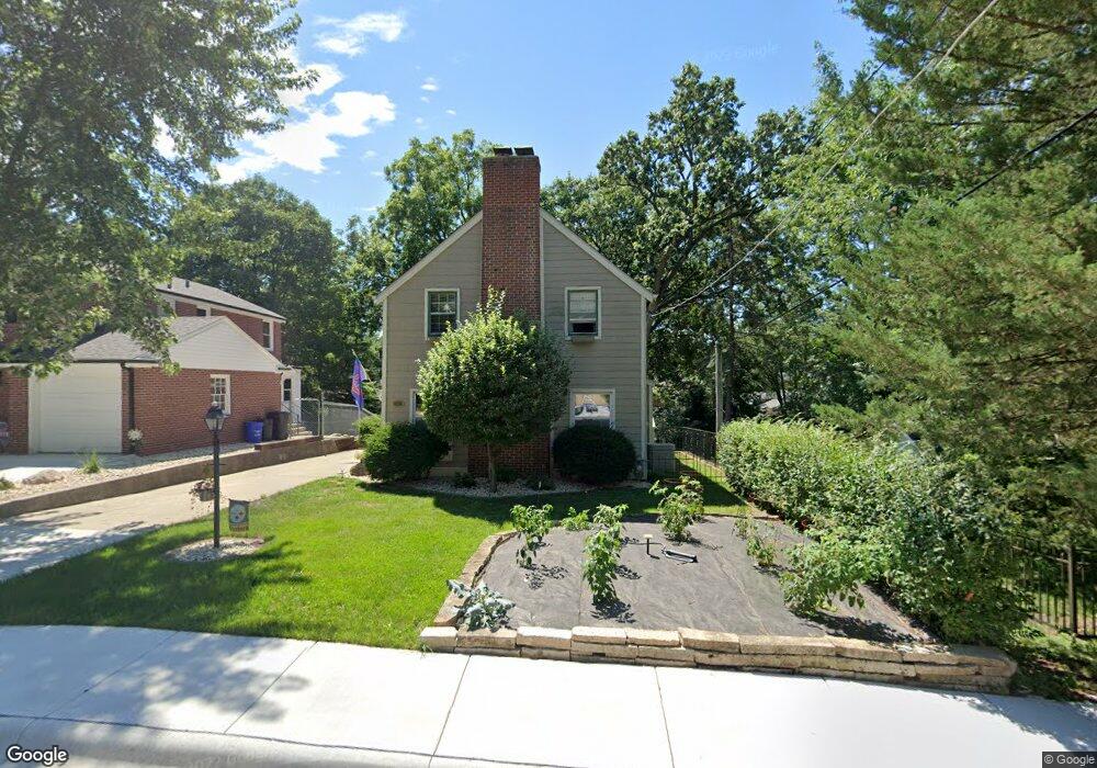
1917 Hawthorne Ave Rockford, IL 61107
Sinnissippi Park NeighborhoodEstimated Value: $204,000 - $227,455
3
Beds
2
Baths
1,466
Sq Ft
$147/Sq Ft
Est. Value
About This Home
This home is located at 1917 Hawthorne Ave, Rockford, IL 61107 and is currently estimated at $215,364, approximately $146 per square foot. 1917 Hawthorne Ave is a home located in Winnebago County with nearby schools including Bloom Elementary School, Abraham Lincoln Middle School, and Rockford East High School.
Ownership History
Date
Name
Owned For
Owner Type
Purchase Details
Closed on
Jun 10, 2021
Sold by
Halverson Mark D and Halverson Nancy W
Bought by
Badker Dylan
Current Estimated Value
Home Financials for this Owner
Home Financials are based on the most recent Mortgage that was taken out on this home.
Original Mortgage
$125,000
Outstanding Balance
$113,172
Interest Rate
2.9%
Mortgage Type
New Conventional
Estimated Equity
$102,192
Purchase Details
Closed on
Nov 24, 1993
Bought by
Halverson Mark D and Halverson Nancy W
Create a Home Valuation Report for This Property
The Home Valuation Report is an in-depth analysis detailing your home's value as well as a comparison with similar homes in the area
Home Values in the Area
Average Home Value in this Area
Purchase History
| Date | Buyer | Sale Price | Title Company |
|---|---|---|---|
| Badker Dylan | $160,000 | None Listed On Document | |
| Badker Dylan | $160,000 | None Listed On Document | |
| Halverson Mark D | $93,500 | -- |
Source: Public Records
Mortgage History
| Date | Status | Borrower | Loan Amount |
|---|---|---|---|
| Open | Badker Dylan | $125,000 | |
| Closed | Badker Dylan | $125,000 |
Source: Public Records
Tax History Compared to Growth
Tax History
| Year | Tax Paid | Tax Assessment Tax Assessment Total Assessment is a certain percentage of the fair market value that is determined by local assessors to be the total taxable value of land and additions on the property. | Land | Improvement |
|---|---|---|---|---|
| 2024 | $5,107 | $64,896 | $7,854 | $57,042 |
| 2023 | $4,799 | $57,222 | $6,925 | $50,297 |
| 2022 | $4,587 | $51,146 | $6,190 | $44,956 |
| 2021 | $4,400 | $46,897 | $5,676 | $41,221 |
| 2020 | $4,286 | $44,335 | $5,366 | $38,969 |
| 2019 | $4,187 | $42,256 | $5,114 | $37,142 |
| 2018 | $4,902 | $40,432 | $4,819 | $35,613 |
| 2017 | $4,851 | $38,695 | $4,612 | $34,083 |
| 2016 | $4,829 | $37,970 | $4,526 | $33,444 |
| 2015 | $4,890 | $37,970 | $4,526 | $33,444 |
| 2014 | $4,918 | $38,711 | $5,670 | $33,041 |
Source: Public Records
Map
Nearby Homes
- 641 Paris Ave
- 627 Paris Ave
- 2224 Princeton Ave
- 504 Paris Ave
- 2133 Guilford Rd
- 2215 Guilford Rd
- 410 N Chicago Ave
- 422 N Rockford Ave
- 701 Lundvall Ave
- 226 Rome Ave
- 1514 Brownwood Dr
- 611 Robert Ave
- 234 N Gardiner Ave
- 224 N Rockford Ave
- 819 James Ave
- 1519 Jackson St
- 121 Paris Ave
- 1370 Brown Hills Rd
- 725 Davis St
- 1919 Hawthorne Ave
- 2003 Hawthorne Ave
- 721 N Chicago Ave
- 717 N Chicago Ave
- 1905 Hawthorne Ave
- 713 N Chicago Ave
- 2007 Hawthorne Ave
- 1916 Rural St
- 1914 Rural St
- 1922 Rural St
- 803 N Chicago Ave
- 2011 Hawthorne Ave
- 1924 Rural St
- 2002 Rural St
- 1908 Rural St
- 807 N Chicago Ave
- 2015 Hawthorne Ave
- 1920 Hawthorne Ave
- 2002 Hawthorne Ave
- 2012 Rural St