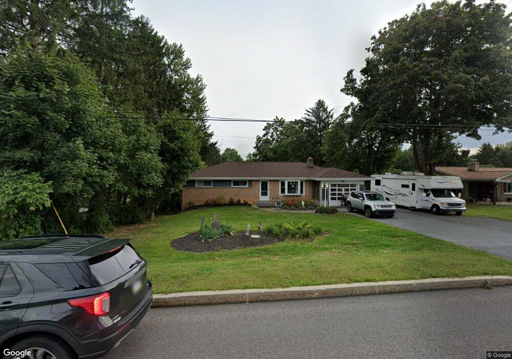
1917 Linglestown Rd Harrisburg, PA 17110
Estimated Value: $270,000 - $292,000
3
Beds
2
Baths
1,457
Sq Ft
$194/Sq Ft
Est. Value
About This Home
This home is located at 1917 Linglestown Rd, Harrisburg, PA 17110 and is currently estimated at $283,184, approximately $194 per square foot. 1917 Linglestown Rd is a home located in Dauphin County with nearby schools including Thomas W. Holtzman Jr. Elementary School, Sara Lindemuth Elementary School, and Susquehanna Township Middle School.
Ownership History
Date
Name
Owned For
Owner Type
Purchase Details
Closed on
Jul 18, 2006
Sold by
Cupp Barry A
Bought by
Sheaffer Paul L
Current Estimated Value
Home Financials for this Owner
Home Financials are based on the most recent Mortgage that was taken out on this home.
Original Mortgage
$123,200
Outstanding Balance
$73,222
Interest Rate
6.67%
Mortgage Type
New Conventional
Estimated Equity
$209,962
Create a Home Valuation Report for This Property
The Home Valuation Report is an in-depth analysis detailing your home's value as well as a comparison with similar homes in the area
Home Values in the Area
Average Home Value in this Area
Purchase History
| Date | Buyer | Sale Price | Title Company |
|---|---|---|---|
| Sheaffer Paul L | $125,000 | -- |
Source: Public Records
Mortgage History
| Date | Status | Borrower | Loan Amount |
|---|---|---|---|
| Open | Sheaffer Paul L | $123,200 |
Source: Public Records
Tax History Compared to Growth
Tax History
| Year | Tax Paid | Tax Assessment Tax Assessment Total Assessment is a certain percentage of the fair market value that is determined by local assessors to be the total taxable value of land and additions on the property. | Land | Improvement |
|---|---|---|---|---|
| 2025 | $4,033 | $111,000 | $28,600 | $82,400 |
| 2024 | $3,636 | $111,000 | $28,600 | $82,400 |
| 2023 | $3,487 | $111,000 | $28,600 | $82,400 |
| 2022 | $3,443 | $111,000 | $28,600 | $82,400 |
| 2021 | $3,383 | $111,000 | $28,600 | $82,400 |
| 2020 | $3,383 | $111,000 | $28,600 | $82,400 |
| 2019 | $3,308 | $111,000 | $28,600 | $82,400 |
| 2018 | $3,125 | $111,000 | $28,600 | $82,400 |
| 2017 | $3,125 | $111,000 | $28,600 | $82,400 |
| 2016 | $0 | $111,000 | $28,600 | $82,400 |
| 2015 | -- | $111,000 | $28,600 | $82,400 |
| 2014 | -- | $111,000 | $28,600 | $82,400 |
Source: Public Records
Map
Nearby Homes
- 2001 Mount Vernon Cir
- 2040 Chevy Chase Dr
- 4317 Beaufort Hunt Dr
- 4623 Deer Path Rd
- 224 Forest Oak Ln
- 118 Hiddenwood Dr
- 2400 Linglestown Rd
- 2051 Sauers Rd
- 403 Redbud Ct
- 4529 Custer Terrace
- 4536 Custer Terrace
- 4648 Margarets Dr
- 2312 Continental Dr
- 4607 Hamlin Ln
- 4631 Hamlin Ln
- 1817 Dogwood Rd
- 4113 Cotswold Dr
- 1300 Mountain Laurel Cir
- 2125 Chatham Way
- 4700 Laurel Dr
- 1913 Linglestown Rd
- 1921 Linglestown Rd
- L01 Linglestown Rd
- 1909 Linglestown Rd
- 1816 Cortland Rd
- 1905 Linglestown Rd
- 2000 Chevy Chase Dr
- 1812 Cortland Rd
- 2004 Chevy Chase Dr
- 1808 Cortland Rd
- 2001 Chevy Chase Dr
- 4319 Orchard Hill Rd
- 2008 Chevy Chase Dr
- 1804 Cortland Rd
- 4117 Beaufort Hunt Dr
- 2012 Chevy Chase Dr
- 2306 Bartlett Rd
- 2304 Bartlett Rd
- 2308 Bartlett Rd
- 2302 Bartlett Rd