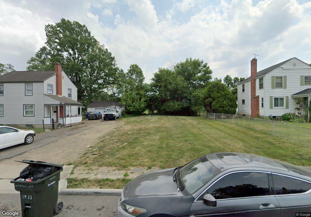
1917 Myrtle Ave Columbus, OH 43211
East Linden NeighborhoodEstimated Value: $49,000
3
Beds
1
Bath
1,056
Sq Ft
$46/Sq Ft
Est. Value
About This Home
This home is located at 1917 Myrtle Ave, Columbus, OH 43211 and is currently priced at $49,000, approximately $46 per square foot. 1917 Myrtle Ave is a home located in Franklin County with nearby schools including Linden STEM Academy (K-6), Linden-Mckinley Stem School On Arcadia, and Focus Learning Academy of Central Columbus.
Ownership History
Date
Name
Owned For
Owner Type
Purchase Details
Closed on
Nov 16, 2017
Sold by
White
Bought by
Central Ohio Community Improvement Corpo
Current Estimated Value
Purchase Details
Closed on
May 13, 2010
Sold by
White White Leonard W Leonard W and White Patricia C
Bought by
White Leonard W
Purchase Details
Closed on
Mar 25, 2002
Sold by
Coleman Ernest R and Coleman Opal L
Bought by
White Patricia Coleman
Purchase Details
Closed on
Mar 15, 1962
Bought by
Coleman Ernest R
Create a Home Valuation Report for This Property
The Home Valuation Report is an in-depth analysis detailing your home's value as well as a comparison with similar homes in the area
Home Values in the Area
Average Home Value in this Area
Purchase History
| Date | Buyer | Sale Price | Title Company |
|---|---|---|---|
| Central Ohio Community Improvement Corpo | -- | None Available | |
| White Leonard W | $12,000 | Attorney | |
| White Patricia Coleman | -- | -- | |
| Coleman Ernest R | -- | -- |
Source: Public Records
Tax History
| Year | Tax Paid | Tax Assessment Tax Assessment Total Assessment is a certain percentage of the fair market value that is determined by local assessors to be the total taxable value of land and additions on the property. | Land | Improvement |
|---|---|---|---|---|
| 2025 | -- | $5,890 | $2,280 | $3,610 |
| 2024 | -- | $5,890 | $2,280 | $3,610 |
| 2023 | $0 | $5,880 | $2,275 | $3,605 |
| 2022 | $0 | $3,960 | $2,100 | $1,860 |
| 2021 | $0 | $3,960 | $2,100 | $1,860 |
| 2020 | $0 | $3,960 | $2,100 | $1,860 |
| 2019 | $250 | $3,470 | $1,820 | $1,650 |
| 2018 | $250 | $3,470 | $1,820 | $1,650 |
| 2017 | $953 | $3,470 | $1,820 | $1,650 |
| 2016 | $1,396 | $4,830 | $2,660 | $2,170 |
| 2015 | $499 | $4,830 | $2,660 | $2,170 |
| 2014 | $299 | $4,830 | $2,660 | $2,170 |
| 2013 | $484 | $12,320 | $3,115 | $9,205 |
Source: Public Records
Map
Nearby Homes
- 1938 Myrtle Ave
- 2475 Parkwood Ave
- 2291 Taylor Ave
- 1971 Aberdeen Ave
- 1799 Harold Place
- 1326 Minnesota Ave
- 1884 Aberdeen Ave
- 1864 E Hudson St
- 1827 Aberdeen Ave
- 0 Parkwood Ave
- 2192 Genessee Ave
- 0 Aberdeen Ave Unit 226000728
- 0 Aberdeen Ave Unit 226002456
- 0 Aberdeen Ave Unit 226002459
- 0 Aberdeen Ave Unit 226002457
- 0 Aberdeen Ave Unit 226002458
- 2407 Marcia Dr
- 2765 Joyce Ave
- 2735 Berrell Ave
- 2080 Parkwood Ave Unit 2090
- 1911 Myrtle Ave
- 1923 Myrtle Ave
- 1903 Myrtle Ave
- 1935 Myrtle Ave
- 1922 Myrtle Ave
- 1914 Myrtle Ave
- 2384 Delbert Rd
- 2378 Delbert Rd
- 1893 Myrtle Ave
- 1906 Myrtle Ave
- 1941 Myrtle Ave
- 2372 Delbert Rd
- 2372 Delbert Rd Unit 2373
- 2411 Bretton Place
- 1896 Myrtle Ave
- 1947 Myrtle Ave
- 2366 Delbert Rd
- 2418 Delbert Rd
- 2417 Bretton Place
- 2362 Delbert Rd
Your Personal Tour Guide
Ask me questions while you tour the home.