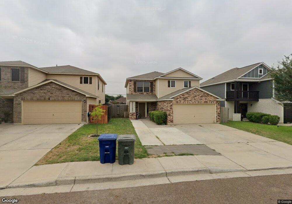
1917 Port Edward Dr Laredo, TX 78045
Estimated Value: $239,000 - $265,000
4
Beds
3
Baths
2,455
Sq Ft
$103/Sq Ft
Est. Value
About This Home
This home is located at 1917 Port Edward Dr, Laredo, TX 78045 and is currently estimated at $252,515, approximately $102 per square foot. 1917 Port Edward Dr is a home located in Webb County with nearby schools including Julia Bird Jones Muller Elementary School, George Washington Middle School, and United High School.
Ownership History
Date
Name
Owned For
Owner Type
Purchase Details
Closed on
Feb 24, 2015
Sold by
Armadillo Construction Company Ltd
Bought by
Molina Armando
Current Estimated Value
Home Financials for this Owner
Home Financials are based on the most recent Mortgage that was taken out on this home.
Original Mortgage
$166,361
Outstanding Balance
$127,043
Interest Rate
3.68%
Mortgage Type
FHA
Estimated Equity
$125,472
Create a Home Valuation Report for This Property
The Home Valuation Report is an in-depth analysis detailing your home's value as well as a comparison with similar homes in the area
Home Values in the Area
Average Home Value in this Area
Purchase History
| Date | Buyer | Sale Price | Title Company |
|---|---|---|---|
| Molina Armando | -- | None Available |
Source: Public Records
Mortgage History
| Date | Status | Borrower | Loan Amount |
|---|---|---|---|
| Open | Molina Armando | $166,361 |
Source: Public Records
Tax History Compared to Growth
Tax History
| Year | Tax Paid | Tax Assessment Tax Assessment Total Assessment is a certain percentage of the fair market value that is determined by local assessors to be the total taxable value of land and additions on the property. | Land | Improvement |
|---|---|---|---|---|
| 2025 | $1,284 | $253,000 | $47,669 | $205,331 |
| 2024 | $1,284 | $253,000 | $47,669 | $205,331 |
| 2023 | $4,862 | $244,939 | -- | -- |
| 2022 | $5,055 | $222,672 | $0 | $0 |
| 2021 | $5,203 | $203,002 | $28,601 | $174,401 |
| 2020 | $4,705 | $182,840 | $28,610 | $154,230 |
| 2019 | $4,799 | $182,840 | $28,610 | $154,230 |
| 2018 | $4,717 | $177,310 | $27,920 | $149,390 |
| 2017 | $4,547 | $173,560 | $27,920 | $145,640 |
| 2016 | $4,526 | $172,780 | $22,770 | $150,010 |
| 2015 | $507 | $143,220 | $18,090 | $125,130 |
| 2014 | $507 | $19,760 | $19,760 | $0 |
Source: Public Records
Map
Nearby Homes
- 1916 Port Edward Dr
- 1903 Port Edward Dr
- 1912 Port Miami St
- 1616 Port Victoria Dr
- 1912 Port Louisiana Dr
- 2038 Port Miami St
- 1903 Port Miami St
- 1906 Port Louisiana Dr Unit 1906
- 2040 Port Miami St
- 1833 Port Louisiana Dr
- 1831 Port Louisiana Dr
- 1829 Port Louisiana Dr
- 1822 Port Louisiana Dr
- 1820 Port Louisiana Dr
- 1203 Port Texas Dr
- San Agustin Plan at Green Ranch - Green XB
- Santa Elizabeth Plan at Green Ranch - Green XB
- San Vicente Plan at Green Ranch - Green XB
- San Gregorio Plan at Green Ranch - Green XB
- Santa Martha Plan at Green Ranch - Green XB
- 1919 Port Edward Dr
- 1915 Port Edward Dr
- 1913 Port Edward Dr
- 1921 Port Edward Dr
- 1923 Port Edward Dr
- 1911 Port Edward Dr
- 1914 Port Edward Dr
- 1918 Port Edward Dr
- 2010 Port Miami St
- 2008 Port Miami St
- 1909 Port Edward Dr
- 2012 Port Miami St
- 1912 Port Edward Dr
- 1920 Port Edward Dr
- 2006 Port Miami St
- 1922 Port Edward Dr
- 2014 Port Miami St
- 1910 Port Edward Dr
- 2004 Port Miami St
- 1907 Port Edward Dr