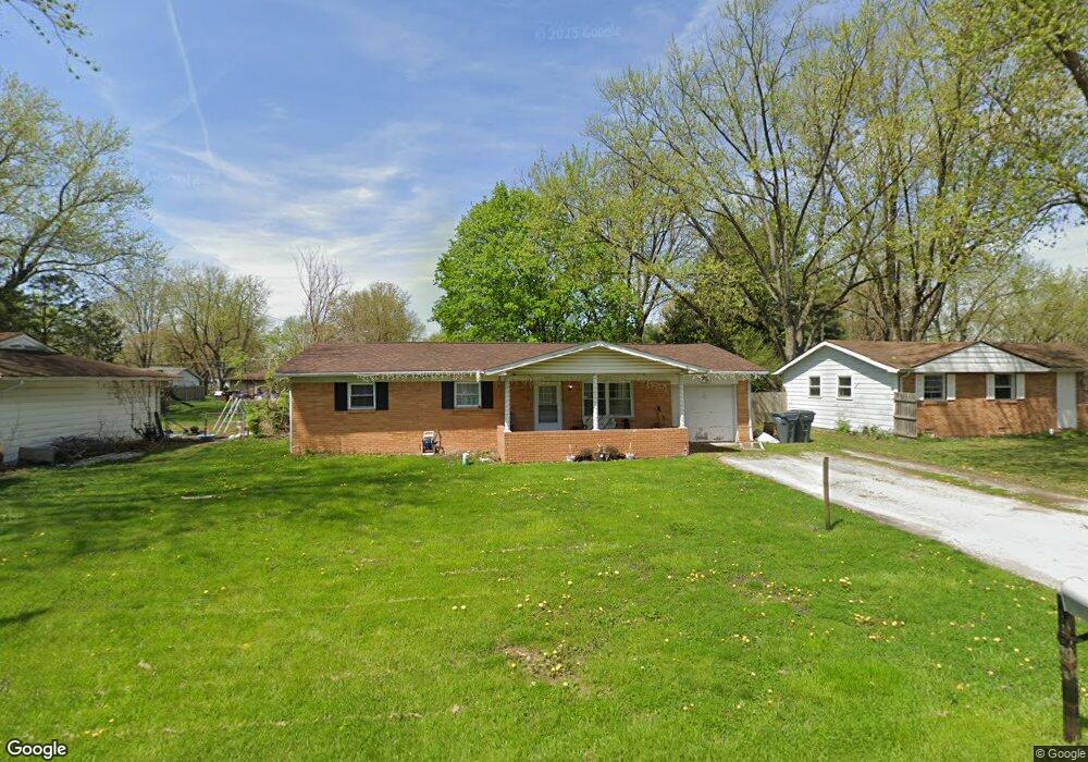
1917 Rosewood Dr Anderson, IN 46011
Estimated Value: $157,000 - $188,000
4
Beds
2
Baths
1,160
Sq Ft
$145/Sq Ft
Est. Value
About This Home
This home is located at 1917 Rosewood Dr, Anderson, IN 46011 and is currently estimated at $167,997, approximately $144 per square foot. 1917 Rosewood Dr is a home located in Madison County with nearby schools including Anderson Elementary School, Highland Middle School, and Anderson High School.
Ownership History
Date
Name
Owned For
Owner Type
Purchase Details
Closed on
Jun 5, 2009
Sold by
Keybank Na
Bought by
Alorin Midwest Properties Llc
Current Estimated Value
Purchase Details
Closed on
Oct 3, 2008
Sold by
Reel Scott
Bought by
Keybank Na
Purchase Details
Closed on
Sep 21, 2007
Sold by
Burge Larry E and Burge Carolyn S
Bought by
Reel Scott A
Home Financials for this Owner
Home Financials are based on the most recent Mortgage that was taken out on this home.
Original Mortgage
$71,000
Interest Rate
6.66%
Mortgage Type
New Conventional
Create a Home Valuation Report for This Property
The Home Valuation Report is an in-depth analysis detailing your home's value as well as a comparison with similar homes in the area
Home Values in the Area
Average Home Value in this Area
Purchase History
| Date | Buyer | Sale Price | Title Company |
|---|---|---|---|
| Alorin Midwest Properties Llc | -- | -- | |
| Keybank Na | $76,500 | -- | |
| Reel Scott A | -- | -- |
Source: Public Records
Mortgage History
| Date | Status | Borrower | Loan Amount |
|---|---|---|---|
| Previous Owner | Reel Scott A | $71,000 |
Source: Public Records
Tax History Compared to Growth
Tax History
| Year | Tax Paid | Tax Assessment Tax Assessment Total Assessment is a certain percentage of the fair market value that is determined by local assessors to be the total taxable value of land and additions on the property. | Land | Improvement |
|---|---|---|---|---|
| 2025 | $1,933 | $87,000 | $10,300 | $76,700 |
| 2024 | $1,933 | $87,000 | $10,300 | $76,700 |
| 2023 | $1,781 | $79,600 | $9,800 | $69,800 |
| 2022 | $1,783 | $79,700 | $9,200 | $70,500 |
| 2021 | $1,773 | $78,800 | $9,100 | $69,700 |
| 2020 | $1,692 | $74,900 | $8,700 | $66,200 |
| 2019 | $1,649 | $72,900 | $8,700 | $64,200 |
| 2018 | $1,542 | $66,800 | $8,700 | $58,100 |
| 2017 | $1,322 | $66,100 | $8,700 | $57,400 |
| 2016 | $1,360 | $68,000 | $8,700 | $59,300 |
| 2014 | $1,458 | $72,900 | $8,800 | $64,100 |
| 2013 | $1,458 | $72,900 | $8,800 | $64,100 |
Source: Public Records
Map
Nearby Homes
- 2015 Rosewood Dr
- 2121 Euclid Dr
- 1820 Euclid Dr
- 0 Oak Ct Unit LotWP001 24609107
- 0 Oak Ct Unit MBR22059682
- 3008 Nichol Ave
- 118 Winding Way
- 908 Wayside Ln
- 34 Colony Rd
- 3134 Meadowcrest Dr
- 1827 Fulton St
- 0 Fulton St Unit MBR22051501
- 2308 W 16th St
- 718 Longfellow Rd
- 2401 W 27th St
- 45 Spring Valley Dr
- 1818 Dewey St
- 2205 Nichol Ave
- 2104 W 16th St
- 910 Raible Ave
- 2003 Rosewood Dr
- 1911 Rosewood Dr
- 1916 Manger Ln
- 2011 Rosewood Dr
- 1907 Rosewood Dr
- 1912 Manger Ln
- 2004 Manger Ln
- 1916 Rosewood Dr
- 1906 Manger Ln
- 2008 Manger Ln
- 1815 Rosewood Dr
- 2010 Rosewood Dr
- 1812 Manger Ln
- 1906 Rosewood Dr
- 1818 Manger Ln
- 2014 Manger Ln
- 2014 Rosewood Dr
- 1812 Rosewood Dr
- 2021 Rosewood Dr
- 1809 Rosewood Dr