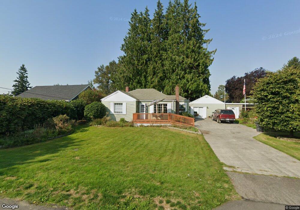
1917 S Wall St Mount Vernon, WA 98273
Estimated Value: $449,000 - $495,000
3
Beds
1
Bath
1,449
Sq Ft
$328/Sq Ft
Est. Value
About This Home
This home is located at 1917 S Wall St, Mount Vernon, WA 98273 and is currently estimated at $475,206, approximately $327 per square foot. 1917 S Wall St is a home located in Skagit County with nearby schools including Jefferson Elementary School, Mount Baker Middle School, and Mount Vernon High School.
Ownership History
Date
Name
Owned For
Owner Type
Purchase Details
Closed on
Jul 23, 2024
Sold by
Mauvais Robert D
Bought by
Pettigrew Clifton L and Pettigrew Winter E
Current Estimated Value
Home Financials for this Owner
Home Financials are based on the most recent Mortgage that was taken out on this home.
Original Mortgage
$344,250
Outstanding Balance
$340,107
Interest Rate
6.95%
Mortgage Type
New Conventional
Estimated Equity
$135,099
Create a Home Valuation Report for This Property
The Home Valuation Report is an in-depth analysis detailing your home's value as well as a comparison with similar homes in the area
Home Values in the Area
Average Home Value in this Area
Purchase History
| Date | Buyer | Sale Price | Title Company |
|---|---|---|---|
| Pettigrew Clifton L | $7,349 | Chicago Title |
Source: Public Records
Mortgage History
| Date | Status | Borrower | Loan Amount |
|---|---|---|---|
| Open | Pettigrew Clifton L | $344,250 |
Source: Public Records
Tax History Compared to Growth
Tax History
| Year | Tax Paid | Tax Assessment Tax Assessment Total Assessment is a certain percentage of the fair market value that is determined by local assessors to be the total taxable value of land and additions on the property. | Land | Improvement |
|---|---|---|---|---|
| 2024 | $2,366 | $426,600 | $206,900 | $219,700 |
| 2023 | $1,021 | $264,900 | $0 | $0 |
| 2022 | $1,215 | $265,700 | $0 | $0 |
| 2021 | $1,086 | $258,200 | $0 | $0 |
| 2020 | $3,084 | $225,400 | $0 | $0 |
| 2019 | $2,459 | $225,400 | $0 | $0 |
| 2018 | $2,631 | $201,900 | $0 | $0 |
| 2017 | $2,283 | $167,800 | $0 | $0 |
| 2016 | $2,200 | $143,300 | $57,800 | $85,500 |
| 2015 | $2,389 | $136,400 | $55,000 | $81,400 |
| 2013 | $2,445 | $142,700 | $0 | $0 |
Source: Public Records
Map
Nearby Homes
- 1802 Douglas St
- 16785 Britt Rd
- 803 W Hazel St
- 1817 S 3rd St
- 2318 Old Hw 99 S
- 1700 S 6th St
- 1212 S 3rd St
- 2210 Old Highway 99 S Unit 12
- 2522 Old Hwy 99 Rd S Unit 3
- 2522 Old Hwy 99 Rd S
- 2522 Old Highway 99 S Unit 19
- 2522 Old Highway 99 S Unit 23
- 112 Milwaukee St
- 1613 S 10th St
- 1410 S 10th St
- 303 S Baker St
- 821 Garfield St
- 206 S Baker St
- 1221 S 12th St
- 1708 S 14th St
- 1923 S Wall St
- 1900 Britt Rd
- 1903 S Wall St
- 1927 S Wall St
- 1904 S Wall St
- 1922 S Wall St
- 1015 W Blackburn Rd
- 1900 S Wall St
- 1906 Britt Rd
- 1951 S Wall St
- 1916 Britt Rd
- 1934 S Wall St
- 1919 Heather Ln
- 1918A Britt Rd
- 1931 Heather Ln
- 1021 W Blackburn Rd
- 1930 Heather Ln
- 1030 -2 W Blackburn Rd
- 1020 W Blackburn Rd
- 1010 W Blackburn Rd