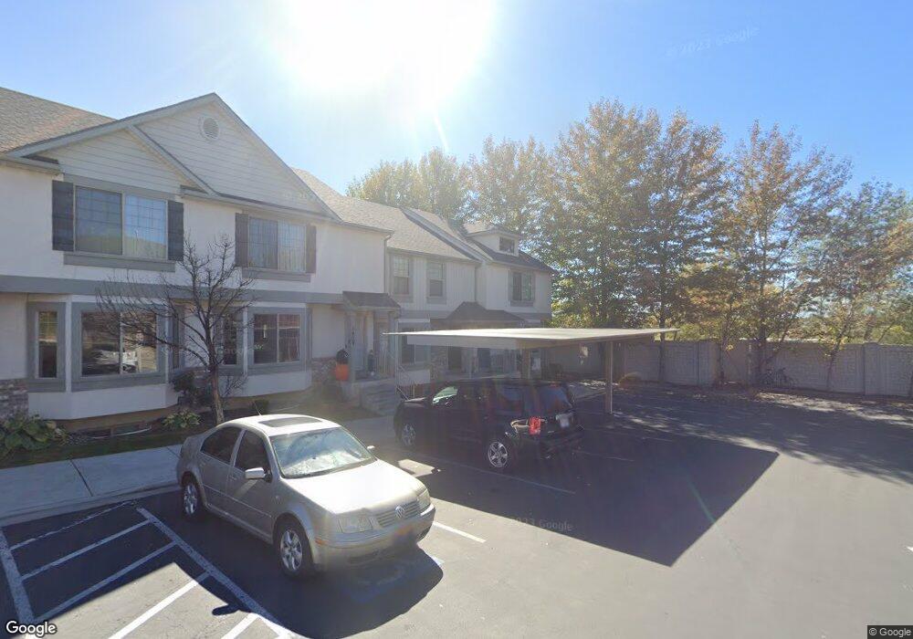
1917 W 960 N Provo, UT 84604
Rivergrove NeighborhoodEstimated Value: $404,000 - $422,000
4
Beds
4
Baths
2,130
Sq Ft
$193/Sq Ft
Est. Value
About This Home
This home is located at 1917 W 960 N, Provo, UT 84604 and is currently estimated at $410,350, approximately $192 per square foot. 1917 W 960 N is a home located in Utah County with nearby schools including Westridge Elementary School, Dixon Middle School, and Provo High School.
Ownership History
Date
Name
Owned For
Owner Type
Purchase Details
Closed on
Nov 20, 2014
Sold by
Mckenna C Troy
Bought by
Nash Vyling
Current Estimated Value
Home Financials for this Owner
Home Financials are based on the most recent Mortgage that was taken out on this home.
Original Mortgage
$119,900
Outstanding Balance
$91,473
Interest Rate
3.89%
Mortgage Type
New Conventional
Estimated Equity
$318,877
Create a Home Valuation Report for This Property
The Home Valuation Report is an in-depth analysis detailing your home's value as well as a comparison with similar homes in the area
Home Values in the Area
Average Home Value in this Area
Purchase History
| Date | Buyer | Sale Price | Title Company |
|---|---|---|---|
| Nash Vyling | -- | Provo Abstract Co |
Source: Public Records
Mortgage History
| Date | Status | Borrower | Loan Amount |
|---|---|---|---|
| Open | Nash Vyling | $119,900 |
Source: Public Records
Tax History
| Year | Tax Paid | Tax Assessment Tax Assessment Total Assessment is a certain percentage of the fair market value that is determined by local assessors to be the total taxable value of land and additions on the property. | Land | Improvement |
|---|---|---|---|---|
| 2025 | $2,128 | $207,900 | -- | -- |
| 2024 | $2,128 | $209,495 | $0 | $0 |
| 2023 | $2,041 | $198,055 | $0 | $0 |
| 2022 | $2,129 | $208,285 | $0 | $0 |
| 2021 | $1,668 | $284,700 | $42,700 | $242,000 |
| 2020 | $1,613 | $258,000 | $33,500 | $224,500 |
| 2019 | $1,551 | $258,000 | $33,500 | $224,500 |
| 2018 | $1,410 | $238,000 | $29,000 | $209,000 |
| 2017 | $1,305 | $121,000 | $0 | $0 |
| 2016 | $1,317 | $113,850 | $0 | $0 |
| 2015 | $1,240 | $108,350 | $0 | $0 |
| 2014 | $1,093 | $99,550 | $0 | $0 |
Source: Public Records
Map
Nearby Homes
- 1903 W 890 N
- 962 Independence Ave
- 925 N 1760 W
- 2043 W 1100 N
- 1127 Independence Ave
- 579 N Geneva Rd
- 1489 Arthur Dr
- 1162 Reese Dr
- 1441 Arthur Dr
- 2397 W 1160 N
- 1415 Arthur Dr
- 2359 W 540 N
- 1574 W 1400 N
- 1515 N 1830 W
- 1387 W 570 North St
- 255 N 1600 W Unit 148
- 255 N 1600 W Unit 52
- 255 N 1600 W Unit 108
- 255 N 1600 W Unit 94
- 255 N 1600 W Unit 73
- 1917 W 960 N Unit 18
- 1913 W 960 N
- 1913 W 960 N Unit 17
- 1909 W 960 N
- 1909 W 960 N Unit 16
- 1905 W 960 N
- 1901 W 960 N
- 1901 W 960 N Unit 14
- 1916 W 890 N Unit 92
- 1916 W 890 N
- 1897 W 960 N
- 1912 W 890 N Unit 91
- 1912 W 890 N
- 1906 W 890 N Unit 90
- 1906 W 890 N
- 1902 W 890 N
- 1893 W 960 N
- 1916 W 960 N
- 1916 W 960 N Unit 19
- 1896 W 890 N Unit 88
Your Personal Tour Guide
Ask me questions while you tour the home.