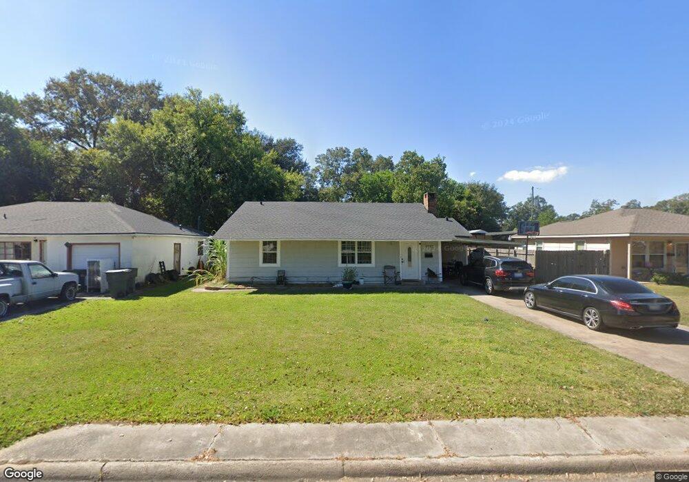
1917 Woodrow Dr Unit WiLL OWNER FINANCE ! Port Arthur, TX 77642
Estimated Value: $145,000 - $170,000
3
Beds
2
Baths
1,944
Sq Ft
$80/Sq Ft
Est. Value
About This Home
This home is located at 1917 Woodrow Dr Unit WiLL OWNER FINANCE !, Port Arthur, TX 77642 and is currently estimated at $154,645, approximately $79 per square foot. 1917 Woodrow Dr Unit WiLL OWNER FINANCE ! is a home located in Jefferson County with nearby schools including Tyrrell Elementary School, Jefferson Middle School, and Memorial High School.
Ownership History
Date
Name
Owned For
Owner Type
Purchase Details
Closed on
Nov 5, 2018
Sold by
Shepherd Jason and Shepherd Maritza
Bought by
Becerra Juan
Current Estimated Value
Home Financials for this Owner
Home Financials are based on the most recent Mortgage that was taken out on this home.
Original Mortgage
$94,261
Outstanding Balance
$82,714
Interest Rate
4.7%
Mortgage Type
FHA
Estimated Equity
$71,931
Purchase Details
Closed on
Sep 19, 2017
Sold by
Pham Khai Kim and Pham Kathy
Bought by
Shepherd Jason and Shepherd Martiza
Home Financials for this Owner
Home Financials are based on the most recent Mortgage that was taken out on this home.
Original Mortgage
$68,000
Interest Rate
3.9%
Mortgage Type
New Conventional
Purchase Details
Closed on
Feb 15, 2005
Sold by
Dang Caitlin
Bought by
Pham Khai
Create a Home Valuation Report for This Property
The Home Valuation Report is an in-depth analysis detailing your home's value as well as a comparison with similar homes in the area
Home Values in the Area
Average Home Value in this Area
Purchase History
| Date | Buyer | Sale Price | Title Company |
|---|---|---|---|
| Becerra Juan | -- | Capital Title | |
| Shepherd Jason | -- | Stewart Title | |
| Pham Khai | -- | -- |
Source: Public Records
Mortgage History
| Date | Status | Borrower | Loan Amount |
|---|---|---|---|
| Open | Becerra Juan | $94,261 | |
| Previous Owner | Shepherd Jason | $68,000 |
Source: Public Records
Tax History Compared to Growth
Tax History
| Year | Tax Paid | Tax Assessment Tax Assessment Total Assessment is a certain percentage of the fair market value that is determined by local assessors to be the total taxable value of land and additions on the property. | Land | Improvement |
|---|---|---|---|---|
| 2025 | $995 | $143,207 | -- | -- |
| 2024 | $995 | $130,188 | -- | -- |
| 2023 | $995 | $118,353 | $3,579 | $114,774 |
| 2022 | $3,582 | $112,776 | $0 | $0 |
| 2021 | $3,398 | $116,569 | $3,579 | $112,990 |
| 2020 | $2,370 | $93,204 | $3,579 | $89,625 |
| 2019 | $2,971 | $93,210 | $3,580 | $89,630 |
| 2018 | $959 | $79,500 | $3,580 | $75,920 |
| 2017 | $2,464 | $79,500 | $3,580 | $75,920 |
| 2016 | $2,106 | $71,910 | $3,580 | $68,330 |
| 2015 | $2,146 | $71,910 | $3,580 | $68,330 |
| 2014 | $2,146 | $71,910 | $3,580 | $68,330 |
Source: Public Records
Map
Nearby Homes
- 2129 Neches Ave
- 4100 Dryden Rd
- 2515 Glenwood Dr
- 1349 Jefferson Dr
- 2515 Date St
- LOT 55 Royal Meadows Estate
- 2621 Evergreen Dr
- 3945 12th St
- 2301 Glenwood Dr
- 4501 Springdale St
- 2325 Oaklawn Ave
- 2720 Royal Ave
- 2615 3rd Ave
- 4545 Hollywood Dr
- 2434 Crescent Dr
- 5301 North St
- 3812 30th St
- 3049 Canal Ave
- 4034 32nd St
- 2323 7th Ave
- 1917 Woodrow Dr
- 1917 Woodrow Dr
- 1923 Woodrow Dr
- 1911 Woodrow Dr
- 1929 Woodrow Dr
- 1905 Woodrow Dr
- 1928 Neches Ave
- 1935 Woodrow Dr
- 1901 Woodrow Dr
- 1916 Woodrow Dr
- 1922 Woodrow Dr
- 1904 Woodrow Dr
- 1928 Woodrow Dr
- 1941 Woodrow Dr
- 4401 Dryden Rd
- 1942 Neches Ave
- 1900 Woodrow Dr
- 1934 Woodrow Dr
- 1947 Woodrow Dr
- 1940 Woodrow Dr