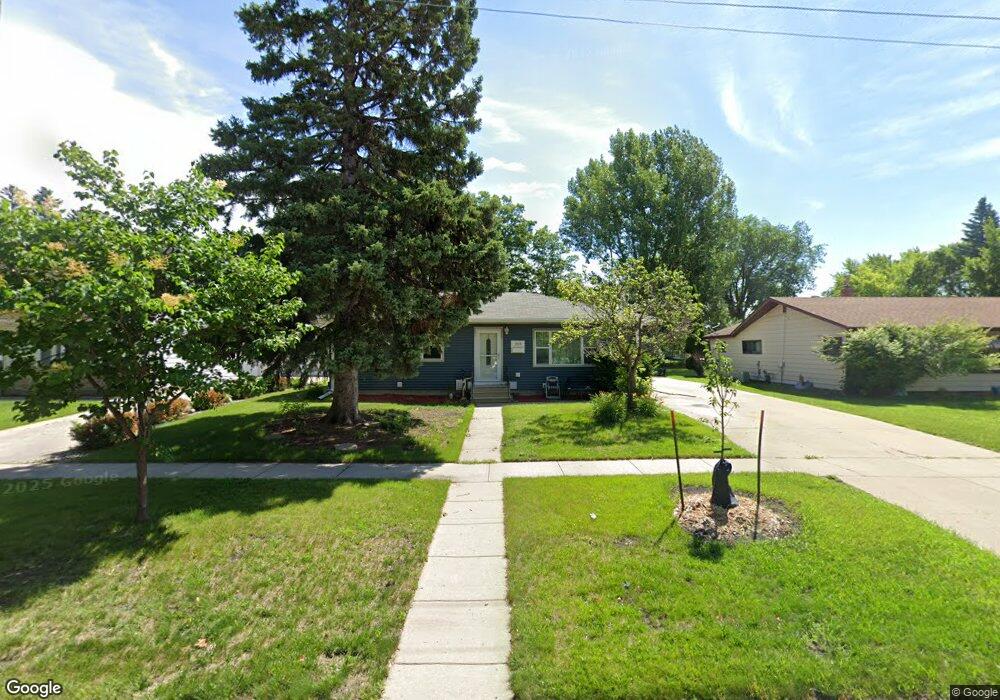
1918 17th St S Fargo, ND 58103
Lewis and Clark NeighborhoodEstimated Value: $256,000 - $321,000
5
Beds
2
Baths
1,313
Sq Ft
$221/Sq Ft
Est. Value
About This Home
This home is located at 1918 17th St S, Fargo, ND 58103 and is currently estimated at $289,955, approximately $220 per square foot. 1918 17th St S is a home located in Cass County with nearby schools including Lewis & Clark Elementary School, Carl Ben Eielson Middle School, and South High School.
Ownership History
Date
Name
Owned For
Owner Type
Purchase Details
Closed on
Jul 1, 2009
Sold by
Sheehan Kerri A and Sheehan Jefferry L
Bought by
Rudnick Melanie I and Rudnick Troy T
Current Estimated Value
Home Financials for this Owner
Home Financials are based on the most recent Mortgage that was taken out on this home.
Original Mortgage
$127,900
Interest Rate
5.28%
Mortgage Type
New Conventional
Create a Home Valuation Report for This Property
The Home Valuation Report is an in-depth analysis detailing your home's value as well as a comparison with similar homes in the area
Home Values in the Area
Average Home Value in this Area
Purchase History
| Date | Buyer | Sale Price | Title Company |
|---|---|---|---|
| Rudnick Melanie I | -- | -- |
Source: Public Records
Mortgage History
| Date | Status | Borrower | Loan Amount |
|---|---|---|---|
| Closed | Rudnick Melanie I | $65,000 | |
| Open | Rudnick Melanie I | $160,800 | |
| Previous Owner | Rudnick Melanie I | $127,900 | |
| Previous Owner | Rudnick Melanie I | $23,950 |
Source: Public Records
Tax History Compared to Growth
Tax History
| Year | Tax Paid | Tax Assessment Tax Assessment Total Assessment is a certain percentage of the fair market value that is determined by local assessors to be the total taxable value of land and additions on the property. | Land | Improvement |
|---|---|---|---|---|
| 2024 | $6,381 | $133,650 | $29,100 | $104,550 |
| 2023 | $6,269 | $127,300 | $29,100 | $98,200 |
| 2022 | $3,095 | $104,450 | $29,100 | $75,350 |
| 2021 | $3,130 | $107,700 | $29,050 | $78,650 |
| 2020 | $3,116 | $107,700 | $29,050 | $78,650 |
| 2019 | $2,895 | $107,700 | $16,150 | $91,550 |
| 2018 | $2,798 | $107,700 | $16,150 | $91,550 |
| 2017 | $2,637 | $102,600 | $16,150 | $86,450 |
| 2016 | $2,347 | $99,600 | $16,150 | $83,450 |
| 2015 | $2,244 | $89,300 | $12,100 | $77,200 |
| 2014 | $2,131 | $82,700 | $12,100 | $70,600 |
| 2013 | $2,133 | $82,700 | $12,100 | $70,600 |
Source: Public Records
Map
Nearby Homes
- 1917 16 1 2 St S
- 1943 19th St S
- 2320 20th Ave S Unit 7
- 2326 20th Ave S Unit 9
- 1834 14 1 2 St S
- 1543 25th Ave S
- 1718 15th St S
- 2402 18th St S Unit 3
- 2440 15th St S Unit B14
- 1737 Park Blvd S
- 1405 25th Ave S Unit A201
- 1725 Whitestone Cir S
- 1710 14th St S
- 1545 15th St S
- 2301 23rd Ave S
- 1550 14 1 2 St S
- 2401 17th Ave S
- 1361 16th Ave S
- 1550 13 1 2 St S
- 2636 18th St S Unit 8
- 1914 17th St S
- 1922 17th St S
- 1926 17th St S
- 1910 17th St S
- 1917 16 1/2 St S
- 1925 16 1/2 St S
- 1913 16 1 2 St S
- 1913 16 1/2 St S
- 1921 16 1/2 St S
- 1629 20th Ave S
- 1925 16 1 2 St S
- 1906 17th St S
- 1909 16 1/2 St S
- 1917 17th St S
- 1921 17th St S
- 1621 20th Ave S
- 1913 17th St S
- 1925 17th St S
- 1905 16 1/2 St S
- 1909 17th St S