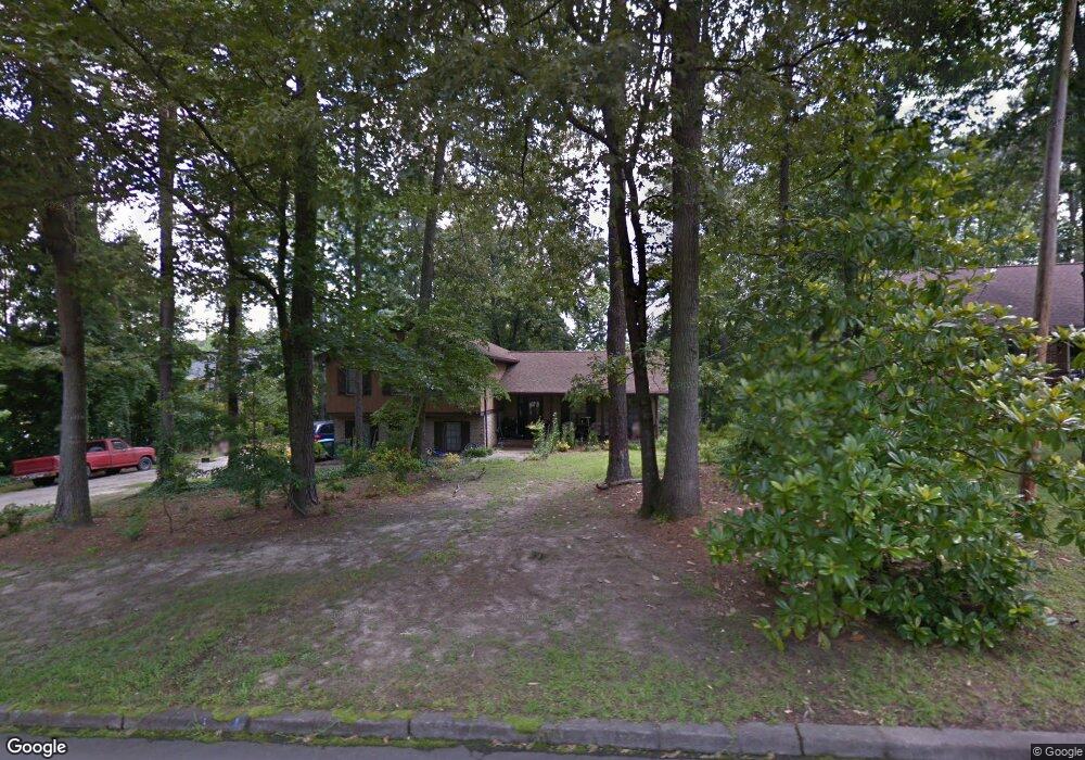
1918 Fabersham Dr Snellville, GA 30078
Estimated Value: $351,000 - $361,902
3
Beds
3
Baths
2,326
Sq Ft
$154/Sq Ft
Est. Value
About This Home
This home is located at 1918 Fabersham Dr, Snellville, GA 30078 and is currently estimated at $358,726, approximately $154 per square foot. 1918 Fabersham Dr is a home located in Gwinnett County with nearby schools including Pharr Elementary School, Couch Middle School, and Grayson High School.
Ownership History
Date
Name
Owned For
Owner Type
Purchase Details
Closed on
Aug 27, 2019
Sold by
Bahari Properties Llc
Bought by
Freeport Title & Guaranty Inc Trustee and 1918 Fabersham Drive Land Trust
Current Estimated Value
Purchase Details
Closed on
Oct 3, 2017
Sold by
Phyfe James W
Bought by
Bahari Properties Llc
Purchase Details
Closed on
Mar 30, 1999
Sold by
Cooper Carolyn
Bought by
Phyfe James W and Phyfe Jennifer M
Home Financials for this Owner
Home Financials are based on the most recent Mortgage that was taken out on this home.
Original Mortgage
$86,500
Interest Rate
6.82%
Mortgage Type
New Conventional
Purchase Details
Closed on
Jul 14, 1995
Sold by
Fabery Raymond M Celia M
Bought by
Cooper Carolyn
Create a Home Valuation Report for This Property
The Home Valuation Report is an in-depth analysis detailing your home's value as well as a comparison with similar homes in the area
Home Values in the Area
Average Home Value in this Area
Purchase History
| Date | Buyer | Sale Price | Title Company |
|---|---|---|---|
| Freeport Title & Guaranty Inc Trustee | -- | -- | |
| Bahari Properties Llc | $136,500 | -- | |
| Phyfe James W | $110,000 | -- | |
| Cooper Carolyn | $5,800 | -- |
Source: Public Records
Mortgage History
| Date | Status | Borrower | Loan Amount |
|---|---|---|---|
| Previous Owner | Phyfe James W | $86,500 | |
| Closed | Cooper Carolyn | $0 |
Source: Public Records
Tax History Compared to Growth
Tax History
| Year | Tax Paid | Tax Assessment Tax Assessment Total Assessment is a certain percentage of the fair market value that is determined by local assessors to be the total taxable value of land and additions on the property. | Land | Improvement |
|---|---|---|---|---|
| 2024 | $3,674 | $114,800 | $26,000 | $88,800 |
| 2023 | $3,674 | $118,280 | $26,000 | $92,280 |
| 2022 | $3,295 | $102,640 | $21,600 | $81,040 |
| 2021 | $2,632 | $80,240 | $17,200 | $63,040 |
| 2020 | $2,808 | $73,080 | $14,400 | $58,680 |
| 2019 | $2,801 | $73,080 | $14,400 | $58,680 |
| 2018 | $2,116 | $54,600 | $12,400 | $42,200 |
| 2016 | $1,816 | $54,520 | $11,000 | $43,520 |
| 2015 | $1,759 | $52,480 | $11,000 | $41,480 |
| 2014 | -- | $50,080 | $11,000 | $39,080 |
Source: Public Records
Map
Nearby Homes
- 1721 Driftwood Place
- 1801 Driftwood Place
- 1847 Englewood Way
- 1727 Ramblewood Way
- 1735 Woodberry Run Dr
- 1825 North Rd
- 1580 Winding Creek Cir
- 2170 Rosie Ln
- 1932 Pharrs Rd
- 2183 Chaparral Dr
- 2050 Woodberry Run Dr
- 1832 Glenwood Ln
- 1883 Bennett Ridge SW
- 1449 Lakeview Rd
- 2055 Pinella Dr
- 1445 Hillside Dr SW
- 1418 Georgetown Way
- 1430 Roanoke Trace
- 1621 Annapolis Way
- 1928 Fabersham Dr
- 1900 Brandie Elaine Ave
- 1905 Brandie Elaine Ave
- 1890 Brandie Elaine Ave
- 1938 Fabersham Dr
- 1929 Fabersham Dr SW
- 1895 Brandie Elaine Ave
- 1919 Fabersham Dr
- 1935 Ridgedale Dr
- 1929 Fabersham Dr
- 1909 Fabersham Dr
- 1880 Brandie Elaine Ave
- 1948 Fabersham Dr
- 1939 Fabersham Dr
- 1712 Brittany Dawn Dr
- 1702 Brittany Dawn Dr
- 1722 Brittany Dawn Dr
- 1949 Fabersham Dr SW
- 1732 Brittany Dawn Dr
- 1949 Fabersham Dr