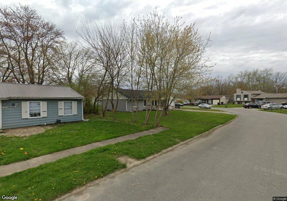
1918 N Balsam Ct Anderson, IN 46011
Estimated Value: $125,000 - $158,943
3
Beds
2
Baths
1,000
Sq Ft
$143/Sq Ft
Est. Value
About This Home
This home is located at 1918 N Balsam Ct, Anderson, IN 46011 and is currently estimated at $143,486, approximately $143 per square foot. 1918 N Balsam Ct is a home located in Madison County with nearby schools including Edgewood Elementary School, Highland Middle School, and Anderson High School.
Ownership History
Date
Name
Owned For
Owner Type
Purchase Details
Closed on
Oct 12, 2021
Sold by
1918 W Balsam Trust
Bought by
Sanders Deanna
Current Estimated Value
Purchase Details
Closed on
Feb 29, 2016
Sold by
Mccormick Curtis and Mccormick Nicole
Bought by
1918 W Balsam Trust
Purchase Details
Closed on
Oct 20, 2015
Sold by
Mccormick Stephanie Chastain and Mccormick Curtis
Bought by
Mccormick Curtis and Mccormick Nicole
Purchase Details
Closed on
Feb 3, 2015
Sold by
Cr Capital Groupllc
Bought by
Mccormick Stephanie Chastain and Mccormick Curtis
Purchase Details
Closed on
Nov 4, 2013
Sold by
Us Bank Na
Bought by
Cr Capital Group Llc
Purchase Details
Closed on
Jul 19, 2013
Sold by
Madison County Sheriff
Bought by
Us Bank Na
Create a Home Valuation Report for This Property
The Home Valuation Report is an in-depth analysis detailing your home's value as well as a comparison with similar homes in the area
Home Values in the Area
Average Home Value in this Area
Purchase History
| Date | Buyer | Sale Price | Title Company |
|---|---|---|---|
| Sanders Deanna | $43,500 | American Land Title | |
| 1918 W Balsam Trust | -- | -- | |
| Mccormick Curtis | -- | -- | |
| Mccormick Stephanie Chastain | -- | -- | |
| Cr Capital Group Llc | $9,050 | -- | |
| Us Bank Na | $42,000 | -- |
Source: Public Records
Tax History Compared to Growth
Tax History
| Year | Tax Paid | Tax Assessment Tax Assessment Total Assessment is a certain percentage of the fair market value that is determined by local assessors to be the total taxable value of land and additions on the property. | Land | Improvement |
|---|---|---|---|---|
| 2025 | $2,098 | $94,400 | $13,100 | $81,300 |
| 2024 | $2,098 | $94,400 | $13,100 | $81,300 |
| 2023 | $1,887 | $84,300 | $12,400 | $71,900 |
| 2022 | $1,719 | $76,800 | $12,000 | $64,800 |
| 2021 | $1,538 | $68,300 | $11,500 | $56,800 |
| 2020 | $1,404 | $62,100 | $10,900 | $51,200 |
| 2019 | $1,329 | $58,700 | $10,900 | $47,800 |
| 2018 | $1,340 | $58,000 | $10,900 | $47,100 |
| 2017 | $1,169 | $58,400 | $10,600 | $47,800 |
| 2016 | $2,347 | $57,100 | $10,400 | $46,700 |
| 2014 | $1,004 | $50,000 | $9,700 | $40,300 |
| 2013 | $1,004 | $50,000 | $9,700 | $40,300 |
Source: Public Records
Map
Nearby Homes
- 1905 E Balsam Ct
- 2415 Bramble Way
- 1641 Hillcrest Ave
- Lot 2 Vanderbilt Dr
- 1820 Whittier Ave
- 2158 W 250 N
- 925 Forest Dr
- Lot 34 Doe Meadow Dr
- Lot 33 Doe Meadow Dr
- Lot 28 Doe Meadow Dr
- 1321 Greenway Dr
- 807 Forest Dr
- 2407 Caramore Cir
- 2915 Harbur Blvd
- 1110 van Buskirk Rd
- 2515 Winterwood Ct
- 2213 Lafayette St
- 2508 Northshore Blvd
- 2518 Northshore Blvd
- 2511 Winterwood Ln
- 1918 W Balsam Ct
- 1908 W Balsam Ct
- 1931 N Balsam Ct
- 1927 N Balsam Ct
- 1928 N Balsam Ct
- 1932 N Balsam Ct
- 1911 W Balsam Ct
- 1904 W Balsam Ct
- 1907 W Balsam Ct
- 1915 N Balsam Ct
- 1818 Greenwood Dr
- 1919 N Balsam Ct
- 1923 N Balsam Ct
- 2004 Ashbourne Rd
- 1924 N Balsam Ct
- N Balsam Ct
- 1909 E Balsam Ct
- 1916 N Balsam Ct
- 1912 Boxwood Dr
- 1916 Boxwood Dr