1918 Riverbend Pkwy Fremont, OH 43420
Estimated Value: $230,000 - $250,000
3
Beds
2
Baths
2,238
Sq Ft
$106/Sq Ft
Est. Value
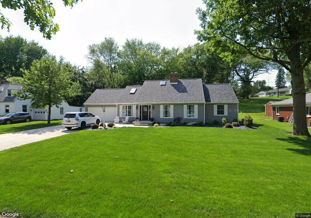
About This Home
This home is located at 1918 Riverbend Pkwy, Fremont, OH 43420 and is currently estimated at $237,855, approximately $106 per square foot. 1918 Riverbend Pkwy is a home located in Sandusky County with nearby schools including Fremont Ross High School, St. Ann Catholic School, and Bishop Hoffman Catholic School - This is St Joe's School now.
Ownership History
Date
Name
Owned For
Owner Type
Purchase Details
Closed on
Sep 23, 2020
Sold by
Urban Gregg C
Bought by
Wiggins Tommy
Current Estimated Value
Purchase Details
Closed on
Sep 22, 2020
Sold by
Wiggins Tommy L
Bought by
Urban Gregg C
Purchase Details
Closed on
Jan 2, 2020
Sold by
Theller Eric A and Theller Kimberly K
Bought by
Wiggins Tommy
Home Financials for this Owner
Home Financials are based on the most recent Mortgage that was taken out on this home.
Original Mortgage
$142,500
Interest Rate
3.6%
Mortgage Type
New Conventional
Purchase Details
Closed on
Jun 1, 1984
Bought by
Theller Eric A and Theller Kimberly K
Create a Home Valuation Report for This Property
The Home Valuation Report is an in-depth analysis detailing your home's value as well as a comparison with similar homes in the area
Home Values in the Area
Average Home Value in this Area
Purchase History
| Date | Buyer | Sale Price | Title Company |
|---|---|---|---|
| Wiggins Tommy | -- | None Available | |
| Urban Gregg C | -- | None Available | |
| Wiggins Tommy | $150,000 | Chicago Title | |
| Theller Eric A | $65,000 | -- |
Source: Public Records
Mortgage History
| Date | Status | Borrower | Loan Amount |
|---|---|---|---|
| Previous Owner | Wiggins Tommy | $142,500 |
Source: Public Records
Tax History Compared to Growth
Tax History
| Year | Tax Paid | Tax Assessment Tax Assessment Total Assessment is a certain percentage of the fair market value that is determined by local assessors to be the total taxable value of land and additions on the property. | Land | Improvement |
|---|---|---|---|---|
| 2024 | $2,493 | $66,230 | $10,540 | $55,690 |
| 2023 | $2,493 | $53,000 | $8,440 | $44,560 |
| 2022 | $2,120 | $52,190 | $8,440 | $43,750 |
| 2021 | $2,559 | $52,190 | $8,440 | $43,750 |
| 2020 | $1,908 | $35,810 | $8,440 | $27,370 |
| 2019 | $1,937 | $35,810 | $8,440 | $27,370 |
| 2018 | $3,246 | $35,810 | $8,440 | $27,370 |
| 2017 | $3,130 | $33,330 | $8,440 | $24,890 |
| 2016 | $2,932 | $33,330 | $8,440 | $24,890 |
| 2015 | $2,893 | $33,330 | $8,440 | $24,890 |
| 2014 | $3,204 | $40,150 | $8,020 | $32,130 |
| 2013 | $3,129 | $40,150 | $8,020 | $32,130 |
Source: Public Records
Map
Nearby Homes
- 1730 Port Clinton Rd Unit 41
- 1730 Port Clinton Rd
- 1730 Port Clinton Rd Unit 33
- 711 Bloom Rd
- 0 Sean Dr
- Outlot A Sean Dr
- 2100 Ohio 53
- 612 2nd St
- 533 Sandusky Ave Unit 535
- 900 Spring St
- 433 Sandusky Ave
- 711 Rawson Ave
- 1441 White Ave
- 340 340 Sandusky Ave
- 1227 White Ave
- 516 N Front St
- 322 4th St
- 224 Sandusky Ave Unit 226
- 427 N Clover St
- 1548 North St
- 1914 Riverbend Pkwy
- 1926 Riverbend Pkwy
- 1921 Riverbend Pkwy
- 1910 Riverbend Pkwy
- 1913 Riverbend Pkwy
- 1915 Whittaker Dr
- 1929 Riverbend Pkwy
- 236 Yacht Club Dr
- 1909 Riverbend Pkwy
- 1900 Riverbend Pkwy
- 1905 Whittaker Dr
- 248 Yacht Club Dr
- 224 Yacht Club Dr
- 1931 Whittaker Dr
- 1901 Whittaker Dr
- 214 Yacht Club Dr
- 1912 Whittaker Dr
- 1939 Whittaker Dr
- 210 Yacht Club Dr
- 1899 Port Clinton Rd