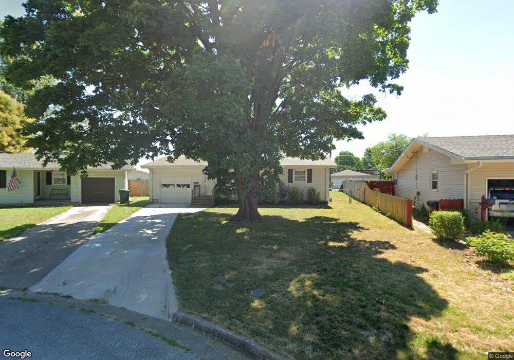
1918 S Lancaster Ave Springfield, MO 65807
Mark Twain NeighborhoodEstimated Value: $163,685 - $193,000
2
Beds
2
Baths
1,064
Sq Ft
$165/Sq Ft
Est. Value
About This Home
This home is located at 1918 S Lancaster Ave, Springfield, MO 65807 and is currently estimated at $175,921, approximately $165 per square foot. 1918 S Lancaster Ave is a home located in Greene County with nearby schools including Sunshine Elementary School, Jarrett Middle, and Parkview High School.
Ownership History
Date
Name
Owned For
Owner Type
Purchase Details
Closed on
Nov 6, 2015
Sold by
Fury Chelsea L and Fury Jonathan J
Bought by
Burton David and Burton Kim
Current Estimated Value
Purchase Details
Closed on
Dec 18, 2008
Sold by
Watkins William T and Watkins Joni L
Bought by
Fury Chelsea L and Fury Jonathan J
Home Financials for this Owner
Home Financials are based on the most recent Mortgage that was taken out on this home.
Original Mortgage
$61,000
Interest Rate
6.15%
Mortgage Type
New Conventional
Purchase Details
Closed on
May 12, 2006
Sold by
Seaver James L and Seaver Doris J
Bought by
Watkins William T and Watkins Joni L
Create a Home Valuation Report for This Property
The Home Valuation Report is an in-depth analysis detailing your home's value as well as a comparison with similar homes in the area
Home Values in the Area
Average Home Value in this Area
Purchase History
| Date | Buyer | Sale Price | Title Company |
|---|---|---|---|
| Burton David | -- | None Available | |
| Fury Chelsea L | -- | None Available | |
| Watkins William T | -- | None Available |
Source: Public Records
Mortgage History
| Date | Status | Borrower | Loan Amount |
|---|---|---|---|
| Previous Owner | Fury Chelsea L | $61,000 |
Source: Public Records
Tax History
| Year | Tax Paid | Tax Assessment Tax Assessment Total Assessment is a certain percentage of the fair market value that is determined by local assessors to be the total taxable value of land and additions on the property. | Land | Improvement |
|---|---|---|---|---|
| 2025 | $1,013 | $20,330 | $5,700 | $14,630 |
| 2024 | $938 | $17,480 | $4,100 | $13,380 |
| 2023 | $932 | $17,480 | $4,100 | $13,380 |
| 2022 | $752 | $13,770 | $4,100 | $9,670 |
| 2021 | $752 | $13,770 | $4,100 | $9,670 |
| 2020 | $745 | $13,050 | $4,100 | $8,950 |
| 2019 | $724 | $13,050 | $4,100 | $8,950 |
| 2018 | $670 | $12,080 | $4,100 | $7,980 |
| 2017 | $663 | $11,490 | $4,100 | $7,390 |
| 2016 | $630 | $11,490 | $4,100 | $7,390 |
| 2015 | $624 | $11,490 | $4,100 | $7,390 |
| 2014 | $616 | $11,260 | $4,100 | $7,160 |
Source: Public Records
Map
Nearby Homes
- 1912 S Lancaster Ave
- 1010 W Cherokee St
- 743 W Whiteside St
- 1948 S Weaver Ave
- 853 W Whiteside St
- 306 W McGee St
- 901 W Portland St
- 526 W Portland St
- 1947 S Fort Ave
- 611 W Portland St
- 810 W Minota St
- 432 W Tracy St
- 1101 W Portland St
- 815 W Broadmoor St
- 1846 S Nettleton Ave
- 308 E Lindberg St
- 2012 S Roanoke Ave
- 529 E McGee St
- 220 E Berkeley St
- 309 E Berkeley St
- 1924 S Lancaster Ave
- 1928 S Lancaster Ave
- 1906 S Lancaster Ave
- 1921 S Grant Ave
- 1927 S Grant Ave
- 1907 S Lancaster Ave
- 1934 S Lancaster Ave
- 1901 S Grant Ave
- 1925 S Lancaster Ave
- 1919 S Lancaster Ave
- 1913 S Lancaster Ave
- 1929 S Lancaster Ave
- 1940 S Lancaster Ave
- 1935 S Lancaster Ave
- 1918 S Missouri Ave
- 1946 S Lancaster Ave
- 1941 S Lancaster Ave
- 1912 S Missouri Ave
- 1924 S Missouri Ave
- 1928 S Missouri Ave
Your Personal Tour Guide
Ask me questions while you tour the home.