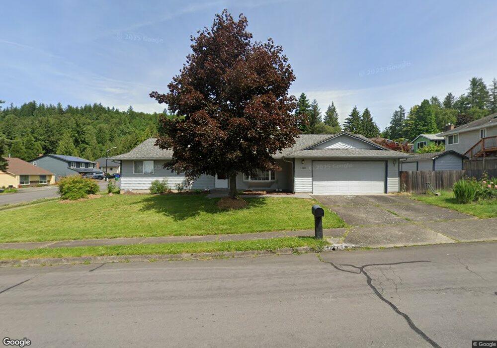
1918 SW Chastain Ave Gresham, OR 97080
Gresham Butte NeighborhoodEstimated Value: $432,000 - $521,000
3
Beds
2
Baths
1,590
Sq Ft
$299/Sq Ft
Est. Value
About This Home
This home is located at 1918 SW Chastain Ave, Gresham, OR 97080 and is currently estimated at $475,189, approximately $298 per square foot. 1918 SW Chastain Ave is a home located in Multnomah County with nearby schools including Dexter McCarty Middle School, Gresham High School, and Portland Adventist Elementary School.
Ownership History
Date
Name
Owned For
Owner Type
Purchase Details
Closed on
Sep 9, 2014
Sold by
Doerr Christopher L
Bought by
Leibham Rebecca
Current Estimated Value
Home Financials for this Owner
Home Financials are based on the most recent Mortgage that was taken out on this home.
Original Mortgage
$144,000
Outstanding Balance
$109,718
Interest Rate
4.09%
Mortgage Type
New Conventional
Estimated Equity
$365,472
Purchase Details
Closed on
Oct 3, 2013
Sold by
Doerr Christopher L
Bought by
Doerr Christopehr L and Doerr Liubov
Purchase Details
Closed on
Sep 16, 2013
Sold by
Sheely Paul
Bought by
Doerr Christopher L and Fernaine Rebecca J
Create a Home Valuation Report for This Property
The Home Valuation Report is an in-depth analysis detailing your home's value as well as a comparison with similar homes in the area
Home Values in the Area
Average Home Value in this Area
Purchase History
| Date | Buyer | Sale Price | Title Company |
|---|---|---|---|
| Leibham Rebecca | $224,000 | Ticor Title | |
| Doerr Christopehr L | -- | None Available | |
| Doerr Christopher L | -- | None Available |
Source: Public Records
Mortgage History
| Date | Status | Borrower | Loan Amount |
|---|---|---|---|
| Open | Leibham Rebecca | $144,000 |
Source: Public Records
Tax History Compared to Growth
Tax History
| Year | Tax Paid | Tax Assessment Tax Assessment Total Assessment is a certain percentage of the fair market value that is determined by local assessors to be the total taxable value of land and additions on the property. | Land | Improvement |
|---|---|---|---|---|
| 2025 | $5,582 | $274,290 | -- | -- |
| 2024 | $5,343 | $266,310 | -- | -- |
| 2023 | $4,868 | $258,560 | $0 | $0 |
| 2022 | $4,732 | $251,030 | $0 | $0 |
| 2021 | $4,613 | $243,720 | $0 | $0 |
| 2020 | $4,340 | $236,630 | $0 | $0 |
| 2019 | $4,227 | $229,740 | $0 | $0 |
| 2018 | $4,030 | $223,050 | $0 | $0 |
| 2017 | $3,867 | $216,560 | $0 | $0 |
| 2016 | $3,409 | $210,260 | $0 | $0 |
| 2015 | $3,336 | $204,140 | $0 | $0 |
| 2014 | $3,254 | $198,200 | $0 | $0 |
Source: Public Records
Map
Nearby Homes
- 1488 SW 17th Ct
- 1421 SW Binford Lake Pkwy
- 1396 SW 22nd Terrace
- 2188 SW Wallula Ln
- 1845 SW 18th Ct
- 1897 SW Binford Lake Pkwy
- 1820 SW Heiney Rd
- 1587 SW Walters Loop
- 2188 SW Binford Lake Pkwy
- 1339 SW 27th Ct
- 975 SW Florence Ct
- 937 SW Florence Ct
- 1278 SW 27th Ct
- 2307 SW 24th St
- 816 SW Overlook Ct
- 1505 SW Battaglia Ave
- 1963 SW Myers Place
- 1660 SW 4th St
- 1466 SW 5th Place
- 1284 SW 4th St
- 1450 SW 19th Dr
- 1930 SW Chastain Ave
- 1471 SW 19th Ct
- 1520 SW 19th Dr
- 1432 SW 19th Dr
- 1921 SW Chastain Ave
- 1475 SW 19th Dr
- 1459 SW 19th Dr
- 1447 SW 19th Ct
- 1443 SW 19th Dr
- 1529 SW 19th Dr
- 1410 SW 19th Dr
- 1941 SW Chastain Ave
- 1968 SW Chastain Ave
- 1425 SW 19th Dr
- 1420 SW 19th Ct
- 1382 SW 19th Dr
- 1470 SW 19th Ct