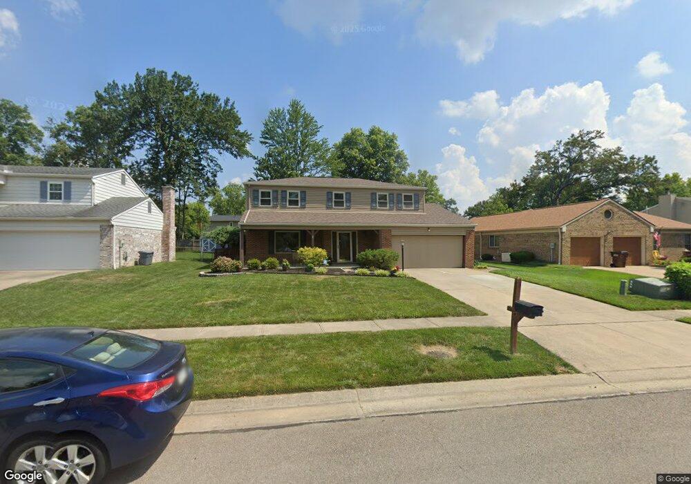
1918 Timberidge Dr Loveland, OH 45140
Estimated Value: $373,000 - $436,000
4
Beds
3
Baths
2,118
Sq Ft
$195/Sq Ft
Est. Value
About This Home
This home is located at 1918 Timberidge Dr, Loveland, OH 45140 and is currently estimated at $413,528, approximately $195 per square foot. 1918 Timberidge Dr is a home located in Hamilton County with nearby schools including Loveland Intermediate School, Loveland Elementary School, and Loveland Primary School.
Ownership History
Date
Name
Owned For
Owner Type
Purchase Details
Closed on
Aug 22, 2008
Sold by
Varon Leann Judy and Varon Bruce David
Bought by
Bober Michael A and Bober Julie A
Current Estimated Value
Home Financials for this Owner
Home Financials are based on the most recent Mortgage that was taken out on this home.
Original Mortgage
$154,800
Outstanding Balance
$102,047
Interest Rate
6.42%
Mortgage Type
New Conventional
Estimated Equity
$311,481
Create a Home Valuation Report for This Property
The Home Valuation Report is an in-depth analysis detailing your home's value as well as a comparison with similar homes in the area
Home Values in the Area
Average Home Value in this Area
Purchase History
| Date | Buyer | Sale Price | Title Company |
|---|---|---|---|
| Bober Michael A | $193,500 | Prodigy Title Agency |
Source: Public Records
Mortgage History
| Date | Status | Borrower | Loan Amount |
|---|---|---|---|
| Open | Bober Michael A | $154,800 |
Source: Public Records
Tax History Compared to Growth
Tax History
| Year | Tax Paid | Tax Assessment Tax Assessment Total Assessment is a certain percentage of the fair market value that is determined by local assessors to be the total taxable value of land and additions on the property. | Land | Improvement |
|---|---|---|---|---|
| 2024 | $6,266 | $118,853 | $18,816 | $100,037 |
| 2023 | $6,444 | $118,853 | $18,816 | $100,037 |
| 2022 | $5,335 | $82,520 | $15,411 | $67,109 |
| 2021 | $5,062 | $82,520 | $15,411 | $67,109 |
| 2020 | $5,142 | $82,520 | $15,411 | $67,109 |
| 2019 | $4,701 | $70,529 | $13,171 | $57,358 |
| 2018 | $4,729 | $70,529 | $13,171 | $57,358 |
| 2017 | $4,484 | $70,529 | $13,171 | $57,358 |
| 2016 | $4,003 | $60,302 | $12,229 | $48,073 |
| 2015 | $4,047 | $60,302 | $12,229 | $48,073 |
| 2014 | $4,143 | $60,302 | $12,229 | $48,073 |
| 2013 | $3,656 | $57,985 | $11,760 | $46,225 |
Source: Public Records
Map
Nearby Homes
- 247 Sinclair Ct
- 1886 Lindenhall Dr
- 1873 Heidelberg Dr
- 1864 W Loveland Ave
- 142 Lakeview Ct
- 3021 Stratford Ct
- 3026 Stratford Ct
- 3015 Stratford Ct Unit 126
- 131 Lakeview Ct
- 3016 Stratford Ct
- 4031 White Chapel Ln
- 5022 Bristol Ct Unit 207
- 124 Pheasantlake Dr
- 5037 Bristol Ct Unit 213
- 9330 Greenhedge Ln
- 1055 Stratford Ct Unit 33
- 160 Lexington Dr
- 196 Shoemaker Dr
- 796 Oak Canyon Dr
- 9550 Union Cemetery Rd
- 1912 Timberidge Dr
- 1924 Timberidge Dr
- 1906 Timberidge Dr
- 1930 Timberidge Dr
- 1919 Stockton Dr
- 1925 Stockton Dr
- 1913 Stockton Dr
- 1931 Stockton Dr
- 1913 Timberidge Dr
- 1936 Timberidge Dr
- 1907 Stockton Dr
- 1931 Timberidge Dr
- 1907 Timberidge Dr
- 1937 Stockton Dr
- 1942 Timberidge Dr
- 241 Albright Dr
- 1937 Timberidge Dr
- 202 Brushwood Dr
- 1901 Timberidge Dr
- 1943 Stockton Dr