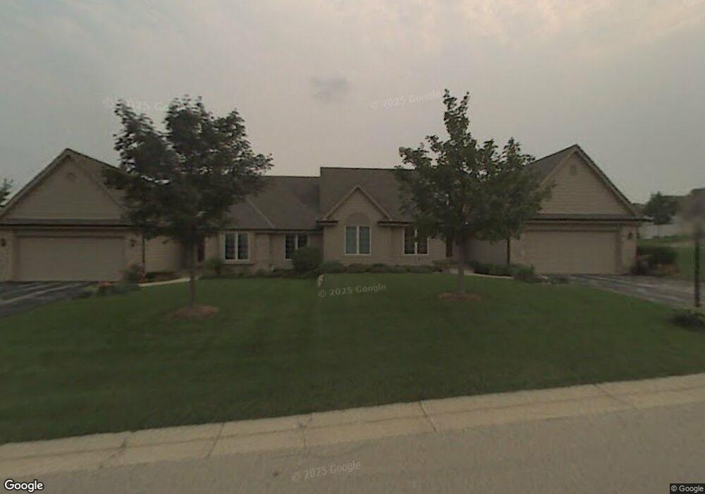
19185 Stonehedge Dr Unit B Brookfield, WI 53045
Estimated Value: $422,000 - $480,000
3
Beds
3
Baths
1,724
Sq Ft
$267/Sq Ft
Est. Value
About This Home
This home is located at 19185 Stonehedge Dr Unit B, Brookfield, WI 53045 and is currently estimated at $460,188, approximately $266 per square foot. 19185 Stonehedge Dr Unit B is a home located in Waukesha County with nearby schools including John F. Miller School, Hillcrest Elementary School, and Horning Middle School.
Ownership History
Date
Name
Owned For
Owner Type
Purchase Details
Closed on
Sep 29, 2004
Sold by
Jacobs Gerald E and Joyce Jacobs M
Bought by
Young James F and Young Karen S
Current Estimated Value
Home Financials for this Owner
Home Financials are based on the most recent Mortgage that was taken out on this home.
Original Mortgage
$276,000
Outstanding Balance
$138,153
Interest Rate
5.93%
Mortgage Type
Stand Alone First
Estimated Equity
$322,035
Purchase Details
Closed on
May 19, 2001
Sold by
Duggan Thomas L and Duggan Barbara J
Bought by
Jacobs Gerald E and Joyce Jacobs M
Create a Home Valuation Report for This Property
The Home Valuation Report is an in-depth analysis detailing your home's value as well as a comparison with similar homes in the area
Home Values in the Area
Average Home Value in this Area
Purchase History
| Date | Buyer | Sale Price | Title Company |
|---|---|---|---|
| Young James F | $345,000 | -- | |
| Jacobs Gerald E | $280,000 | -- |
Source: Public Records
Mortgage History
| Date | Status | Borrower | Loan Amount |
|---|---|---|---|
| Open | Young James F | $276,000 |
Source: Public Records
Tax History Compared to Growth
Tax History
| Year | Tax Paid | Tax Assessment Tax Assessment Total Assessment is a certain percentage of the fair market value that is determined by local assessors to be the total taxable value of land and additions on the property. | Land | Improvement |
|---|---|---|---|---|
| 2024 | $4,194 | $422,700 | $100,000 | $322,700 |
| 2023 | $4,187 | $422,700 | $100,000 | $322,700 |
| 2022 | $4,243 | $318,300 | $90,000 | $228,300 |
| 2021 | $4,290 | $318,300 | $90,000 | $228,300 |
| 2020 | $4,410 | $318,300 | $90,000 | $228,300 |
| 2019 | $4,329 | $318,300 | $90,000 | $228,300 |
| 2018 | $4,115 | $301,400 | $70,000 | $231,400 |
| 2017 | $4,162 | $301,400 | $70,000 | $231,400 |
| 2016 | $4,423 | $301,400 | $70,000 | $231,400 |
| 2015 | $4,211 | $301,400 | $70,000 | $231,400 |
| 2014 | $4,567 | $301,400 | $70,000 | $231,400 |
| 2013 | $4,567 | $301,400 | $70,000 | $231,400 |
Source: Public Records
Map
Nearby Homes
- 655 Mac Henry Cir Unit B
- 550 McPride Ln Unit B
- 675 Charleston Ct Unit B
- 18785 Davidson Rd
- 18740 Emerald Cir Unit E
- 18520 Emerald Cir Unit F
- 18425 Emerald Dr Unit G
- 19770 Foxkirk Ct
- Lt1 Davidson Rd
- 18925 Eagle Dr Unit 101
- 18925 Eagle Dr Unit 102
- 18925 Eagle Dr Unit 202
- 18925 Eagle Dr Unit 201
- 165 Aerie Cir Unit 105
- 18290 Prairie Falcon Ln
- 18710 Follett Dr Unit 502
- 18575 Brookfield Lake Dr Unit 61
- 18275 Brookfield Lake Dr Unit 93
- 18415 W Wisconsin Ave Unit 18415
- 1080 Westbrooke Pkwy
- 19185 Stonehedge Dr Unit A
- 19185 Stonehedge Dr Unit 19185
- 19235 W Mc Allister Ln Unit A
- 19235 W Mc Allister Ln Unit B
- 19160 Stonehedge Dr Unit A
- 19160 Stonehedge Dr Unit B
- 19230 W Mc Allister Ln Unit B
- 19230 W Mc Allister Ln Unit A
- 635 Mcnally Ln Unit C
- 635 Mcnally Ln Unit 21B
- 635 Mcnally Ln Unit A
- 635 Mcnally Ln Unit D
- 19245 W Mc Allister Ln Unit A
- 19245 W Mc Allister Ln Unit B
- 19190 Stonehedge Dr Unit B
- 19190 Stonehedge Dr Unit A
- 19220 Stonehedge Dr Unit B
- 19220 Stonehedge Dr Unit A
- 19260 W Mc Allister Ln Unit A
- 19260 W Mc Allister Ln Unit B