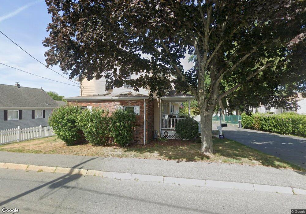
1919 Brayton Point Rd Somerset, MA 02726
Brayton Point NeighborhoodEstimated Value: $582,000 - $613,898
5
Beds
5
Baths
2,801
Sq Ft
$212/Sq Ft
Est. Value
About This Home
This home is located at 1919 Brayton Point Rd, Somerset, MA 02726 and is currently estimated at $593,475, approximately $211 per square foot. 1919 Brayton Point Rd is a home located in Bristol County with nearby schools including South Elementary School, Somerset Middle School, and St. Michael's School.
Ownership History
Date
Name
Owned For
Owner Type
Purchase Details
Closed on
Aug 8, 2019
Sold by
Ganem Kathleen
Bought by
Cavaco John C and Cavaco Lynn A
Current Estimated Value
Purchase Details
Closed on
May 6, 2004
Sold by
Ganem Kathleen
Bought by
Cavaco John C and Cavaco Lynn A
Purchase Details
Closed on
Sep 11, 2003
Sold by
Ganem John J and Ganem Lorie A
Bought by
Ganem Kathleen
Home Financials for this Owner
Home Financials are based on the most recent Mortgage that was taken out on this home.
Original Mortgage
$40,000
Interest Rate
6.29%
Create a Home Valuation Report for This Property
The Home Valuation Report is an in-depth analysis detailing your home's value as well as a comparison with similar homes in the area
Home Values in the Area
Average Home Value in this Area
Purchase History
| Date | Buyer | Sale Price | Title Company |
|---|---|---|---|
| Cavaco John C | $10,800 | -- | |
| Cavaco John C | $10,800 | -- | |
| Cavaco John C | -- | -- | |
| Cavaco John C | -- | -- | |
| Ganem Kathleen | -- | -- | |
| Ganem Kathleen | -- | -- |
Source: Public Records
Mortgage History
| Date | Status | Borrower | Loan Amount |
|---|---|---|---|
| Previous Owner | Ganem Kathleen | $40,000 | |
| Previous Owner | Ganem Kathleen | $35,000 |
Source: Public Records
Tax History Compared to Growth
Tax History
| Year | Tax Paid | Tax Assessment Tax Assessment Total Assessment is a certain percentage of the fair market value that is determined by local assessors to be the total taxable value of land and additions on the property. | Land | Improvement |
|---|---|---|---|---|
| 2025 | $6,678 | $502,100 | $179,500 | $322,600 |
| 2024 | $6,203 | $485,000 | $179,500 | $305,500 |
| 2023 | $5,692 | $448,900 | $149,600 | $299,300 |
| 2022 | $5,285 | $397,700 | $130,000 | $267,700 |
| 2021 | $5,341 | $363,800 | $118,200 | $245,600 |
| 2020 | $5,561 | $365,400 | $118,500 | $246,900 |
| 2019 | $6,229 | $341,300 | $118,500 | $222,800 |
| 2018 | $4,997 | $318,800 | $116,800 | $202,000 |
| 2017 | $5,269 | $302,800 | $110,800 | $192,000 |
| 2016 | $5,302 | $302,800 | $110,800 | $192,000 |
| 2015 | $4,950 | $285,300 | $105,500 | $179,800 |
| 2014 | $6,627 | $274,400 | $105,500 | $168,900 |
Source: Public Records
Map
Nearby Homes
- 1907 Brayton Point Rd
- 1893 Brayton Point Rd
- 1902 Brayton Point Rd
- 77 Merton St
- 62 Summer St
- 1875 Brayton Point Rd
- 55 Merton St
- 50 Mason Ave
- 43 Mason Ave
- 63 Summer St
- 37 Merton St
- 1968 Brayton Point Rd
- 36 Summer St
- 49 Summer St
- 1850 Brayton Point Rd
- 76 Winslow Ave
- 74 Winslow Ave
- 33 Summer St
- 23 Merton St
- 25 Alberta Ave