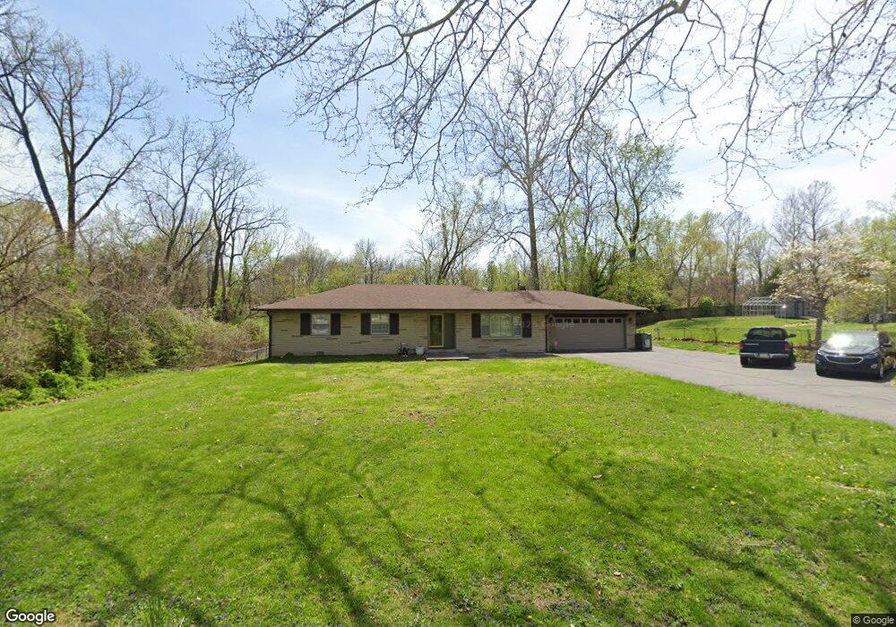
1919 E Loretta Dr Indianapolis, IN 46227
Estimated Value: $249,000 - $261,000
3
Beds
2
Baths
1,519
Sq Ft
$168/Sq Ft
Est. Value
About This Home
This home is located at 1919 E Loretta Dr, Indianapolis, IN 46227 and is currently estimated at $255,044, approximately $167 per square foot. 1919 E Loretta Dr is a home located in Marion County with nearby schools including Southport Elementary School, Southport 6th Grade Academy, and Southport Middle School.
Ownership History
Date
Name
Owned For
Owner Type
Purchase Details
Closed on
Sep 17, 2014
Sold by
Gum Nelson and Gum Maureen
Bought by
Johnson Charles Raymond and Johnson Amey C
Current Estimated Value
Home Financials for this Owner
Home Financials are based on the most recent Mortgage that was taken out on this home.
Original Mortgage
$114,130
Outstanding Balance
$85,869
Interest Rate
4.07%
Mortgage Type
FHA
Estimated Equity
$169,175
Purchase Details
Closed on
Feb 28, 2013
Sold by
Gum Nelson A
Bought by
Johnson Amey C and Johnson Charles R
Create a Home Valuation Report for This Property
The Home Valuation Report is an in-depth analysis detailing your home's value as well as a comparison with similar homes in the area
Home Values in the Area
Average Home Value in this Area
Purchase History
| Date | Buyer | Sale Price | Title Company |
|---|---|---|---|
| Johnson Charles Raymond | $115,000 | Prominent Title Agency Llc | |
| Johnson Amey C | $115,000 | -- |
Source: Public Records
Mortgage History
| Date | Status | Borrower | Loan Amount |
|---|---|---|---|
| Open | Johnson Charles Raymond | $114,130 |
Source: Public Records
Tax History
| Year | Tax Paid | Tax Assessment Tax Assessment Total Assessment is a certain percentage of the fair market value that is determined by local assessors to be the total taxable value of land and additions on the property. | Land | Improvement |
|---|---|---|---|---|
| 2025 | $2,603 | $235,200 | $18,400 | $216,800 |
| 2024 | $2,640 | $206,300 | $18,400 | $187,900 |
| 2023 | $2,640 | $200,100 | $18,400 | $181,700 |
| 2022 | $2,449 | $181,500 | $18,400 | $163,100 |
| 2021 | $2,024 | $148,700 | $18,400 | $130,300 |
| 2020 | $1,941 | $142,200 | $18,400 | $123,800 |
| 2019 | $1,795 | $131,400 | $16,600 | $114,800 |
| 2018 | $1,719 | $127,300 | $16,600 | $110,700 |
| 2017 | $1,606 | $120,200 | $16,600 | $103,600 |
| 2016 | $1,641 | $121,900 | $16,600 | $105,300 |
| 2014 | $621 | $78,800 | $16,600 | $62,200 |
| 2013 | $1,751 | $72,000 | $16,600 | $55,400 |
Source: Public Records
Map
Nearby Homes
- 6653 Homestead Dr
- 2326 E Banta Rd
- 6506 Twin Brooks Dr
- 1718 Tulip Dr
- 2502 E Southport Rd
- 1603 Maynard Dr
- 700 E Werges Ave
- 6104 Madison Ave
- 6420 Linden Dr
- 3209 E Loretta Dr
- 6332 Bryan Dr
- 6350 Shelby St
- 1821 E Stop 10 Rd
- 2716 Marywood Dr
- 7532 Briarstone Dr
- 6029 Barth Ave
- 7548 Briarstone Dr
- 5521 S Randolph St
- 7209 Shelby St
- 7108 Hearthstone Way
- 1929 E Loretta Dr
- 1909 E Loretta Dr
- 6631 Fable St
- 1910 E Loretta Dr
- 6610 Derbyshire Rd
- 1920 E Loretta Dr
- 6616 Derbyshire Rd
- 1906 E Loretta Dr
- 6530 Derbyshire Rd
- 6612 Fable St
- 6616 Fable St
- 6604 Fable St
- 6523 Fable St
- 2310 E Loretta Dr
- 6535 Derbyshire Rd
- 6524 Fable St
- 2309 E Loretta Dr
- 6646 Derbyshire Rd
- 2231 E Banta Rd
- 2229 E Banta Rd
Your Personal Tour Guide
Ask me questions while you tour the home.