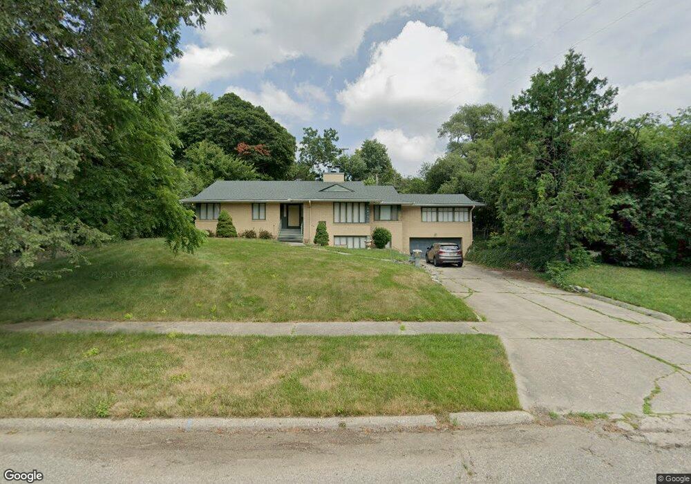
1919 Hampden Rd Flint, MI 48503
Woodcroft Estates NeighborhoodEstimated Value: $213,545 - $287,000
Studio
3
Baths
1,846
Sq Ft
$133/Sq Ft
Est. Value
About This Home
This home is located at 1919 Hampden Rd, Flint, MI 48503 and is currently estimated at $245,386, approximately $132 per square foot. 1919 Hampden Rd is a home located in Genesee County with nearby schools including Durant-Tuuri-Mott Elementary School, Flint Southwestern Classical Academy, and St. Paul Lutheran School.
Ownership History
Date
Name
Owned For
Owner Type
Purchase Details
Closed on
Oct 12, 2006
Sold by
Freppel Joanna R Lydic and Freppel Robert
Bought by
Smith Reginald E and Smith Willie Mae
Current Estimated Value
Create a Home Valuation Report for This Property
The Home Valuation Report is an in-depth analysis detailing your home's value as well as a comparison with similar homes in the area
Home Values in the Area
Average Home Value in this Area
Purchase History
| Date | Buyer | Sale Price | Title Company |
|---|---|---|---|
| Smith Reginald E | $169,900 | Guaranty Title Company |
Source: Public Records
Tax History Compared to Growth
Tax History
| Year | Tax Paid | Tax Assessment Tax Assessment Total Assessment is a certain percentage of the fair market value that is determined by local assessors to be the total taxable value of land and additions on the property. | Land | Improvement |
|---|---|---|---|---|
| 2025 | $1,984 | $101,800 | $0 | $0 |
| 2024 | $1,762 | $78,300 | $0 | $0 |
| 2023 | $1,711 | $75,600 | $0 | $0 |
| 2022 | $0 | $68,000 | $0 | $0 |
| 2021 | $1,802 | $63,200 | $0 | $0 |
| 2020 | $1,922 | $70,200 | $0 | $0 |
| 2019 | $1,841 | $70,300 | $0 | $0 |
| 2018 | $2,012 | $65,700 | $0 | $0 |
| 2017 | $1,884 | $0 | $0 | $0 |
| 2016 | $1,869 | $0 | $0 | $0 |
| 2015 | -- | $0 | $0 | $0 |
| 2014 | -- | $0 | $0 | $0 |
| 2012 | -- | $38,700 | $0 | $0 |
Source: Public Records
Map
Nearby Homes
- 3102 Westwood Pkwy
- 2624 Miller Rd
- 2608 Cumings Ave
- 3214 Clairmont St
- 3402 Brandon St
- 2618 Brown St
- 1725 Lincoln Dr
- 3217 Arlene Ave
- 1114 Clancy Ave
- 3317 Arlene Ave
- 3506 Chicago Blvd
- 2537 Swayze St
- 3510 Hogarth Ave
- 2433 Brown St
- 2429 Brown St
- 1202 Knapp Ave
- 2509 Corunna Rd
- 1122 Stocker Ave
- 2830 Reynolds St
- 2112 Miller Rd
- 1901 Hampden Rd
- 2750 Westwood Pkwy
- 2730 Westwood Pkwy Unit Bldg-Unit
- 2730 Westwood Pkwy
- 2720 Westwood Pkwy
- 1851 Hampden Rd
- 1920 Hampden Rd
- 1910 Hampden Rd
- 2802 Westwood Pkwy
- 1902 Hampden Rd
- 1730 Overhill Dr
- 1860 Hampden Rd
- 1724 Overhill Dr
- 2702 Westwood Pkwy
- 2820 Westwood Pkwy
- 1911 Colchester Rd
- 1921 Colchester Rd Unit Bldg-Unit
- 1921 Colchester Rd
- 1931 Colchester Rd
- 1840 Hampden Rd