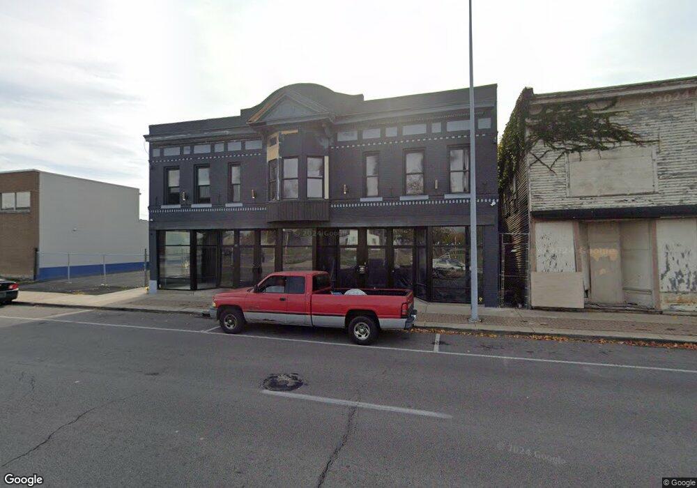
1919 Monroe St Toledo, OH 43604
Downtown Toledo NeighborhoodEstimated Value: $305,036
--
Bed
--
Bath
9,882
Sq Ft
$31/Sq Ft
Est. Value
About This Home
This home is located at 1919 Monroe St, Toledo, OH 43604 and is currently estimated at $305,036, approximately $30 per square foot. 1919 Monroe St is a home located in Lucas County with nearby schools including Sherman Elementary School, Woodward High School, and Madison Avenue School Of Arts.
Ownership History
Date
Name
Owned For
Owner Type
Purchase Details
Closed on
Mar 20, 2020
Sold by
Sftf Llc
Bought by
Golden Spear Llc
Current Estimated Value
Purchase Details
Closed on
Sep 23, 2003
Sold by
King Paul A
Bought by
Sftf Llc
Home Financials for this Owner
Home Financials are based on the most recent Mortgage that was taken out on this home.
Original Mortgage
$75,000
Interest Rate
6.43%
Mortgage Type
Commercial
Purchase Details
Closed on
May 25, 1993
Create a Home Valuation Report for This Property
The Home Valuation Report is an in-depth analysis detailing your home's value as well as a comparison with similar homes in the area
Home Values in the Area
Average Home Value in this Area
Purchase History
| Date | Buyer | Sale Price | Title Company |
|---|---|---|---|
| Golden Spear Llc | $187,000 | None Available | |
| Sftf Llc | -- | -- | |
| -- | $36,000 | -- |
Source: Public Records
Mortgage History
| Date | Status | Borrower | Loan Amount |
|---|---|---|---|
| Previous Owner | Sftf Llc | $75,000 |
Source: Public Records
Tax History Compared to Growth
Tax History
| Year | Tax Paid | Tax Assessment Tax Assessment Total Assessment is a certain percentage of the fair market value that is determined by local assessors to be the total taxable value of land and additions on the property. | Land | Improvement |
|---|---|---|---|---|
| 2024 | $11,565 | $54,285 | $8,820 | $45,465 |
| 2023 | $5,439 | $54,285 | $8,820 | $45,465 |
| 2022 | $5,398 | $57,120 | $9,275 | $47,845 |
| 2021 | $5,553 | $57,120 | $9,275 | $47,845 |
| 2020 | $5,532 | $54,285 | $8,820 | $45,465 |
| 2019 | $5,450 | $54,285 | $8,820 | $45,465 |
| 2018 | $5,428 | $54,285 | $8,820 | $45,465 |
| 2017 | $5,487 | $54,180 | $8,715 | $45,465 |
| 2016 | $5,473 | $154,800 | $24,900 | $129,900 |
| 2015 | $5,429 | $154,800 | $24,900 | $129,900 |
| 2014 | $7,226 | $54,190 | $8,720 | $45,470 |
| 2013 | $4,817 | $54,190 | $8,720 | $45,470 |
Source: Public Records
Map
Nearby Homes
- 636 Norwood Ave
- 1109 City Park Ave
- 619 Pinewood Ave
- 628 Belmont Ave
- 1201 Ewing St
- 842 Lincoln Ave
- 856 Lincoln Ave
- 122 Columbia St
- 2246 Warren St
- 1 S Saint Clair St
- 2267 Robinwood Ave
- 2208 Fulton St
- 424 Winthrop St
- 630 Acklin Ave
- 910 Blum St
- 838 Tecumseh St
- 18 City Park Ave
- 1081 W Woodruff Ave
- 110 Ottawa St Unit 2F
- 1015 Belmont Ave
- 2005 Monroe St
- 1924 Brookwood Ave
- 1937 Brookwood Ave
- 117 20th St
- 18 21st St
- 122 20th St
- 1934 Washington St
- 2110 Brookwood Ave
- 1908 Washington St
- 3 Norwood Ct
- 5 Norwood Ct
- 10 Norwood Ct
- 0 Pineview Lot 19 Unit 4645681
- 0 Pineview Lot 19 Unit 4653963
- 0 Pineview Lot 19
- 0 Brooklynn Park Lot #19 Unit 5021102
- 0 Brooklynn Park Lot #19
- 0 Pineview Lot 21
- 15 Norwood Ct
- 16 Norwood Ct