Estimated Value: $535,000 - $585,000
4
Beds
2
Baths
1,576
Sq Ft
$359/Sq Ft
Est. Value
About This Home
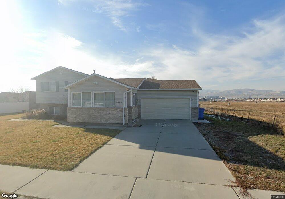
This home is located at 1919 N 2060 W, Lehi, UT 84043 and is currently estimated at $566,250, approximately $359 per square foot. 1919 N 2060 W is a home located in Utah County with nearby schools including North Point Elementary School, Willowcreek Middle School, and Lehi High School.
Ownership History
Date
Name
Owned For
Owner Type
Purchase Details
Closed on
May 14, 2024
Sold by
Lee Thundore and Lee Rose Marie
Bought by
Thundore And Rose Lee Legacy Trust and Lee
Current Estimated Value
Home Financials for this Owner
Home Financials are based on the most recent Mortgage that was taken out on this home.
Original Mortgage
$100,000
Outstanding Balance
$98,582
Interest Rate
6.82%
Mortgage Type
Credit Line Revolving
Estimated Equity
$467,668
Purchase Details
Closed on
Jul 9, 2013
Sold by
Lee Thundore and Lee Rosemarie
Bought by
Lee Thundore and Lee Rose Marie
Purchase Details
Closed on
May 10, 2010
Sold by
Beth & Milton Llc
Bought by
Lee Thundore and Lee Rosemarie
Home Financials for this Owner
Home Financials are based on the most recent Mortgage that was taken out on this home.
Original Mortgage
$97,000
Interest Rate
5.01%
Mortgage Type
Purchase Money Mortgage
Purchase Details
Closed on
Mar 24, 2010
Sold by
Kennedy Robert C
Bought by
Beth & Milton Llc
Home Financials for this Owner
Home Financials are based on the most recent Mortgage that was taken out on this home.
Original Mortgage
$97,000
Interest Rate
5.01%
Mortgage Type
Purchase Money Mortgage
Purchase Details
Closed on
Jan 5, 2008
Sold by
Reeder Raymond Sean and Reeder Raeann
Bought by
Kennedy Robert C
Home Financials for this Owner
Home Financials are based on the most recent Mortgage that was taken out on this home.
Original Mortgage
$193,000
Interest Rate
6.15%
Mortgage Type
Purchase Money Mortgage
Purchase Details
Closed on
Feb 23, 2001
Sold by
Western Samuel S and Western Katie Jo
Bought by
Reeder Raymond Sean and Reeder Raeann
Home Financials for this Owner
Home Financials are based on the most recent Mortgage that was taken out on this home.
Original Mortgage
$150,636
Interest Rate
6.89%
Mortgage Type
FHA
Purchase Details
Closed on
Jun 15, 1999
Sold by
Western Samuel S and Jones Katie Jo
Bought by
Western Samuel S and Western Katie Jo
Home Financials for this Owner
Home Financials are based on the most recent Mortgage that was taken out on this home.
Original Mortgage
$110,000
Interest Rate
7.01%
Purchase Details
Closed on
Jun 11, 1999
Sold by
Salisbury Development Llc
Bought by
Western Samuel S and Jones Katie Jo
Home Financials for this Owner
Home Financials are based on the most recent Mortgage that was taken out on this home.
Original Mortgage
$110,000
Interest Rate
7.01%
Create a Home Valuation Report for This Property
The Home Valuation Report is an in-depth analysis detailing your home's value as well as a comparison with similar homes in the area
Home Values in the Area
Average Home Value in this Area
Purchase History
| Date | Buyer | Sale Price | Title Company |
|---|---|---|---|
| Thundore And Rose Lee Legacy Trust | -- | Meridian Title Company | |
| Lee Thundore | -- | Meridian Title Company | |
| Lee Thundore | -- | None Available | |
| Lee Thundore | -- | Select Title Insurance Agen | |
| Beth & Milton Llc | $137,600 | Utah Commercial Title | |
| Kennedy Robert C | -- | Title West Title Company | |
| Reeder Raymond Sean | -- | First American Title Ins Age | |
| Western Samuel S | -- | Provo Land Title Company | |
| Western Samuel S | -- | Provo Land Title Company |
Source: Public Records
Mortgage History
| Date | Status | Borrower | Loan Amount |
|---|---|---|---|
| Open | Lee Thundore | $100,000 | |
| Previous Owner | Beth & Milton Llc | $97,000 | |
| Previous Owner | Kennedy Robert C | $193,000 | |
| Previous Owner | Reeder Raymond Sean | $150,636 | |
| Previous Owner | Western Samuel S | $110,000 | |
| Previous Owner | Western Samuel S | $106,910 |
Source: Public Records
Tax History Compared to Growth
Tax History
| Year | Tax Paid | Tax Assessment Tax Assessment Total Assessment is a certain percentage of the fair market value that is determined by local assessors to be the total taxable value of land and additions on the property. | Land | Improvement |
|---|---|---|---|---|
| 2025 | $2,210 | $512,800 | $208,000 | $304,800 |
| 2024 | $2,210 | $258,610 | $0 | $0 |
| 2023 | $2,122 | $269,665 | $0 | $0 |
| 2022 | $2,119 | $261,030 | $0 | $0 |
| 2021 | $1,880 | $350,200 | $120,400 | $229,800 |
| 2020 | $1,773 | $326,300 | $111,500 | $214,800 |
| 2019 | $1,559 | $298,300 | $111,500 | $186,800 |
| 2018 | $1,582 | $286,200 | $99,400 | $186,800 |
| 2017 | $1,403 | $134,915 | $0 | $0 |
| 2016 | $1,365 | $121,770 | $0 | $0 |
| 2015 | $1,373 | $116,325 | $0 | $0 |
| 2014 | -- | $105,435 | $0 | $0 |
Source: Public Records
Map
Nearby Homes
- 1896 N 2230 W
- 1970 N 2090 St W
- Palisade Plan at Pioneer Meadows
- Silver Lake Plan at Pioneer Meadows
- Summit Plan at Pioneer Meadows
- Huntington Plan at Pioneer Meadows
- 2012 N 2040 W
- 1990 N 2040 W
- 2013 N 2040 W
- 1968 N 2040 W
- 1991 N 2040 St W
- 1969 N 2040 St W
- 1542 N 1900 W
- 1898 W Pointe Meadow Loop
- 2191 N 2350 W
- 4380 W Bergen Ln
- 2280 N 2350 W
- 2209 W Swift Fox Way Unit 271
- 2184 W Cape Fox Way N Unit 220
- 1060 N Canvasback Dr Unit 405