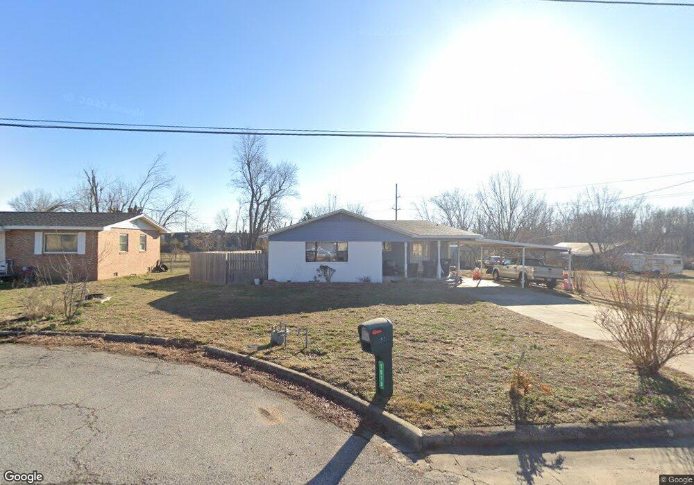
1919 S 10th St Rogers, AR 72758
Estimated Value: $289,000 - $312,248
Studio
2
Baths
1,794
Sq Ft
$169/Sq Ft
Est. Value
About This Home
This home is located at 1919 S 10th St, Rogers, AR 72758 and is currently estimated at $302,562, approximately $168 per square foot. 1919 S 10th St is a home located in Benton County with nearby schools including Bonnie Grimes Elementary School, Elmwood Middle School, and Rogers High School.
Ownership History
Date
Name
Owned For
Owner Type
Purchase Details
Closed on
Jul 10, 2018
Sold by
Donahue John Michael and Donahue Rebecca Ann
Bought by
Donahue John M and Donahue Kylie C
Current Estimated Value
Home Financials for this Owner
Home Financials are based on the most recent Mortgage that was taken out on this home.
Original Mortgage
$126,800
Outstanding Balance
$109,430
Interest Rate
4.5%
Estimated Equity
$193,133
Purchase Details
Closed on
Jun 18, 1996
Bought by
Donahue
Purchase Details
Closed on
Dec 27, 1983
Bought by
Callaway
Create a Home Valuation Report for This Property
The Home Valuation Report is an in-depth analysis detailing your home's value as well as a comparison with similar homes in the area
Home Values in the Area
Average Home Value in this Area
Purchase History
| Date | Buyer | Sale Price | Title Company |
|---|---|---|---|
| Donahue John M | $158,500 | Pci Advance Title Llc | |
| Donahue | $105,000 | -- | |
| Callaway | $45,000 | -- |
Source: Public Records
Mortgage History
| Date | Status | Borrower | Loan Amount |
|---|---|---|---|
| Open | Donahue John M | $126,800 |
Source: Public Records
Tax History
| Year | Tax Paid | Tax Assessment Tax Assessment Total Assessment is a certain percentage of the fair market value that is determined by local assessors to be the total taxable value of land and additions on the property. | Land | Improvement |
|---|---|---|---|---|
| 2025 | $1,881 | $49,101 | $19,000 | $30,101 |
| 2024 | $1,682 | $49,101 | $19,000 | $30,101 |
| 2023 | $1,529 | $33,810 | $8,000 | $25,810 |
| 2022 | $1,468 | $33,810 | $8,000 | $25,810 |
| 2021 | $1,342 | $33,810 | $8,000 | $25,810 |
| 2020 | $1,222 | $22,250 | $1,200 | $21,050 |
| 2019 | $1,222 | $22,250 | $1,200 | $21,050 |
| 2018 | $759 | $22,250 | $1,200 | $21,050 |
| 2017 | $720 | $22,250 | $1,200 | $21,050 |
| 2016 | $607 | $22,250 | $1,200 | $21,050 |
| 2015 | $929 | $17,560 | $3,600 | $13,960 |
| 2014 | $579 | $17,560 | $3,600 | $13,960 |
Source: Public Records
Map
Nearby Homes
- 1904 S 8th St
- 1011 W Green Acres Place
- 1208 W Lazy L St
- 1839 S 11th Place
- 2006 S 11th St
- 1012 W Linden St
- 1012 & 1014 W Linden St
- 1014 W Linden St
- 2011 S 13th St
- 2211 S 9th St
- 825 W Linden St
- 1009 W Cottonwood St
- 9.02 Acres W Dyke Rd
- 1009 W Lilac St
- 805 W Lilac St
- 1700 S 11th St
- 1325 W New Hope Rd
- 1902 S 16th St
- 907 W Banz Rd Unit 3
- 1100 W Banz Rd
Your Personal Tour Guide
Ask me questions while you tour the home.