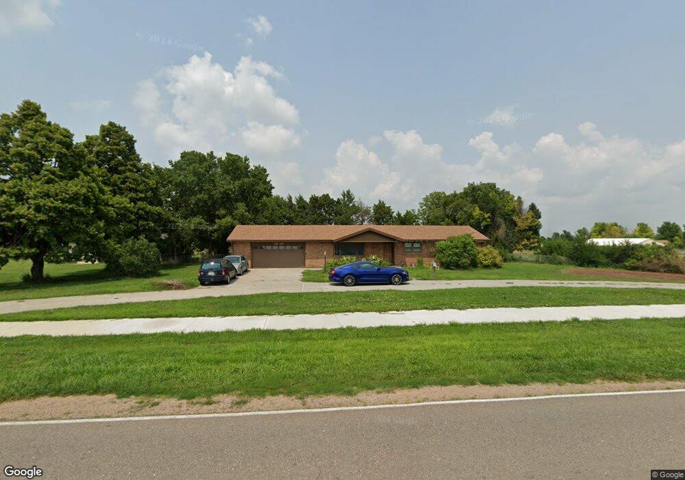
1919 W State Farm Rd North Platte, NE 69101
Estimated Value: $324,000 - $382,000
3
Beds
4
Baths
2,148
Sq Ft
$161/Sq Ft
Est. Value
About This Home
This home is located at 1919 W State Farm Rd, North Platte, NE 69101 and is currently estimated at $346,299, approximately $161 per square foot. 1919 W State Farm Rd is a home located in Lincoln County with nearby schools including North Platte High School, McDaid Elementary School, and Our Redeemer Lutheran School.
Ownership History
Date
Name
Owned For
Owner Type
Purchase Details
Closed on
Nov 10, 2019
Sold by
Rowland Sandra K
Bought by
Packard Dean L and Packard Gwen M
Current Estimated Value
Home Financials for this Owner
Home Financials are based on the most recent Mortgage that was taken out on this home.
Original Mortgage
$176,000
Outstanding Balance
$118,839
Interest Rate
3.7%
Mortgage Type
New Conventional
Estimated Equity
$227,460
Purchase Details
Closed on
Jun 21, 2005
Sold by
Anderson Lavern P
Bought by
Parkerkinsinger Sharon K and Kinsinger Sam R
Home Financials for this Owner
Home Financials are based on the most recent Mortgage that was taken out on this home.
Original Mortgage
$120,000
Interest Rate
5.76%
Mortgage Type
New Conventional
Create a Home Valuation Report for This Property
The Home Valuation Report is an in-depth analysis detailing your home's value as well as a comparison with similar homes in the area
Home Values in the Area
Average Home Value in this Area
Purchase History
| Date | Buyer | Sale Price | Title Company |
|---|---|---|---|
| Packard Dean L | $220,000 | Western Title | |
| Parkerkinsinger Sharon K | $225,000 | None Available |
Source: Public Records
Mortgage History
| Date | Status | Borrower | Loan Amount |
|---|---|---|---|
| Open | Packard Dean L | $176,000 | |
| Previous Owner | Parkerkinsinger Sharon K | $120,000 |
Source: Public Records
Tax History Compared to Growth
Tax History
| Year | Tax Paid | Tax Assessment Tax Assessment Total Assessment is a certain percentage of the fair market value that is determined by local assessors to be the total taxable value of land and additions on the property. | Land | Improvement |
|---|---|---|---|---|
| 2024 | $2,669 | $285,475 | $45,840 | $239,635 |
| 2023 | $3,617 | $263,202 | $45,840 | $217,362 |
| 2022 | $3,222 | $222,634 | $45,840 | $176,794 |
| 2021 | $3,248 | $222,634 | $45,840 | $176,794 |
| 2020 | $3,309 | $222,634 | $45,840 | $176,794 |
| 2019 | $3,706 | $248,498 | $16,519 | $231,979 |
| 2018 | $3,425 | $227,980 | $15,155 | $212,825 |
| 2017 | $3,444 | $227,980 | $15,155 | $212,825 |
| 2016 | $3,517 | $228,625 | $15,155 | $213,470 |
| 2014 | $3,243 | $198,675 | $15,155 | $183,520 |
Source: Public Records
Map
Nearby Homes
- 221 Prairie Rd
- 2421 W State Farm Rd
- 2421 W State Farm Rd Unit North Platte NE 6910
- 602 Tomahawk Rd
- N Platte Unit NE 69101
- 0 S Buffalo Bill Development
- N Platte Unit NE 69101
- N Platte Unit NE 69101
- 0 Buffalo Triangle Frontage
- 0 State Farm Road Short Acreage W
- 0 State Farm Road Short Acreage E
- N Platte Unit NE 69101
- 0 N Buffalo Bill Grass
- 0 Unit Lot
- N Platte Unit NE 69101
- 0 Unit 11584518
- N Platte Unit NE 69101
- 0 State Farm Road Long Acreage W
- N Platte Unit NE 69101
- 0 N Platte Fremont Slough Development Unit 11573268
- 1994 W State Farm Rd
- 4701 Heritage Dr
- 102 Prairie Rd
- 2101 W State Farm Rd
- 4720 Heritage Dr
- 120 Prairie Rd
- 4702 Heritage Dr
- 1825 W State Farm Rd
- 101 Prairie Rd
- 202 Prairie Rd
- 4601 Heritage Dr
- 4801 Valley Dr
- 4620 Heritage Dr
- 4721 Valley Dr
- 220 Prairie Rd
- 4701 Valley Dr
- 201 Prairie Rd
- 4602 Heritage Dr
- 4621 Valley Dr
- 304 Prairie Rd