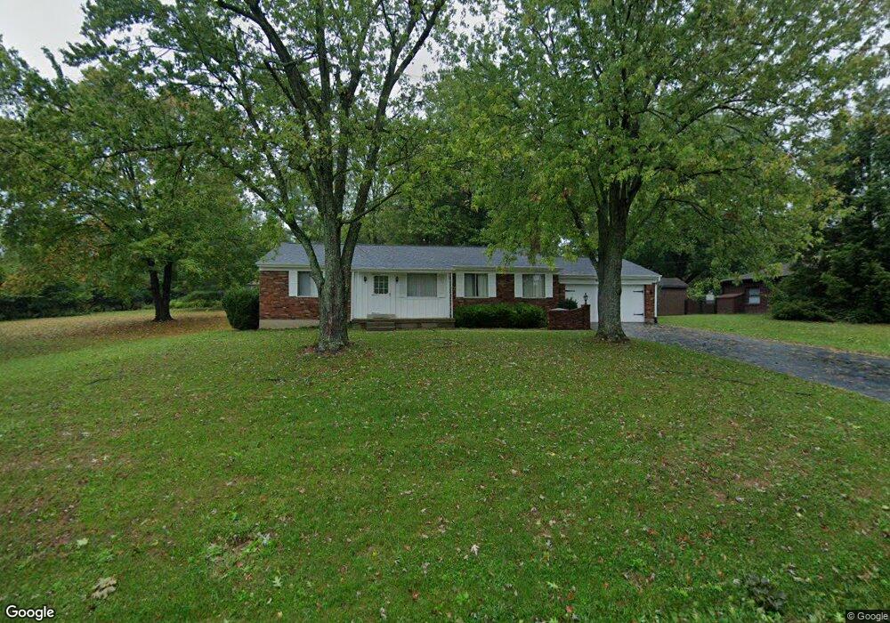
1919 Wanninger Ln Cincinnati, OH 45255
Estimated Value: $303,000 - $345,000
3
Beds
2
Baths
1,568
Sq Ft
$211/Sq Ft
Est. Value
About This Home
This home is located at 1919 Wanninger Ln, Cincinnati, OH 45255 and is currently estimated at $330,658, approximately $210 per square foot. 1919 Wanninger Ln is a home located in Hamilton County with nearby schools including Summit Elementary School, Nagel Middle School, and Anderson High School.
Ownership History
Date
Name
Owned For
Owner Type
Purchase Details
Closed on
Jul 16, 2025
Sold by
Motz Family Living Trust and Reinert Elizabeth M
Bought by
Sarah E Motz Living Trust and Motz
Current Estimated Value
Purchase Details
Closed on
Dec 18, 2018
Sold by
Motz Sarah E
Bought by
Motz Sarah E and Motz Susan M
Purchase Details
Closed on
Jun 8, 2005
Sold by
Motz Ted H and Motz Sarah E
Bought by
Motz Ted H and Motz Sarah E
Create a Home Valuation Report for This Property
The Home Valuation Report is an in-depth analysis detailing your home's value as well as a comparison with similar homes in the area
Home Values in the Area
Average Home Value in this Area
Purchase History
| Date | Buyer | Sale Price | Title Company |
|---|---|---|---|
| Sarah E Motz Living Trust | -- | None Listed On Document | |
| Motz Sarah E | -- | None Available | |
| Motz Ted H | -- | None Available |
Source: Public Records
Tax History Compared to Growth
Tax History
| Year | Tax Paid | Tax Assessment Tax Assessment Total Assessment is a certain percentage of the fair market value that is determined by local assessors to be the total taxable value of land and additions on the property. | Land | Improvement |
|---|---|---|---|---|
| 2024 | $5,490 | $90,294 | $19,065 | $71,229 |
| 2023 | $4,688 | $90,294 | $19,065 | $71,229 |
| 2022 | $3,821 | $67,614 | $18,589 | $49,025 |
| 2021 | $3,720 | $67,614 | $18,589 | $49,025 |
| 2020 | $3,776 | $67,614 | $18,589 | $49,025 |
| 2019 | $3,289 | $55,420 | $15,236 | $40,184 |
| 2018 | $3,080 | $55,420 | $15,236 | $40,184 |
| 2017 | $2,898 | $55,420 | $15,236 | $40,184 |
| 2016 | $2,273 | $44,625 | $15,204 | $29,421 |
| 2015 | $2,214 | $44,625 | $15,204 | $29,421 |
| 2014 | $2,217 | $44,625 | $15,204 | $29,421 |
| 2013 | $2,045 | $43,751 | $14,907 | $28,844 |
Source: Public Records
Map
Nearby Homes
- 7660 Clough Pike
- 7652 Clough Pike
- L Clough Pike
- 2117 Berrypatch Dr
- 2083 Forestcrest Way
- 1682 Yellowglen Dr
- 8190 Riovista Dr
- 8032 Lancelot Dr
- 8069 Ashgrove Dr
- 2193 Forestlake Dr
- 8413 Summitridge Dr
- 2067 Knightsbridge Dr
- 1747 Summithills Dr
- 2161 Knightsbridge Dr
- 8022 Stonegate Dr
- 1434 Castleberry Ct
- 7827 State Rd
- 8019 Stonegate Dr
- 1786 Woodpine Ln
- 8588 Denallen Dr
- 1929 Wanninger Ln
- 1885 Wanninger Ln
- 1951 Wanninger Ln
- 1918 Wanninger Ln
- 1900 Wanninger Ln
- 1938 Wanninger Ln
- 1872 Wexwood Ln
- 1870 Wexwood Ln
- 1869 Wanninger Ln
- 1868 Wanninger Ln
- 1873 Wexwood Ln
- 1858 Wexwood Ln
- 8141 Clough Pike
- 1851 Wanninger Ln
- 8119 Clough Pike
- 1869 Wexwood Ln
- 1846 Wexwood Ln
- 1986 Wanninger Ln
- 1850 Wanninger Ln
- 1857 Wexwood Ln